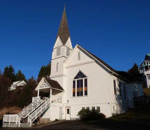
Cathlamet dates to 1846, and 31% of its homes were built before 1940
Its Register listings are the Pioneer Church and the Julia Butler Hansen House. Below: 6 old photos and papers, maps from 1914 on, and the census since 1880.
Cathlamet was the largest, or one of the largest, villages of Columbia River Native Americans west of the Cascade Mountains, and the home of the Kathlamet people. "Cathlamet was sighted in 1792 by Lt. W.R. Broughton, while verifying Capt. Robert Gray's reported exploration of the Columbia River." This village of cedar houses included 300-400 inhabitants when visited by Lewis and Clark.
In 1846, James Albion Birnie became the first permanent white settler at Cathlamet, moving there after a career with the Hudson's Bay Company. He set up a trading post, remnants of which were reported still standing in 1906. "Birnie named the area Birnie's Retreat. The name was later changed to Cathlamet in 1851."
Nothing in the archives for these yearsWeddings on Main Street, storms, parades, school pictures, the old store. If it’s in your family album, it belongs here.
Nothing in the archives for these yearsWeddings on Main Street, storms, parades, school pictures, the old store. If it’s in your family album, it belongs here.
U.S. Geological Survey historical topographic maps (public domain), via Esri’s collection of the scans. The red ring marks the center of Cathlamet.
Every building
Cathlamet, building by building, 1914–1929
Fire insurance maps drew every building, what it was made of and what it was used for, so insurers could price the risk of fire. Pick a year, then a sheet.
Founding dates: Wikidata, Wikipedia, the U.S. post office records of Blevins & Helbock (CC0) and the Census. Homes by year built: Census ACS 2020–24. National Register of Historic Places: National Park Service (list of May 22, 2026). Old photos, postcards and papers: Wikimedia Commons, the Library of Congress and other public archives, credited on each item’s page. Maps: U.S. Geological Survey historical topographic maps (via Esri) and Sanborn fire-insurance maps (Library of Congress). History text and census tables: Wikipedia (CC BY-SA 4.0). Places that used to be: USGS Geographic Names Information System (2021). How TownRatings grades history →
From Wikimedia Commons (18), the National Register of Historic Places (2), Wikipedia, U.S. Geological Survey historical maps, U.S. Census counts (via Wikipedia), the US Post Offices dataset (Blevins & Helbock), the USGS Geographic Names Information System and Sanborn fire insurance maps (Library of Congress). Archive images are copied here with their credits and licenses, shown on each photo’s page. Refreshed monthly.


 1973
 1973
 1973
 1973
 2012
 2012
 2012
 2011
 2011
 2011
 2011
 2011
 2011
 2011
 2007
 2004