8 places in town are on the National Register, among them three historic districts with 29 buildings between them. Below: 1 old photo or paper, maps from 1930 on, and the census since 1790.
The Townshend post office opened in 1811, the earliest record of the town by name. Another post office, West Townshend (1821), opened inside today’s town and later closed.
First census: 676 in 17902020 census: 1,291215 years
How historic is Townshend?
A
More historic than 90% of U.S. towns, on its age, its old homes and the National Register.
Founding year: the first Townshend post office (Blevins & Helbock, CC0).The full story ↓
History grade
What drives Townshend’s History grade
On its age, its old homes and the National Register, Townshend is more historic than 90% of U.S. towns. All 3 inputs are above most U.S. towns; its share of homes from before 1940 ranks highest and its age lowest.
A
HistoryA character grade: shown, never part of Townshend’s overall grade.
Vermont towns list more on the Register than most of the country (a typical Vermont town has 147 per 10,000 residents, the U.S. 2.4), so Townshend’s 208 sits above most of its state (71% of Vermont towns have fewer) while its 32 historic buildings outnumber those of 82% of U.S. towns.
How sure. Graded on any two of the three inputs instead, the letter would range from A− to A. The pre-1940 share is a Census survey estimate (±4.4 points). The founding year is the first post office, not a stated founding date.
Founding year: the first post office (other dates in Quick answers). Homes: Census ACS 2020–24. National Register: National Park Service, May 2026 list; each listing counted once (boundary changes and added documentation belong to their listing), and a historic district counts its contributing buildings. How TownRatings grades history →
What stands out about Townshend’s past
Read from the archive, the National Register and the record. The page puts what stands out first.
The land grant for Townshend was chartered by New Hampshire Governor Benning Wentworth, on June 20, 1753. The town was named after Charles Townshend, the Secretary of War under King George III. Between 1755 and 1761, plans and occupation of Townshend were abandoned due to the impact of the French and Indian War. The grant had required the settlement of the town within five years, so in August 1762, Townshend was regranted under the same stipulations by Governor Wentworth. However, proprietors had already begun meeting again in 1761, and settlement of the town was led by proprietor John Hazeltine in May of that year.
Passages that mention Townshend, cut from the printed page as they were published.
Collections relating to the history and inhabitants of the town of Townshend, Vermont1877 · page 33Read the page →
Read the text
" Voted : To be set and annexed to the town of Townshend, without proviso or condition, in pursuance of the 5th article in the warrant." At the same meeting, Lemuel Farwell, Isaac Fisher, Jr. and Nathan Fisher were chosen a Committee to attend the adjourned meeting of the town of Townshend, and solicit the passage of a vote at said town meeting to have the town of Acton set to and annexed to said town of Townshend.
Text read by machine from the scan; it may contain errors.
Collections relating to the history and inhabitants of the town of Townshend, Vermont1877 · page 15Read the page →
Read the text
"That the freemen of said town may assemble for the time being, with the freemen of the town of Townsheud, for the choice of State officers, and representatives, either in Congress, or in the State : and it is hereby made the duty of the first Constable of the town of Townshend, to warn the freemen of said town of Acton, to assemble with the freemen of the town of Townshend, in all freemen's meetings, by posting a warning of said meeting, in the most public place in said town of Acton," That part of the foregoing statute which deprived the new town of its
Text read by machine from the scan; it may contain errors.
Scans and text from the Internet Archive. Books published in 1930 or earlier, which are in the public domain.
Timeline
Townshend, 1810 to 1970
Woven from the archive, old maps, post office records, the National Register and the people born here.
Nothing in the archives for these yearsWeddings on Main Street, storms, parades, school pictures, the old store. If it’s in your family album, it belongs here.
The Townshend post office opened in 1811, the earliest record of the town by name (U.S. post office records).
How does Townshend rank for history?
Townshend is more historic than 90% of U.S. towns. The History grade combines the town’s founding era, the share of homes built before 1940 and its National Register listings. It’s a character grade, so it isn’t part of the overall grade. How it works.
What is on the National Register in Townshend?
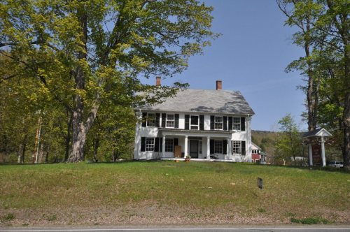
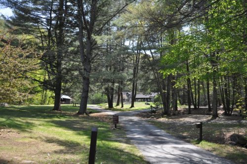
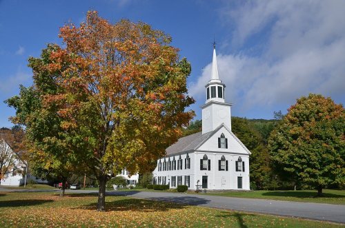
8 listings: 2 buildings, 3 historic districts, the Follett Stone Arch Bridge Historic District, the West Townshend Village Historic District and the Townshend State Park, with 29 contributing buildings, and 3 structures. 32 historic buildings in all.
How old are the homes in Townshend?
25% of Townshend’s homes were built before 1940 (Census estimate, ±4.4 points), against a typical 22% for a Vermont town; the median home was built in 1982.
Founding dates: Wikidata, Wikipedia, the U.S. post office records of Blevins & Helbock (CC0) and the Census. Homes by year built: Census ACS 2020–24. National Register of Historic Places: National Park Service (list of May 22, 2026). Old photos, postcards and papers: Wikimedia Commons, the Library of Congress and other public archives, credited on each item’s page. Maps: U.S. Geological Survey historical topographic maps (via Esri) and Sanborn fire-insurance maps (Library of Congress). History text and census tables: Wikipedia (CC BY-SA 4.0). Places that used to be: USGS Geographic Names Information System (2021).
From Wikimedia Commons (18), the Library of Congress (3), Wikidata (3), the National Register of Historic Places (8), Wikipedia, Wikidata and Wikipedia for famous people, U.S. Geological Survey historical maps, U.S. Census counts (via Wikipedia), the US Post Offices dataset (Blevins & Helbock), the USGS Geographic Names Information System and old county and town histories (Internet Archive). Archive images are copied here with their credits and licenses, shown on each photo’s page. Refreshed monthly.





 2017
 2017
 2017
 2016
 2016
 2016
 2016
 2014
 2013
 2013
 2013
 2013
 2013
 2013
 2013
 2013
 2013
 2012
 2011
 2004


