Shelburne dates to 1763, and 5 of its places are on the National Register
More historic than 82% of U.S. towns · #46 of 71 in Vermont. What drives it
Most of Shelburne was built recently: 7% of its homes predate 1940 and the median home dates from 1986. 5 places in town are on the National Register, among them 2 National Historic Landmarks and two historic districts with 116 buildings between them. Below: 5 old photos and papers, maps from 1906 on, and the census since 1790.
Founding year: Wikipedia. First post office: 1814.The full story ↓
History grade
What drives Shelburne’s History grade
On its age, its old homes and the National Register, Shelburne is more historic than 82% of U.S. towns, #46 of 71 in Vermont. Its age holds the grade up; its share of homes from before 1940 pulls it down.
A−
HistoryA character grade: shown, never part of Shelburne’s overall grade.
Vermont towns list more on the Register than most of the country (a typical Vermont town has 147 per 10,000 residents, the U.S. 2.4), so Shelburne’s 166 sits above most of its state (67% of Vermont towns have fewer) while its 132 historic buildings outnumber those of 91% of U.S. towns.
NoteThe founding year comes from Wikipedia alone; no second source gives 1763.
How sure. Graded on any two of the three inputs instead, the letter would range from B to A+. The pre-1940 share is a Census survey estimate (±3.5 points).
Founding year: Wikipedia (other dates in Quick answers). Homes: Census ACS 2020–24. National Register: National Park Service, May 2026 list; each listing counted once (boundary changes and added documentation belong to their listing), and a historic district counts its contributing buildings. How TownRatings grades history →
What stands out about Shelburne’s past
Read from the archive, the National Register and the record. The page puts what stands out first.
Shelburne was chartered by New Hampshire, August 18, 1763, to Jesse Hallock and 64 associates by governor Benning Wentworth. The name "Shelburne" or "Shelburn" was chosen to honor William Petty, 2nd Earl of Shelburne, a celebrated nobleman of the British parliament and Prime Minister. According to the charter, the town was to have an area of 23,500 acres (95.1 km2), or a tract a little over 6 square miles (15.5 km2), but owing to a blunder on the part of the surveyors, it was shorn of a large portion of its possessions.
Passages that mention Shelburne, cut from the printed page as they were published.
History of Chittenden County, Vermont, with illustrations and biographical sketches of some of its prominent men and pioneers1886Read the page →
Read the text
The first settlement commenced at Shelburne Falls was in 1785, by Ira Allen, then a resident in Winooski village. A rudely-constructed log bridge was built across La Plotte River, a dam was constructed some ten rods above the present saw-mill dam, a saw-mill erected on the north side of the stream, and a forge on the south. In 1786 a dam was constructed at the lower end
Text read by machine from the scan; it may contain errors.
History of Chittenden County, Vermont, with illustrations and biographical sketches of some of its prominent men and pioneers1886 · page 430Read the page →
Read the text
Captain Dan Lyon was born in the town of Shelburne, Vt, on the loth of May, 1803. He received a common school education, and when his father, Timothy, died of the epidemic of 18 13, in March of that year, he went to live with his uncle, Robert White, of Shelburne Harbor, and afterwards in BurUngton village. He served in various capacities on a sailing vessel until 1825, when he became captain of the steamer General Green. He remained on this steamer until 1835, when he became captain of the Phoiix, the trip extending the entire length of the lake. From 1836 to 1839 he commanded the Winoo-
Text read by machine from the scan; it may contain errors.
Scans and text from the Internet Archive. Books published in 1930 or earlier, which are in the public domain.
Timeline
Shelburne, 1763 to 2001
Woven from the archive, old maps, post office records, the National Register and the people born here.
Nothing in the archives for these yearsWeddings on Main Street, storms, parades, school pictures, the old store. If it’s in your family album, it belongs here.
In 1763, according to Wikipedia’s history of the town. Shelburne’s post office opened in 1814, and the first U.S. census counted 389 people here in 1790.
How does Shelburne rank for history?
Shelburne is more historic than 82% of U.S. towns, #46 of 71 in Vermont. The History grade combines the town’s founding era, the share of homes built before 1940 and its National Register listings. It’s a character grade, so it isn’t part of the overall grade. How it works.
What is on the National Register in Shelburne?
5 listings, 2 of them National Historic Landmarks: 2 buildings, 2 historic districts, the Shelburne Village Historic District and the Shelburne Falls Historic District, with 116 contributing buildings, and 1 structure. 132 historic buildings in all.
How old are the homes in Shelburne?
7% of Shelburne’s homes were built before 1940 (Census estimate, ±3.5 points), against a typical 22% for a Vermont town; the median home was built in 1986.
Founding dates: Wikidata, Wikipedia, the U.S. post office records of Blevins & Helbock (CC0) and the Census. Homes by year built: Census ACS 2020–24. National Register of Historic Places: National Park Service (list of May 22, 2026). Old photos, postcards and papers: Wikimedia Commons, the Library of Congress and other public archives, credited on each item’s page. Maps: U.S. Geological Survey historical topographic maps (via Esri) and Sanborn fire-insurance maps (Library of Congress). History text and census tables: Wikipedia (CC BY-SA 4.0). Places that used to be: USGS Geographic Names Information System (2021).
From Wikimedia Commons (7), the Library of Congress (14), Wikidata (1), the National Register of Historic Places (5), Wikipedia, Wikidata and Wikipedia for famous people, U.S. Geological Survey historical maps, U.S. Census counts (via Wikipedia), the US Post Offices dataset (Blevins & Helbock), the USGS Geographic Names Information System and old county and town histories (Internet Archive). Archive images are copied here with their credits and licenses, shown on each photo’s page. Refreshed monthly.


 ★ Landmark
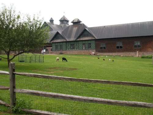 ★ Landmark


 1984
 1984
 1984
 2017
 2017
 2017
 2017
 2017
 2017
 2017
 2017
 2017
 2017
 2017
 2017
 2017
 2017
 2012
 2009


