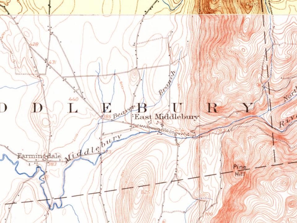
Every edition of the U.S. Geological Survey’s map of East Middlebury. Tap a year, or press play to watch the town change.
1902Brandon sheet · 1:62,500
U.S. Geological Survey historical topographic maps (public domain), via Esri’s collection of the scans. The red ring marks the center of East Middlebury.
East Middlebury first came to the attention of settlers from British America after the French and Indian War. The charter that created Middlebury dates from 1761 and the earliest settlement in East Middlebury dates from 1775 when Ebar Evarts cleared land for the construction of a tavern, the forerunner of today’s Waybury Inn. Jonathan Foot began the development of the area of the Middlebury River Gorge in 1790. The development of the village was encouraged by its location at the west end of the trail over the Green Mountains as it entered into the Otter Creek Valley. The Middlebury River Gorge was also a prime area for waterpower for mills located along its banks. The first mill of many built in the town, was a sawmill on the south side of the river near the top of gorge. This area was also the site of The East Middlebury Iron Works (1831-1890) and was the last iron works in Vermont to …
Passages that mention East Middlebury, cut from the printed page as they were published.
History of Addison county Vermont, with illustrations and biographical sketches of some of its prominent men and pioneers1886 · page 343Read the page →
Read the text
Post-office. — The post-office of East Middlebury was established January 29, 1834, with Timothy Matthews, jr., as the first postmaster; in November, 1837, ne was succeeded by Levi Needham, and he by O. P. Torrance in April, 1846; Mr. Needham again took the office in 1850, and was succeeded by Royal D. Farr in 1854. J. P. Champlin then had the office fourteen years, and was succeeded by M. E. Day, for eight years. The present postmaster is Julius A. Douglass, who has recently accepted the office.
Text read by machine from the scan; it may contain errors.
History of Addison county Vermont, with illustrations and biographical sketches of some of its prominent men and pioneers1886 · page 243Read the page →
Read the text
the same line until it reaches the Centre Turnpike. The road leading from the late dwelling house of Abner Everts to the line of Salisbury is on the west line of the east tier, and the east line of the same tier passes through the village of East Middlebury ; the building lots of David Olmstead and Kneeland being on the east end of lot No. 36. " It seems that at the time this division was made, the Middlebury lands were not in very high estimation. Benjamin Smalley, who had been appointed collector of the ' rate,' assessed to ' defray the charge of laying out the first and
Text read by machine from the scan; it may contain errors.
Scans and text from the Internet Archive. Books published in 1930 or earlier, which are in the public domain.
By decade
No old photos in the archives yet
Weddings on Main Street, storms, parades, school pictures, the old store. If it’s in your family album, it belongs here.
Be the first to add onePhotograph a print flat, in daylight, no flash.
Founding dates: Wikidata, Wikipedia, the U.S. post office records of Blevins & Helbock (CC0) and the Census. Homes by year built: Census ACS 2020–24. National Register of Historic Places: National Park Service (list of May 22, 2026). Old photos, postcards and papers: Wikimedia Commons, the Library of Congress and other public archives, credited on each item’s page. Maps: U.S. Geological Survey historical topographic maps (via Esri) and Sanborn fire-insurance maps (Library of Congress). History text and census tables: Wikipedia (CC BY-SA 4.0). Places that used to be: USGS Geographic Names Information System (2021). How TownRatings grades history →
From Wikipedia, U.S. Geological Survey historical maps and old county and town histories (Internet Archive). Archive images are copied here with their credits and licenses, shown on each photo’s page. Refreshed monthly.