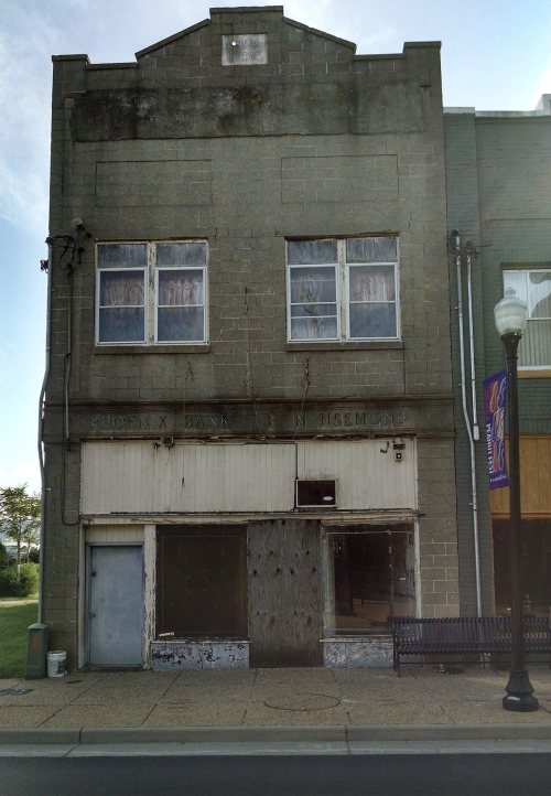
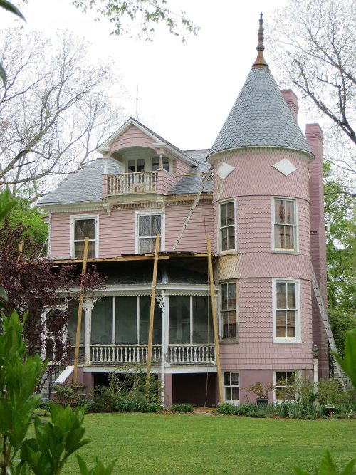
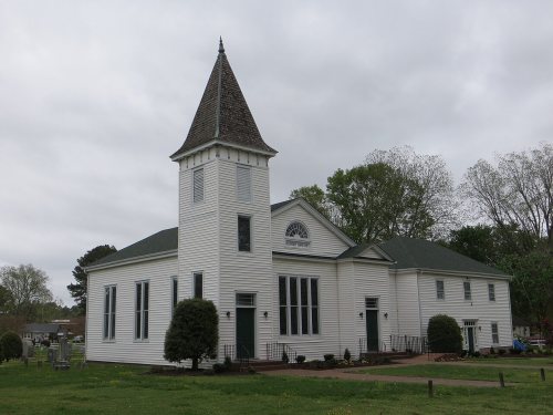
Suffolk dates to 1742, and 22 of its places are on the National Register
More historic than 83% of U.S. towns · #33 of 253 in Virginia. What drives it
Most of Suffolk was built recently: 5% of its homes predate 1940 and the median home dates from 1996. 22 places in town are on the National Register, among them nine historic districts with 1,023 buildings between them. Below: maps from 1885 on and the census since 1860.
Founding year: Wikidata; Wikipedia’s history section gives the same year. First post office: 1774.The full story ↓
History grade
What drives Suffolk’s History grade
On its age, its old homes and the National Register, Suffolk is more historic than 83% of U.S. towns, #33 of 253 in Virginia. Its age holds the grade up; its share of homes from before 1940 pulls it down.
A−
HistoryA character grade: shown, never part of Suffolk’s overall grade.
Among the 400 U.S. cities of 100,000 or more, Suffolk ranks #109 on History.
Virginia towns list more on the Register than most of the country (a typical Virginia town has 3.6 per 10,000 residents, the U.S. 2.4), so Suffolk’s 106 sits above most of its state (73% of Virginia towns have fewer) while its 1,049 historic buildings outnumber those of 99% of U.S. towns.
How sure. Graded on any two of the three inputs instead, the letter would range from B to A+. The pre-1940 share (±0.6 points) is firm at this size. Two sources give 1742.
Founding year: Wikidata (other dates in Quick answers). Homes: Census ACS 2020–24. National Register: National Park Service, May 2026 list; each listing counted once (boundary changes and added documentation belong to their listing), and a historic district counts its contributing buildings. How TownRatings grades history →
What stands out about Suffolk’s past
Read from the archive, the National Register and the record. The page puts what stands out first.
Baines Hill SchoolschoolBethlehem SchoolschoolBoxelder SchoolschoolCherry Grove SchoolschoolExchange SchoolschoolFranklin Grove SchoolschoolGreshen SchoolschoolHolly Neck SchoolschoolIda V Easter Graded SchoolschoolJohn Randolph Public SchoolschoolLaurel Hill SchoolschoolLittle Aide SchoolschoolMarsh Hill SchoolschoolMary E Estes Graded SchoolschoolNansemond County CourthousebuildingNansemond County JailbuildingNansemond Ordnance DepotmilitaryNew Road Schoolschool
24cemeteries and burying grounds inside Suffolk
Albert G Horton Junior Memorial VeteransAmesBadgerBarrettBrinkleyCanaanCedar HillDukeHolly LawnLittle ZionMeadowbrook Memorial GardensMount ZionOak LawnOliverPleasant HillRabeyRawlesRiddickRiddickRosemontSkeeterTriangleWhiteheadWright
See all 24
Albert G Horton Junior Memorial Veterans Cemetery · Ames Cemetery · Badger Cemetery · Barrett Cemetery · Brinkley Cemetery · Canaan Cemetery · Cedar Hill Cemetery · Duke Cemetery · Holly Lawn Cemetery · Little Zion Cemetery · Meadowbrook Memorial Gardens · Mount Zion Cemetery · Oak Lawn Cemetery · Oliver Cemetery · Pleasant Hill Cemetery · Rabey Cemetery · Rawles Cemetery · Riddick Cemetery · Riddick Cemetery · Rosemont Cemetery · Skeeter Cemetery · Triangle Cemetery · Whitehead Cemetery · Wright Cemetery
US Post Offices dataset (Blevins & Helbock, CC0). Places and cemeteries from the USGS Geographic Names Information System (2021).
Prior to colonization, the region was inhabited by the indigenous Nansemond people. The settlement of Suffolk was established in 1742 by Virginian colonists as a port town on the Nansemond River. It was originally named Constant's Warehouse (for John Constant, one of the first founders of the settlement) before being renamed after Royal Governor of Virginia Sir William Gooch's home county of the same name in England. During the colonial era, Virginian colonists in the region cultivated tobacco with enslaved labor as a cash crop, before transitioning to mixed farming. Suffolk was designated as the county seat of Nansemond County in 1750.
Passages that mention Suffolk, cut from the printed page as they were published.
Historical and descriptive sketches of Norfolk and vicinity1853 · page 300Read the page →
Read the text
Branch and the Dismal Swamp Canal, at a distance of six miles from the starting-point ; thence a more westerly course to Suffolk, making the entire distance from Norfolk nearly twenty-one miles, which, compared with the distance from Suffolk to Norfolk, via Seaboard and Roanoke Railroad, of eighteen and a quarter miles, is a loss of two and three-quarter miles, which loss is but a secondary thought, taking into consideration the peculiar situation of Norfolk, and the advantages which it is believed will
Text read by machine from the scan; it may contain errors.
Historical and descriptive sketches of Norfolk and vicinity1853 · page 481Read the page →
Read the text
Suffolk, the county-seat of Nansemond, is about sixteen miles southwest of Portsmouth, on the Nansemond River, and is on the line of the Seaboard and Roanoke Railroad. The situation is high, pleasant, and remarkably healthful. It contains four churches, a good court-house, and several other public buildings, besides a number of stores and neat family residences. Suffolk was burned by the British on May 13th, 1779, and not many years ago the buildings on the principal street were nearly all
Text read by machine from the scan; it may contain errors.
Scans and text from the Internet Archive. Books published in 1930 or earlier, which are in the public domain.
Timeline
Suffolk, 1742 to 2020
Woven from the archive, old maps, post office records, the National Register and the people born here.
Every edition of the U.S. Geological Survey’s map of Suffolk. Tap a year, or press play to watch the town change.
1919Suffolk sheet · 1:62,500
U.S. Geological Survey historical topographic maps (public domain), via Esri’s collection of the scans. The red ring marks the center of Suffolk.
Every building
Suffolk, building by building, 1885–1921
Fire insurance maps drew every building, what it was made of and what it was used for, so insurers could price the risk of fire. Pick a year, then a sheet.
1885Sheet 1 of 1
Edition
Sheets
BrickWoodStone
Sanborn Map Company, via the Library of Congress. Editions published in 1930 or earlier, which are in the public domain.
People over time
Suffolk, census by census
Lost a third of its people between 1860 and 1870, then grew more than tenfold.
17 censuses, 1860–2020.
U.S. Census Bureau decennial counts, from the census table on Suffolk’s Wikipedia page.
Famous people
30 famous people were born in Suffolk
Writers, athletes, leaders and more, ranked by how widely they’re known.
In 1742, according to Wikidata and Wikipedia’s history of the town. Suffolk’s post office opened in 1774, and the census of 1860 counted 1,395 people here.
How does Suffolk rank for history?
Suffolk is more historic than 83% of U.S. towns, #33 of 253 in Virginia. The History grade combines the town’s founding era, the share of homes built before 1940 and its National Register listings. It’s a character grade, so it isn’t part of the overall grade. How it works.
What is on the National Register in Suffolk?
22 listings: 13 buildings, among them the St. John's Church (listed 1973, the first), and 9 historic districts with 1,023 contributing buildings. 1,049 historic buildings in all.
How old are the homes in Suffolk?
5% of Suffolk’s homes were built before 1940 (Census estimate), against a typical 1.9% for a Virginia town; the median home was built in 1996.
Founding dates: Wikidata, Wikipedia, the U.S. post office records of Blevins & Helbock (CC0) and the Census. Homes by year built: Census ACS 2020–24. National Register of Historic Places: National Park Service (list of May 22, 2026). Old photos, postcards and papers: Wikimedia Commons, the Library of Congress and other public archives, credited on each item’s page. Maps: U.S. Geological Survey historical topographic maps (via Esri) and Sanborn fire-insurance maps (Library of Congress). History text and census tables: Wikipedia (CC BY-SA 4.0). Places that used to be: USGS Geographic Names Information System (2021).
From the National Register of Historic Places (22), Wikipedia, Wikidata and Wikipedia for famous people, U.S. Geological Survey historical maps, U.S. Census counts (via Wikipedia), the US Post Offices dataset (Blevins & Helbock), the USGS Geographic Names Information System, Sanborn fire insurance maps (Library of Congress) and old county and town histories (Internet Archive). Archive images are copied here with their credits and licenses, shown on each photo’s page. Refreshed monthly.