Stanardsville’s post office opened in 1807, and 25% of its homes were built before 1940
2 places in town are on the National Register, among them a historic district with 146 buildings. Below: 2 old photos and papers, maps from 1930 on, and the census since 1930.
Stanardsville is named for the Stanard family, landholders who surveyed the first lots for the town in 1794. In 1838, Greene County was created from land previously contained within Orange County and Stanardsville was selected as the county seat.
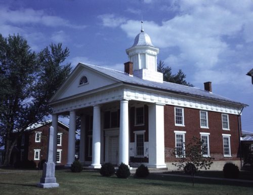
The Greene County Courthouse, Beadles House, Octonia Stone, Powell–McMullan House, and Stanardsville Historic District are listed on the National Register of Historic Places.
Every edition of the U.S. Geological Survey’s map of Stanardsville. Tap a year, or press play to watch the town change.
1930Madison sheet · 1:62,500
U.S. Geological Survey historical topographic maps (public domain), via Esri’s collection of the scans. The red ring marks the center of Stanardsville.
Then & now
Stand where they stood
No then-and-now pairs yet. Take a photo from the same spot as an old one and they appear here side by side.
Retake this viewFire road just off the trail to Bearfence Hut on the Appalachian Trail in northern Virginia, 1980
Find the spot, match the angle, and add your photo. It becomes the first then-and-now pair on Stanardsville’s page.
Founding dates: Wikidata, Wikipedia, the U.S. post office records of Blevins & Helbock (CC0) and the Census. Homes by year built: Census ACS 2020–24. National Register of Historic Places: National Park Service (list of May 22, 2026). Old photos, postcards and papers: Wikimedia Commons, the Library of Congress and other public archives, credited on each item’s page. Maps: U.S. Geological Survey historical topographic maps (via Esri) and Sanborn fire-insurance maps (Library of Congress). History text and census tables: Wikipedia (CC BY-SA 4.0). Places that used to be: USGS Geographic Names Information System (2021). How TownRatings grades history →
From Wikimedia Commons (17), the Library of Congress (1), the National Register of Historic Places (2), Wikipedia, U.S. Geological Survey historical maps, U.S. Census counts (via Wikipedia), the US Post Offices dataset (Blevins & Helbock) and the USGS Geographic Names Information System. Archive images are copied here with their credits and licenses, shown on each photo’s page. Refreshed monthly.




 2023
 2020
 2020
 2012
 2012
 2012
 2012
 2012
 2012
 2012
 2011
 2009
 2009
 2009
 2009
 2005


