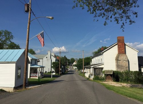
The village of Middlebrook, founded in 1799 by Scots-Irish and German settlers, stretches along Middlebrook Road, which by 1851 was a stagecoach road and a main transport route to Staunton. By the end of the 19th century it was a thriving agricultural community, growing to significance within Augusta County. Railroad building in the region in the late 19th and early 20th century caused Middlebrook to fade in economic importance and cease growing. As a result, the buildings in Middlebrook today reflect an earlier era, a window of what a village looked like in late 19th century.
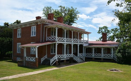
Middlebrook Historic District, Middlebrook Schools, A. J. Miller House, Henry Mish Barn and Maple Front Farm are listed on the National Register of Historic Places.
Lost post offices, old corners and places now gone
Middlebrook’s post office has been open since 1800. Another post office, Summerdean, opened and closed inside today’s town.
Middlebrook
1800–today
Summerdean
1856–1903
18001910today
Hamlets and corners on the map
Summerdean
Gone or out of use
Middlebrook High Schoolschool
US Post Offices dataset (Blevins & Helbock, CC0). Places and cemeteries from the USGS Geographic Names Information System (2021).
Questions about Middlebrook’s history
What is on the National Register in Middlebrook?
7 listings: 6 buildings, among them the A. J. Miller House (listed 1982, the first), and 1 historic district, the Middlebrook Historic District, with 50 contributing buildings. 73 historic buildings in all.
Founding dates: Wikidata, Wikipedia, the U.S. post office records of Blevins & Helbock (CC0) and the Census. Homes by year built: Census ACS 2020–24. National Register of Historic Places: National Park Service (list of May 22, 2026). Old photos, postcards and papers: Wikimedia Commons, the Library of Congress and other public archives, credited on each item’s page. Maps: U.S. Geological Survey historical topographic maps (via Esri) and Sanborn fire-insurance maps (Library of Congress). History text and census tables: Wikipedia (CC BY-SA 4.0). Places that used to be: USGS Geographic Names Information System (2021). How TownRatings grades history →
From Wikimedia Commons (10), the National Register of Historic Places (7), Wikipedia, U.S. Geological Survey historical maps, the US Post Offices dataset (Blevins & Helbock) and the USGS Geographic Names Information System. Archive images are copied here with their credits and licenses, shown on each photo’s page. Refreshed monthly.





 2026
 2016
 2016
 2016
 2016
 2016
 2016
 2016
 2016
 2016


