Leesburg dates to 1758, and 16 of its places are on the National Register
More historic than 73% of U.S. towns · #51 of 253 in Virginia. What drives it
Most of Leesburg was built recently: 2% of its homes predate 1940 and the median home dates from 1993. 16 places in town are on the National Register, among them 2 National Historic Landmarks and two historic districts with 79 buildings between them. Below: 18 old photos and papers, maps from 1886 on, and the census since 1850.
Founding year: Wikidata. First post office: 1792.The full story ↓
History grade
What drives Leesburg’s History grade
On its age, its old homes and the National Register, Leesburg is more historic than 73% of U.S. towns, #51 of 253 in Virginia. Its age holds the grade up; its share of homes from before 1940 pulls it down.
B+
HistoryA character grade: shown, never part of Leesburg’s overall grade.
Virginia towns list more on the Register than most of the country (a typical Virginia town has 3.6 per 10,000 residents, the U.S. 2.4), so Leesburg’s 25.6 sits near the middle of its state (60% of Virginia towns have fewer) while its 126 historic buildings outnumber those of 91% of U.S. towns.
NoteThe founding year comes from Wikidata alone; no second source gives 1758.
How sure. Graded on any two of the three inputs instead, the letter would range from B− to A+. The pre-1940 share (±0.7 points) is firm at this size.
Founding year: Wikidata (other dates in Quick answers). Homes: Census ACS 2020–24. National Register: National Park Service, May 2026 list; each listing counted once (boundary changes and added documentation belong to their listing), and a historic district counts its contributing buildings. How TownRatings grades history →
What stands out about Leesburg’s past
Read from the archive, the National Register and the record. The page puts what stands out first.
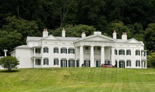
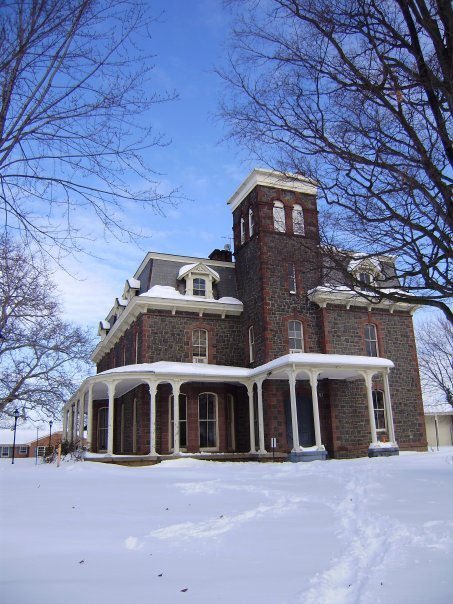
The country’s official list of buildings and places worth saving. 2 are National Historic Landmarks, the highest tier. Boundary changes and added documentation are counted with their listing.
Prior to European settlement, the area around Leesburg was occupied by various Native American tribes.
In 1670, John Lederer (1670) testified that the entire Piedmont region had once been occupied by the "Tacci, alias Dogi", but that the Siouan tribes, driven from the northwest, had occupied it for 400 years.
In 1699, the Algonquian Piscataway (Conoy) moved to an island in the Potomac in the environs of Leesburg, and were there when the first known Europeans visited what is now Loudoun County.
Passages that mention Leesburg, cut from the printed page as they were published.
History and comprehensive description of Loudoun County, Virginia1909 · page 75Read the page →
Read the text
Waterford, a thriving Quaker settlement, is situated on Catoctin Creek in the northern part of the County, 6 miles south of Taylorstown, 7 miles northwest of Leesburg, 47 miles in a like direction from Washington and 159 miles north of Richmond. It was named after the town of Waterford, in Ireland, where some of its founders had formerly resided. The first house within the town limits was built by one Asa Moore, and remains standing at the present day. In common with
Text read by machine from the scan; it may contain errors.
History and comprehensive description of Loudoun County, Virginia1909 · page 77Read the page →
Read the text
Other towns, post villages and settlements in the County are: Airmont, 2]4, miles fromBluemont, population 25; Aldie, on lyittle River, 5 miles from both Middleburg and Oatlands and 12 miles from Leesburg, the County seat, population 155, 7 merchants and mechanics; Arcola,'6 miles from Sterling and 12 miles from Leesburg, population 100, 4 merchants and mechanics; Bebnont Park, a small railway station on the east bank of Goose Creek about 4 miles east of Leesburg, formerly
Text read by machine from the scan; it may contain errors.
Scans and text from the Internet Archive. Books published in 1930 or earlier, which are in the public domain.
Timeline
Leesburg, 1758 to 2024
Woven from the archive, old maps, post office records, the National Register and the people born here.
Nothing in the archives for these yearsWeddings on Main Street, storms, parades, school pictures, the old store. If it’s in your family album, it belongs here.
Every edition of the U.S. Geological Survey’s map of Leesburg. Tap a year, or press play to watch the town change.
1944Leesburg sheet · 1:31,680
U.S. Geological Survey historical topographic maps (public domain), via Esri’s collection of the scans. The red ring marks the center of Leesburg.
Every building
Leesburg, building by building, 1886–1912
Fire insurance maps drew every building, what it was made of and what it was used for, so insurers could price the risk of fire. Pick a year, then a sheet.
Balls Bluff BattlefieldlocaleCool Spring SchoolschoolLeesburg AcademyschoolLeesburg High SchoolschoolOld Stone ChurchchurchSmithsonian Naturalist CenterparkWallace George Fieldairport
4cemeteries and burying grounds inside Leesburg
Ball's Bluff NationalMount Zion CommunitySaint James EpiscopalUnion
US Post Offices dataset (Blevins & Helbock, CC0). Places and cemeteries from the USGS Geographic Names Information System (2021).
Help out
Finish Leesburg’s story
Most archives stop around 1920. The photos from after that are in family albums, not libraries.
Decades since 1900 with photos
00s10s20s30s40s50s60s70s80s90s
4 of 10 decades. The empty ones are waiting for someone’s album.
In 1758, according to Wikidata. Leesburg’s post office opened in 1792, and the census of 1850 counted 1,691 people here.
How does Leesburg rank for history?
Leesburg is more historic than 73% of U.S. towns, #51 of 253 in Virginia. The History grade combines the town’s founding era, the share of homes built before 1940 and its National Register listings. It’s a character grade, so it isn’t part of the overall grade. How it works.
What is on the National Register in Leesburg?
16 listings, 2 of them National Historic Landmarks: 13 buildings and 2 historic districts, the Leesburg Historic District and the Murray Hill, with 79 contributing buildings. 126 historic buildings in all.
How old are the homes in Leesburg?
2% of Leesburg’s homes were built before 1940 (Census estimate), against a typical 1.9% for a Virginia town; the median home was built in 1993.
Founding dates: Wikidata, Wikipedia, the U.S. post office records of Blevins & Helbock (CC0) and the Census. Homes by year built: Census ACS 2020–24. National Register of Historic Places: National Park Service (list of May 22, 2026). Old photos, postcards and papers: Wikimedia Commons, the Library of Congress and other public archives, credited on each item’s page. Maps: U.S. Geological Survey historical topographic maps (via Esri) and Sanborn fire-insurance maps (Library of Congress). History text and census tables: Wikipedia (CC BY-SA 4.0). Places that used to be: USGS Geographic Names Information System (2021).
From Wikimedia Commons (7), the Library of Congress (11), the National Register of Historic Places (16), Wikipedia, Wikidata and Wikipedia for famous people, U.S. Geological Survey historical maps, U.S. Census counts (via Wikipedia), the US Post Offices dataset (Blevins & Helbock), the USGS Geographic Names Information System, Sanborn fire insurance maps (Library of Congress) and old county and town histories (Internet Archive). Archive images are copied here with their credits and licenses, shown on each photo’s page. Refreshed monthly.


 ★ Landmark
 ★ Landmark





![Other towns, post villages and settlements in the County are: Airmont, 2]4, miles fromBluemont, population 25; Aldie, on lyittle River, 5 miles from both Middleburg and Oatlands and 12 miles from Leesburg, the County seat, population 155, 7 merchants and mechanics; Arcola,'6 miles from Sterling and…](https://images.townratings.com/story/18235/bk-88c695b9f93432f9-l.jpg)


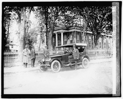


 1905
 1910
 1917
 1929
 1929
 1930
 1930
 1930
 1930
 1930
 1930
 1930
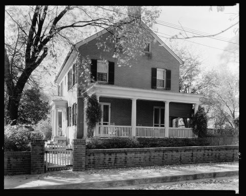 1930


