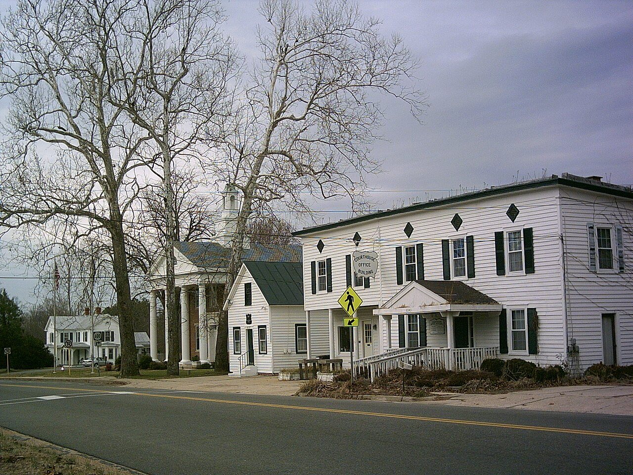
Lancaster Court House Historic District · National Register of Historic Places
Lancaster’s story
133 years in pictures
1 place on the National Register of Historic Places.
- 1893Lancaster is settled
Each edition grades its towns against each other only.

A town of 20, settled in 1893.
Lancaster’s trail density is 2.7 miles per square mile, above both the Virginia town median (0.7) and the median of U.S. towns (0.4). St. Mary's Whitechapel and Belle Isle is on the National Register of Historic Places. Lancaster has fewer than 1,000 residents, too few for fair grades; the figures below are still real.
In a town this size, neighbors are the best guide. Ask them anything.
1 place on the National Register of Historic Places.
Lancaster is unincorporated, so Lancaster County and regional agencies provide most services.
EPA SDWIS (Oct 9, 2026) · HIFLD + EIA-861 2025 · Census 2020 ZCTAs · NCES 2024–25 · registration: vote.gov, updated Sep 30, 2026.
Ordered by what stands out in Lancaster.
5.9 miles of trail in 1 park or preserve. Hickory Hollow State Natural Area Preserve, at 240 acres with 4.3 miles of trail, is the biggest park or preserve.
| Biggest places to walk | Trails | Acres |
|---|---|---|
| 1. Hickory Hollow State Natural Area Preserve | 4.3 mi | 240 |
Trails & parks © OpenStreetMap contributors · Conserved land: USGS PAD-US
Its public schools are run by the Lancaster County Public Schools. Its two schools are below. The largest public high school is Lancaster High, with 402 students.
| School | Level | Students | Letter |
|---|---|---|---|
| New Middle-High SchoolLargest public school before high school | – | – | |
| Lancaster HighLargest public high schoolGrades 8–12 | Grades 8–12 | 402 | C− |
NCES · EDFacts
Lancaster has mild winters and warm summers. Lancaster’s July high is 88°F, close to Virginia’s towns (88°F) and above U.S. towns (85°F).
NOAA U.S. Climate Normals, 1991–2020
The typical Lancaster home is worth about $339,000, up 7.4% in a year, 18% below the Virginia typical home.
Zillow Home Value Index · Redfin Data Center
Lancaster beats the Virginia average on 0 of 32 CDC measures and trails it on 15. 42% of adults have high blood pressure in Lancaster.
| Lancaster | Virginia towns | U.S. towns | |
|---|---|---|---|
| High blood pressure (CDC PLACES) | 42% | 33% | 35% |
| Diabetes (CDC PLACES) | 15% | 11% | 12% |
| Food insecurity (CDC PLACES) | 21% | 12% | 14% |
| Fair or poor health (CDC PLACES) | 24% | 17% | 19% |
| What stands out | Lancaster | VA |
|---|---|---|
| More older adults who have lost all their teeth | 26.2% | 11.1% |
| More adults facing a utility shut-off | 12.4% | 7.1% |
| More adults facing food insecurity | 21.4% | 13.1% |
CDC PLACES 2025 · modeled estimates for adults · CMS · HRSA
Expected storm and flood damage is lower than in 51% of U.S. communities.
FEMA National Risk Index · OpenFEMA
None within 15 miles of Lancaster; the nearest are
About 0 of every 100 Lancaster residents are enrolled in college, against 7 across Virginia.
Unincorporated community in Virginia, United States
Lancaster is an unincorporated community and census-designated place (CDP) in Lancaster County, Virginia, United States. It is the county seat, and is also known as Lancaster Courthouse or by an alternative spelling, Lancaster Court House. The community was first drawn as a CDP prior to the 2020 census and had a population of 105 at the said census. Lancaster lies along Virginia State Route 3, 23 miles (37 km) southeast of Warsaw and 7 miles (11 km) northwest of Kilmarnock, the largest community in Lancaster County. Belle Isle and the Lancaster Court House Historic District are listed on the National Register of Historic Places.
From Wikipedia, licensed CC BY-SA 4.0 · facts via Wikidata (CC0)
Short answers, built from the data on this page.
Lancaster has fewer than 1,000 residents, too few for fair grades; the figures below are still real.