Irvington’s post office opened in 1891, and 24% of its homes were built before 1940
3 places in town are on the National Register, among them the Christ Church, a National Historic Landmark, and a historic district with 149 buildings. Below: maps from 1916 on and the census since 1960.
The Irvington post office opened in 1891, the earliest record of the town by name. Two smaller post offices, Carter's Creek (1873) and Chesapeake (1883), opened inside today’s town and later closed.
First census: 570 in 19602020 census: 474135 years
Founding year: the first Irvington post office (Blevins & Helbock, CC0).The full story ↓
What stands out about Irvington’s past
Read from the archive, the National Register and the record. The page puts what stands out first.
From 1871 until 1893, the town was called "Carter's Creek Wharf" or simply "Carter's Creek", since steamboats docked at the relatively deep water confluence of a tributary that had much earlier been called "Cossotomen Creek" and later "Carter's Creek" after early settler John Carter, Sr., the father of the powerful colonial era politician King Carter, who was the Virginia agent for the Northern Neck Proprietary. The town formally adopted the name "Irvington" to honor Baltimore native Captain Levin Irvington following a 1891 referendum, since mail had been often confused between this town and that of Center Cross in relatively nearby Essex County.
The original Chesapeake Academy, 1889–1907, was located in Irvington.
Founding dates: Wikidata, Wikipedia, the U.S. post office records of Blevins & Helbock (CC0) and the Census. Homes by year built: Census ACS 2020–24. National Register of Historic Places: National Park Service (list of May 22, 2026). Old photos, postcards and papers: Wikimedia Commons, the Library of Congress and other public archives, credited on each item’s page. Maps: U.S. Geological Survey historical topographic maps (via Esri) and Sanborn fire-insurance maps (Library of Congress). History text and census tables: Wikipedia (CC BY-SA 4.0). Places that used to be: USGS Geographic Names Information System (2021). How TownRatings grades history →
From Wikimedia Commons (24), the National Register of Historic Places (3), Wikipedia, Wikidata and Wikipedia for famous people, U.S. Geological Survey historical maps, U.S. Census counts (via Wikipedia), the US Post Offices dataset (Blevins & Helbock) and the USGS Geographic Names Information System. Archive images are copied here with their credits and licenses, shown on each photo’s page. Refreshed monthly.


 ★ Landmark


 2014
 2014
 2014
 2014
 2014
 2014
 2014
 2013
 2013
 2013
 2013
 2013
 2013
 2013
 2013
 2013
 2013
 2013
 2013
 2011
 2011
 2011
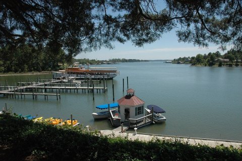 2006
 2006


