Grottoes’ post office opened in 1893, and 1 of its places is on the National Register
More historic than 36% of U.S. towns · #118 of 253 in Virginia. What drives it
Most of Grottoes was built recently: 6% of its homes predate 1940 and the median home dates from 1991. Its Register listing is the Stephen Harnsberger House. Below: 5 old photos and papers, maps from 1941 on, and the census since 1900.
The Grottoes post office opened in 1893, the earliest record of the town by name. Two smaller post offices, Mount Vernon Forge (1870) and Shendun (1890), opened inside today’s town and later closed.
First census: 381 in 19002020 census: 2,899133 years
How historic is Grottoes?
C+
More historic than 36% of U.S. towns, on its age, its old homes and the National Register.
Founding year: the first Grottoes post office (Blevins & Helbock, CC0).The full story ↓
History grade
What drives Grottoes’ History grade
On its age, its old homes and the National Register, Grottoes is more historic than 36% of U.S. towns, #118 of 253 in Virginia. Its National Register listings hold the grade up; its share of homes from before 1940 pulls it down.
C+
HistoryA character grade: shown, never part of Grottoes’ overall grade.
Virginia towns list more on the Register than most of the country (a typical Virginia town has 3.6 per 10,000 residents, the U.S. 2.4), so Grottoes’ 6.8 sits near the middle of its state (50% of Virginia towns have fewer) while its 2 historic buildings outnumber those of 60% of U.S. towns.
How sure. Graded on any two of the three inputs instead, the letter would range from C to C+. The pre-1940 share is a Census survey estimate (±4.0 points). The founding year is the first post office, not a stated founding date.
Founding year: the first post office (other dates in Quick answers). Homes: Census ACS 2020–24. National Register: National Park Service, May 2026 list; each listing counted once (boundary changes and added documentation belong to their listing), and a historic district counts its contributing buildings. How TownRatings grades history →
What stands out about Grottoes’ past
Read from the archive, the National Register and the record. The page puts what stands out first.
The town was previously known as Liola in the 1880s, then briefly called Grottoes (meaning "caves") in 1889. A group of land speculators formally founded Shendun, a combination of "Shenandoah" and the Gaelic word "dun" meaning 'castle' or 'fortified hill', in 1892. Through a series of financial missteps, the Shendun Corporation went bankrupt in 1893. On March 11, 1912 the name was officially changed back to Grottoes.
west side of the Massanutten, and passing through Strasburg, Woodstock, Broadway, Harrisonburg, and Staunton; (2) the one coming up the Valley on the east side of the Massanutten, and passing through Shenandoah City, Elkton, Grottoes, and Basic City; (3) the one crossing the Valley from Elkton, through Harrisonburg, Dayton, and Bridgewater. Having spoken of these, we shall next present a few facts regarding certain railroads that have been projected, but not constructed,
Text read by machine from the scan; it may contain errors.
In 1891 a dispute had arisen between Rockingham and Augusta concerning the location of the dividing line from North River to the top of the Blue Ridge — past Grottoes and Black Rock Springs. About June, 1893, the matter was settled, according to the Rockingham claims, for the most part, at least. Professor William M. Thornton of the University of Virginia acting as expert arbiter. In August (1893) stones were put up, marking that part of the line that had
Text read by machine from the scan; it may contain errors.
Scans and text from the Internet Archive. Books published in 1930 or earlier, which are in the public domain.
Timeline
Grottoes, 1870 to 1968
Woven from the archive, old maps, post office records, the National Register and the people born here.
Nothing in the archives for these yearsWeddings on Main Street, storms, parades, school pictures, the old store. If it’s in your family album, it belongs here.
The Grottoes post office opened in 1893, the earliest record of the town by name (U.S. post office records).
How does Grottoes rank for history?
Grottoes is more historic than 36% of U.S. towns, #118 of 253 in Virginia. The History grade combines the town’s founding era, the share of homes built before 1940 and its National Register listings. It’s a character grade, so it isn’t part of the overall grade. How it works.
What is on the National Register in Grottoes?
One place: the Stephen Harnsberger House (listed 1982).
How old are the homes in Grottoes?
6% of Grottoes’ homes were built before 1940 (Census estimate, ±4.0 points), against a typical 1.9% for a Virginia town; the median home was built in 1991.
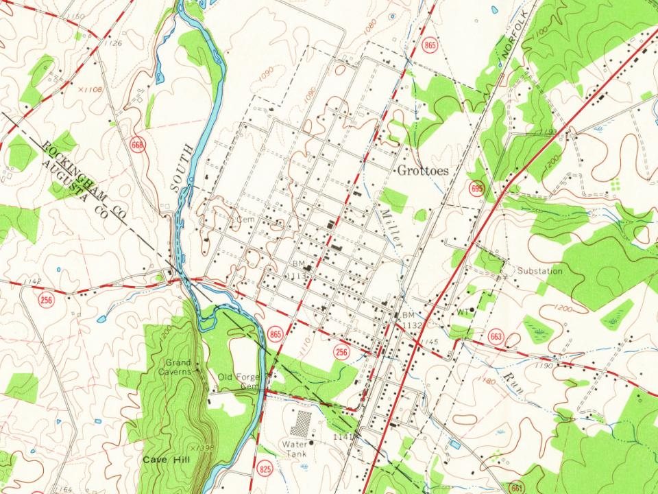
Founding dates: Wikidata, Wikipedia, the U.S. post office records of Blevins & Helbock (CC0) and the Census. Homes by year built: Census ACS 2020–24. National Register of Historic Places: National Park Service (list of May 22, 2026). Old photos, postcards and papers: Wikimedia Commons, the Library of Congress and other public archives, credited on each item’s page. Maps: U.S. Geological Survey historical topographic maps (via Esri) and Sanborn fire-insurance maps (Library of Congress). History text and census tables: Wikipedia (CC BY-SA 4.0). Places that used to be: USGS Geographic Names Information System (2021).
From Wikimedia Commons (5), the Library of Congress (3), the National Register of Historic Places (1), Wikipedia, U.S. Geological Survey historical maps, U.S. Census counts (via Wikipedia), the US Post Offices dataset (Blevins & Helbock), the USGS Geographic Names Information System and old county and town histories (Internet Archive). Archive images are copied here with their credits and licenses, shown on each photo’s page. Refreshed monthly.


 1968
 Date?
 Date?
 2024
 2024
 2012