Berryville dates to 1798, and 17% of its homes were built before 1940
More historic than 91% of U.S. towns · #16 of 253 in Virginia. What drives it
8 places in town are on the National Register, among them three historic districts with 360 buildings between them. Below: 4 old photos and papers, maps from 1944 on, and the census since 1860.
Founding year: Wikipedia. First post office: 1831.The full story ↓
History grade
What drives Berryville’s History grade
On its age, its old homes and the National Register, Berryville is more historic than 91% of U.S. towns, #16 of 253 in Virginia. All 3 inputs are above most U.S. towns; its National Register listings ranks highest and its share of homes from before 1940 lowest.
A
HistoryA character grade: shown, never part of Berryville’s overall grade.
Virginia towns list more on the Register than most of the country (a typical Virginia town has 3.6 per 10,000 residents, the U.S. 2.4), so Berryville’s 784 sits above most of its state (95% of Virginia towns have fewer) while its 369 historic buildings outnumber those of 96% of U.S. towns.
NoteThe founding year comes from Wikipedia alone; no second source gives 1798.
How sure. Graded on any two of the three inputs instead, the letter would range from A− to A. The pre-1940 share is a Census survey estimate (±6.9 points).
Founding year: Wikipedia (other dates in Quick answers). Homes: Census ACS 2020–24. National Register: National Park Service, May 2026 list; each listing counted once (boundary changes and added documentation belong to their listing), and a historic district counts its contributing buildings. How TownRatings grades history →
What stands out about Berryville’s past
Read from the archive, the National Register and the record. The page puts what stands out first.
Berryville was founded at the intersection of the Winchester Turnpike and Charlestown Road. The land was first granted by the Crown to Captain Isaac Pennington in 1734, and George Washington surveyed it on October 23, 1750. In 1754, Pennington sold the land to Colonel John Hite.
According to legend, Daniel Morgan would engage in combat with young toughs at the intersection, having first piled large stones nearby to use as ammunition in case of need. Because of this story, and a rowdy tavern nearby, the area was first given the informal name of "Battle Town".
Passages that mention Berryville, cut from the printed page as they were published.
History of Clarke County, Virginia and its connection with the war between the states1914 · page 65Read the page →
Read the text
Bishop says: "In the year 1827 Christ Church, Winchester, was organized into a separate parish, to be called the parish of Frederick, Winchester." Luther parish, afterwards changed to Clarke parish (Berryville) was admitted in 1853. Greenway Court parish was admitted in 1868. It was in 1866 that the name of Cunningham Chapel parish was adopted for this parish. (See Dashiel's Digest for foregoing statements.) This is clearly a mis-
Text read by machine from the scan; it may contain errors.
History of Clarke County, Virginia and its connection with the war between the states1914 · page 119Read the page →
Read the text
soon driven from their exceedingly strong position and fell back through Berryville to Sheridan's position along the Summit Point turnpike. The column of cavalry sent toward White Post under Torbert heard the firing at Berryville and returned, but their advance was fallen upon by Mosby's men about a mile south of Berryville and a number killed and captured. The main column advancing to the hill near the toll gate were fired upon by artil-
Text read by machine from the scan; it may contain errors.
Scans and text from the Internet Archive. Books published in 1930 or earlier, which are in the public domain.
Timeline
Berryville, 1785 to 1944
Woven from the archive, old maps, post office records, the National Register and the people born here.
Nothing in the archives for these yearsWeddings on Main Street, storms, parades, school pictures, the old store. If it’s in your family album, it belongs here.
In 1798, according to Wikipedia’s history of the town. Berryville’s post office opened in 1831, and the census of 1860 counted 356 people here.
How does Berryville rank for history?
Berryville is more historic than 91% of U.S. towns, #16 of 253 in Virginia. The History grade combines the town’s founding era, the share of homes built before 1940 and its National Register listings. It’s a character grade, so it isn’t part of the overall grade. How it works.
What is on the National Register in Berryville?
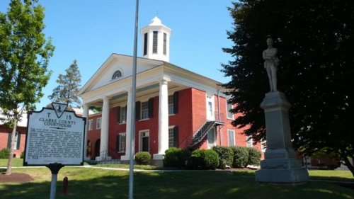
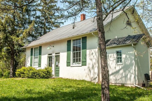
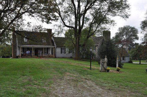
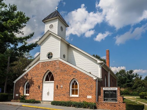
8 listings: 5 buildings, among them the Clarke County Courthouse (Old) (listed 1983, the first), and 3 historic districts, the Berryville Historic District, the Clermont and the Josephine City Historic District, with 360 contributing buildings. 369 historic buildings in all.
How old are the homes in Berryville?
17% of Berryville’s homes were built before 1940 (Census estimate, ±6.9 points), against a typical 1.9% for a Virginia town; the median home was built in 1996.
Founding dates: Wikidata, Wikipedia, the U.S. post office records of Blevins & Helbock (CC0) and the Census. Homes by year built: Census ACS 2020–24. National Register of Historic Places: National Park Service (list of May 22, 2026). Old photos, postcards and papers: Wikimedia Commons, the Library of Congress and other public archives, credited on each item’s page. Maps: U.S. Geological Survey historical topographic maps (via Esri) and Sanborn fire-insurance maps (Library of Congress). History text and census tables: Wikipedia (CC BY-SA 4.0). Places that used to be: USGS Geographic Names Information System (2021).
From Wikimedia Commons (18), the National Register of Historic Places (8), Wikipedia, Wikidata and Wikipedia for famous people, U.S. Geological Survey historical maps, U.S. Census counts (via Wikipedia), the US Post Offices dataset (Blevins & Helbock), the USGS Geographic Names Information System and old county and town histories (Internet Archive). Archive images are copied here with their credits and licenses, shown on each photo’s page. Refreshed monthly.






 1933
 1933
 2012
 2012
 2012
 2012
 2012
 2012
 2010
 2010
 2010
 2010
 2007
 2007
 2007
 2005


