
Bison with saddle (Juvenile Instructor), 1923
Tropic’s story
135 years in pictures
Census counts: 379 in 1900, 486 in 2020. The archive holds 12 old photos and papers going back to 1923 and a map from 1980 on.
- 1891Tropic is settled
Each edition grades its towns against each other only.

A town of 497, settled in 1891.
Only 4 of the 120 Utah towns we compare have a higher median age than Tropic. 35% of the land in Tropic is conserved, where Utah’s towns sit at 3.4% and U.S. towns at 4.3%. Tropic has fewer than 1,000 residents, too few for fair grades; the figures below are still real.
In a town this size, neighbors are the best guide. Ask them anything.
Census counts: 379 in 1900, 486 in 2020. The archive holds 12 old photos and papers going back to 1923 and a map from 1980 on.
Museums, parks, gardens and other places to visit around Tropic. Close and well known come first.
 Big drawin town National ParkBryce Canyon National Park2.0M visitors a year
 33 mi Park & preserveGrand Staircase–Escalante National Monument
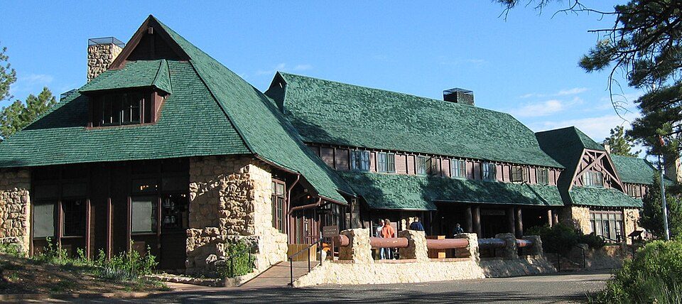 4 mi AttractionBryce Canyon Lodge
 4 mi MuseumOld Administration Building
Bryce Canyon National Park: Luca Galuzzi (Lucag), CC BY-SA 2.5 · Grand Staircase–Escalante National Monument: John Fowler from Placitas, NM, USA, CC BY 2.0 · Bryce Canyon Lodge: Unknown, Public domain · Old Administration Building: National Park Service, Public domain
Who provides power, water and the rest in Tropic, and how to reach them.
EPA SDWIS (Oct 9, 2026) · HIFLD + EIA-861 2025 · Census 2020 ZCTAs · NCES 2024–25 · registration: vote.gov, updated Mar 13, 2026.
Ordered by what stands out in Tropic.
11 miles of trail in 0 parks and preserves. At 1.4 miles per square mile, Tropic’s trail density is against 1.1 in Utah’s towns and 0.4 across U.S. towns.
Trails & parks © OpenStreetMap contributors · Conserved land: USGS PAD-US
Its public schools are run by the Garfield District. Its two schools are below.
| School | Level | Students | Letter |
|---|---|---|---|
| Bryce Valley SchoolLargest public elementary schoolGrades PK–6 | Grades PK–6 | 157 | C− |
| Bryce Valley HighLargest public high schoolGrades 7–12 | Grades 7–12 | 142 | D |
NCES · EDFacts
Expected storm and flood damage is lower than in 82% of U.S. communities.
FEMA National Risk Index · OpenFEMA
Tropic has chilly, snowy winters and warm summers, with very little rain. Tropic’s July high is 85°F.
NOAA U.S. Climate Normals, 1991–2020
Most working residents leave Tropic for work: only 10% work in town. Jobs based in Tropic grew to 154 in 2023, 22 more than in 2013. The average trip to work in Tropic is 27 minutes.
| Tropic | Utah towns | U.S. towns | |
|---|---|---|---|
| Average trip to work | 27 minutes | 22 minutes | 25 minutes |
| Below the poverty line | 3.3% | 6.2% | 9.6% |
| Working residents who work in town | 10% | 8.4% | 8% |
Census LEHD 2023 · ACS
Tropic beats the Utah average on 4 of 32 CDC measures and trails it on 10. 11% of Tropic adults binge drink. Only 4 of the 119 Utah towns we compare have a higher share of adults who had a checkup this year than Tropic.
| Tropic | Utah towns | U.S. towns | |
|---|---|---|---|
| Binge drink (CDC PLACES) | 11% | 11% | 16% |
| Feel lonely (CDC PLACES) | 30% | 33% | 33% |
| Yearly checkup (CDC PLACES) | 76% | 72% | 79% |
| Obesity (CDC PLACES) | 30% | 31% | 35% |
| What stands out | Tropic | UT |
|---|---|---|
| Fewer uninsured adults | 8% | 10.5% |
| More adults treating high blood pressure | 73.8% | 65.6% |
| More adults with heart disease | 7.2% | 4.7% |
CDC PLACES 2025 · modeled estimates for adults · CMS · HRSA
None within 15 miles of Tropic; the nearest are
About 2 of every 100 Tropic residents are enrolled in college, against 8 across Utah.
Town in Garfield County, Utah, United States
Tropic is a town in Garfield County, Utah, United States, along Utah State Route 12 (A Journey Through Time Scenic Byway / Scenic Byway 12). As of the 2020 census, the town had a population of 486. Tropic was founded in 1891.
From Wikipedia, licensed CC BY-SA 4.0 · facts via Wikidata (CC0)
Short answers, built from the data on this page.
Tropic has fewer than 1,000 residents, too few for fair grades; the figures below are still real.


