
Grand Staircase–Escalante National Monument
The Grand Staircase–Escalante National Monument (GSENM) is a United States national monument protecting the Grand Staircase, the Kaiparowits Plateau, and the Canyons of the Escalante (Escalante River) in southern Utah.

A park & preserve, 24 mi south of Escalante
Plan where you’ll sleep
The nearest town with many places to stay is Escalante, 24 miles north. Where to stay ↓
Winters are cold
January nights drop to 18°, with about 26" of snow a year. When to go ↓
Best months: May and Sep
May and September are the mild months, with highs of 73–79°. When to go ↓
Established in 1996
Grand Staircase–Escalante National Monument dates from 1996 and is run by United States Bureau of Land Management. About ↓
Written from NOAA 1991–2020 normals, Overture places to stay, Census town figures, Wikidata and Wikipedia.
Weather, month by month
Typical highs and lows in Escalante. Green months are the mild ones.
Grand Staircase–Escalante National Monument
The Grand Staircase–Escalante National Monument (GSENM) is a United States national monument protecting the Grand Staircase, the Kaiparowits Plateau, and the Canyons of the Escalante (Escalante River) in southern Utah. It was established in 1996 by President Bill Clinton under the authority of the Antiquities Act with 1.7 million acres of land, later expanded to 1,880,461 acres (7,610 km2). In 2017, the monument's size was reduced by half in a succeeding presidential proclamation, and it was restored in 2021. President Trump again cut out most of the monument by proclamation on July 13, 2026. The land is among the most remote in the country; it was the last to be mapped in the contiguous United States.
- Type
- Park & preserve
- Established
- 1996
- Run by
- United States Bureau of Land Management
- Wikipedia readers
- 39K a year
Where to stay near Grand Staircase–Escalante National Monument
The closest towns with hotels, motels or campgrounds are Escalante (16) and Big Water (4).
Escalante
The closest town with somewhere to stay.
817 people
24 mi north of Grand Staircase–Escalante
Compare 4 towns
| Town | From Grand Staircase–Escalante | Drive | Places to stay | People | Typical home |
|---|---|---|---|---|---|
| Escalante | 24 mi north | 35 min | 16 5 hotels · 2 motels · 2 inns & B&Bs · 3 lodges & cabins · 2 campgrounds · 2 RV parks | 817 | $352K |
| Big Water | 25 mi south | 35 min | 4 1 hotel · 1 motel · 1 inn or B&B · 1 RV park | 532 | $273K |
| Cannonville | 29 mi west | 45 min | 5 1 inn or B&B · 2 lodges & cabins · 2 campgrounds | 189 | $332K |
| Greenehaven 37% vacation homes | 29 mi south | 45 min | 1 1 campground | 325 | $235K |
Getting there
Nearest airports with airline service
Also near Grand Staircase–Escalante
Other well-known places within 59 miles. Numbered ones are on the map above.
 Big draw33 mi LakeLake Powell
 Big draw37 mi National ParkBryce Canyon National Park2.0M visitors a year
 33 mi DamGlen Canyon Dam
 40 mi Canyon & gorgeAntelope Canyon
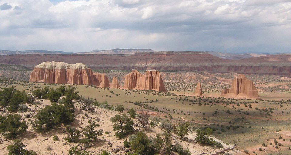 58 mi National ParkCapitol Reef National Park1.4M visitors a year
 40 mi National MonumentRainbow Bridge National Monument11K visitors a year
 43 mi Park & preserveVermilion Cliffs National Monument
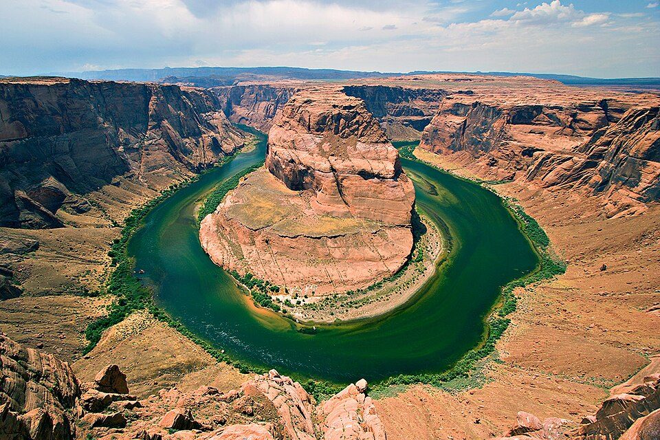 129 mi National Recreation AreaGlen Canyon National Recreation Area3.7M visitors a year
Photo credits
Lake Powell: Copernicus Sentinel-2, ESA, CC BY-SA 3.0 igo · Bryce Canyon National Park: Luca Galuzzi (Lucag), CC BY-SA 2.5 · Glen Canyon Dam: W. Bulach, CC BY-SA 4.0 · Antelope Canyon: Lucas Löffler, Public domain · Capitol Reef National Park: Bob Palin, CC BY-SA 2.5 · Rainbow Bridge National Monument: Jason Hickey, CC BY 2.0 · Vermilion Cliffs National Monument: Lobineau, CC BY 2.5 · Glen Canyon National Recreation Area: User:Moondigger, CC BY-SA 2.5


Visiting Grand Staircase–Escalante
What town is Grand Staircase–Escalante National Monument near?
Escalante, UT, about 24 miles north.
When is the best time to visit Grand Staircase–Escalante National Monument?
May and September, with highs of 73–79°.
What is the closest airport to Grand Staircase–Escalante National Monument?
Page Municipal (PGA), about 34 miles away. The nearest big hub is Harry Reid (LAS), about 220 miles.
Where should I stay near Grand Staircase–Escalante National Monument?
Escalante (24 mi, 16 places to stay), Big Water (25 mi, 4 places to stay) and Cannonville (29 mi, 5 places to stay).
Tips from people in Escalante
No tips yet. Ask, or answer, in Escalante’s Town Square.
Sources: National Park Service · ski areas © OpenSkiMap / OpenStreetMap contributors · Wikidata · Wikipedia readership · NOAA climate normals · U.S. Census.