178 years in pictures
Census counts: 17,448 in 1980, 60,448 in 2020. The archive holds 10 old photos and papers going back to 2005 and 4 maps from 1951 on.
2 places on the National Register of Historic Places.
- 1848Taylorsville is settled
Each edition grades its towns against each other only.
A city of 57,484, settled in 1848.
Taylorsville grades C overall, 109th among Utah's 118 graded towns, with clear strengths and some subjects that lag. It is easier to get around on foot or by transit than 81% of U.S. towns. On the other side, its schools rank behind 80% of the state's. Taylorsville is home to Salt Lake Community College. Taylorsville’s property crime rate is 17.3 per 1,000 residents, above both Utah’s towns (8.6) and U.S. towns (9.9). Taylorsville has 2 places on the National Register of Historic Places, among them Taylorsville LDS Ward Meetinghouse and John and Jennette Gerrard House.
Where Taylorsville beats most towns.
Each subject compared with towns across the country (schools within Utah), ordered by how far Taylorsville is from typical.
How TownRatings grades towns →
Census counts: 17,448 in 1980, 60,448 in 2020. The archive holds 10 old photos and papers going back to 2005 and 4 maps from 1951 on.
2 places on the National Register of Historic Places.
Museums, parks, gardens and other places to visit around Taylorsville. Close and well known come first.
Big draw8 mi Stadium & arenaDelta Center
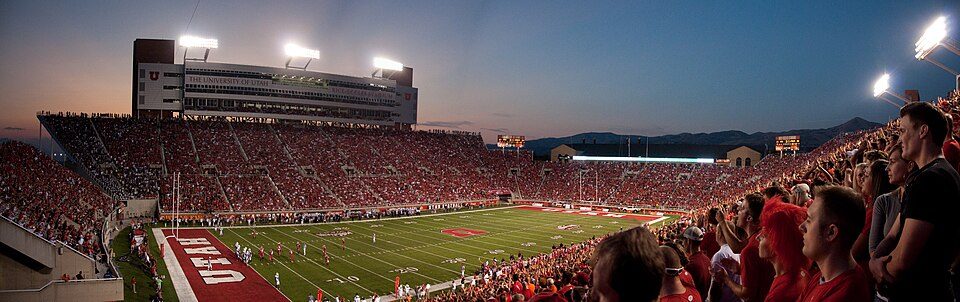
9 mi Stadium & arenaRice–Eccles Stadium
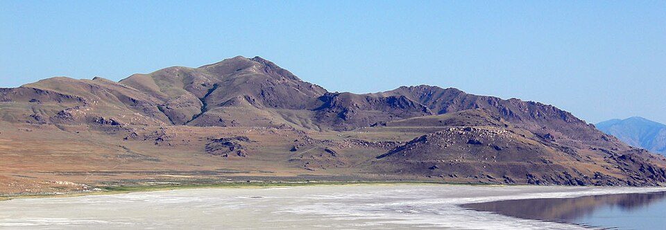
19 mi LakeLake Bonneville
6 mi Stadium & arenaAmerica First Field
3 mi Stadium & arenaMaverik Center
8 mi GardenTemple SquareDelta Center: Lomrjyo, CC BY-SA 4.0 · Rice–Eccles Stadium: Brenton Walker, CC BY 2.0 · Lake Bonneville: Wilson44691, Public domain · America First Field: Scott Catron, CC BY-SA 2.0 · Maverik Center: Dave O, CC BY-SA 2.0 · Temple Square: Carol M. Highsmith, Public domain
Who provides power, water and the rest in Taylorsville, and how to reach them.
EPA SDWIS (Oct 9, 2026) · HIFLD + EIA-861 2025 · Census 2020 ZCTAs · NCES 2024–25 · registration: vote.gov, updated Mar 13, 2026.
Ordered by what stands out in Taylorsville.
Taylorsville reports less crime than West Jordan or any other graded neighbor and is healthy by national standards but behind most towns in Utah.
Its public schools are run by the Granite District. Two of its 18 schools are below, each with why it’s listed.
| School | Level | Students | Letter |
|---|---|---|---|
| Fox Hills SchoolLargest public elementary schoolGrades K–6 | Grades K–6 | 553 | B |
| Taylorsville HighLargest public high schoolGrades 9–12 | Grades 9–12 | 2,685 | C |
NCES · EDFacts · graded within UT on state tests and graduation
Most working residents leave Taylorsville for work: only 5% work in town. Jobs based in Taylorsville fell to 18,786 in 2023, 1,138 fewer than in 2013. The top destinations are Salt Lake City (29%), West Valley City (10%) and Murray (6%).
| Taylorsville | Utah towns | U.S. towns | |
|---|---|---|---|
| Working residents who work in town | 5.1% | 8.5% | 8% |
| Median household income | $86,000 | $101,000 | $80,000 |
| Work from home | 15% | 16% | 11% |
| Average trip to work | 22 minutes | 22 minutes | 25 minutes |
Census LEHD 2023 · ACS
9.6 miles of trail in 16 parks and preserves. Valley Regional Park, at 91 acres with 1.8 miles of trail, is the biggest park or preserve. Taylorsville’s trail density is 0.9 miles per square mile.
| Taylorsville | Utah towns | U.S. towns | |
|---|---|---|---|
| Miles of trail per square mile | 0.9 miles per square mile | 1.1 | 0.4 |
| Conserved land | 6.1% | 3.4% | 4.3% |
| Biggest places to walk | Trails | Acres |
|---|---|---|
| 1. Vista Park | 2.1 mi | 36 |
| 2. Valley Regional Park | 1.8 mi | 91 |
| 3. Southridge Park | 0.4 mi | 39 |
Trails & parks © OpenStreetMap contributors · Conserved land: USGS PAD-US
Within Utah it is less healthy than 82% of the 118 graded towns: Utah sets a high bar.
Taylorsville beats the Utah average on 0 of 32 CDC measures and trails it on 18. 69% of adults had a checkup this year in Taylorsville. Only 7 of the 118 Utah towns we compare have a higher share of adults 18 to 64 who have no health insurance than Taylorsville.
| Taylorsville | Utah towns | U.S. towns | |
|---|---|---|---|
| Yearly checkup (CDC PLACES) | 69% | 72% | 79% |
| Feel lonely (CDC PLACES) | 37% | 33% | 33% |
| No health insurance, 18–64 (CDC PLACES) | 14% | 9.5% | 8.1% |
| Binge drink (CDC PLACES) | 15% | 11% | 16% |
| What stands out | Taylorsville | UT |
|---|---|---|
| More adults facing food insecurity | 17.6% | 12.4% |
| More uninsured adults | 14.4% | 10.5% |
| More adults facing housing insecurity | 13.4% | 10% |
CDC PLACES 2025 · modeled estimates for adults · CMS · HRSA
Crime runs higher than in most U.S. towns, but its C tops all 3 graded towns on its borders; West Jordan (C) comes closest. Reported crimes fell from 1,352 to 1,095 over the last three FBI years, a drop beyond ordinary year-to-year swings.
FBI crime data, 2025 · crimes reported to police
Expected storm and flood damage is higher than in 68% of U.S. communities. One flood insurance claim has been paid in Taylorsville since 2011.
FEMA flood insurance claims · FEMA National Risk Index · OpenFEMA
Taylorsville has chilly, snowy winters and hot summers, with very little rain. The July high in Taylorsville is 92°F.
NOAA U.S. Climate Normals, 1991–2020
The typical Taylorsville home is worth about $492,000, up 0.6% in a year, 8% below the Utah typical home.
| Taylorsville | Utah towns | U.S. towns | |
|---|---|---|---|
| Households that own their home | 71% | 79% | 73% |
| Median rent | $1,482 a month | $1,542 a month | $1,185 a month |
Zillow Home Value Index · Redfin Data Center
8 within 15 miles of the center of Taylorsville
About 5 of every 100 Taylorsville residents are enrolled in college, against 8 across Utah.
Where Taylorsville’s working residents go each day. Line width shows the share.
Census LEHD 2023
5 notable people were born in Taylorsville.


City in Utah, United States
Taylorsville is a city in Salt Lake County, Utah. It is part of the Salt Lake City metropolitan area. The population was 60,448 at the time of the 2020 census. Taylorsville was incorporated from the Taylorsville–Bennion CDP and portions of the Kearns metro township on July 1, 1996. The city is located adjacent to Interstate 215 and Bangerter Highway. It is located in the middle of the Salt Lake Valley.
From Wikipedia, licensed CC BY-SA 4.0 · facts via Wikidata (CC0)
5 towns share a border with Taylorsville.
| Town | UT rank | Overall | Cost | Safety | Schools | Health |
|---|---|---|---|---|---|---|
| Taylorsville | #109 | C | C+ | C | C− | B+ |
| Murray | #103 | C+ | C+ | D | C | A |
| West Jordan | #87 | B | C | C | B | A− |
| Millcreek | #95 | B− | C− | — | C− | A |
| Kearns | #108 | C | C+ | — | C− | B |
| West Valley City | #113 | C− | C+ | C− | C− | B− |
Millcreek and Kearns report no FBI crime data of their own. Compare Taylorsville with a neighbor →
Short answers, built from the data on this page.
Taylorsville grades C overall, better than 34% of U.S. towns and #109 of 118 in Utah. It grades B+ for health, C for safety and C− for schools. Schools is its weak spot, with a C−.
That is 5 years of the area's median household income ($98,083 across the Salt Lake City-Murray, UT metro area). Cost of living, which also weighs rents, property taxes and how many households pay 30% or more of their income for housing, grades C+.
5 notable people were born here, including Adam S. Bennion and Milton Bennion.