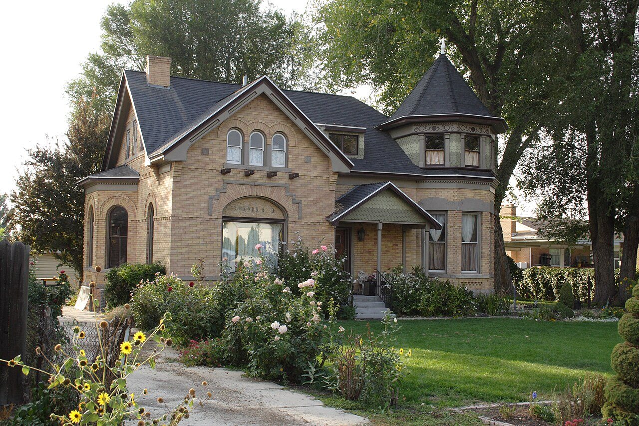
169 years in pictures
Census counts: 32,230 in 1990, 63,380 in 2020. The archive holds 10 old photos and papers going back to 1848 and 2 maps from 1925 on.
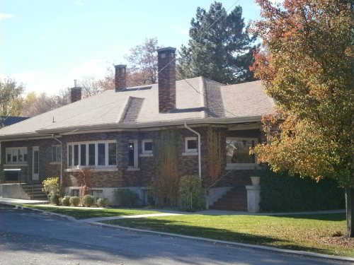
13 places on the National Register of Historic Places.
- 1857Millcreek is settled
Each edition grades its towns against each other only.

Millcreek grades B− overall, ranked 95th of 118 in Utah, with clear strengths and some subjects that lag. CDC estimates put its residents' health ahead of 92% of the country and the median household earns $98K. On the other side, FEMA rates its natural-hazard risk higher than 79% of U.S. communities, with earthquakes at the top. On walkability, just 6 of Utah’s 173 towns do better. Millcreek has 13 places on the National Register of Historic Places, among them Robert Jr. Gardner House and Butler-Wallin House. Among 119 Utah towns, just 9 have a lower share of children under 18 than Millcreek.
Where Millcreek beats most towns.
Census counts: 32,230 in 1990, 63,380 in 2020. The archive holds 10 old photos and papers going back to 1848 and 2 maps from 1925 on.
13 places on the National Register of Historic Places.
Each subject compared with towns across the country (schools within Utah), ordered by how far Millcreek is from typical.
How TownRatings grades towns →
Museums, parks, gardens and other places to visit around Millcreek. Close and well known come first.
Big draw7 mi Stadium & arenaDelta Center
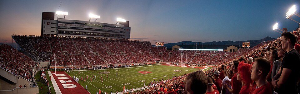
5 mi Stadium & arenaRice–Eccles Stadium
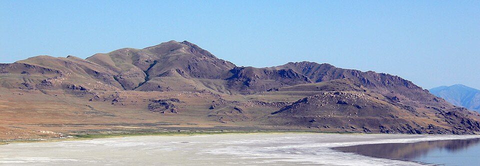
26 mi LakeLake Bonneville
8 mi Stadium & arenaAmerica First Field
7 mi GardenTemple Square
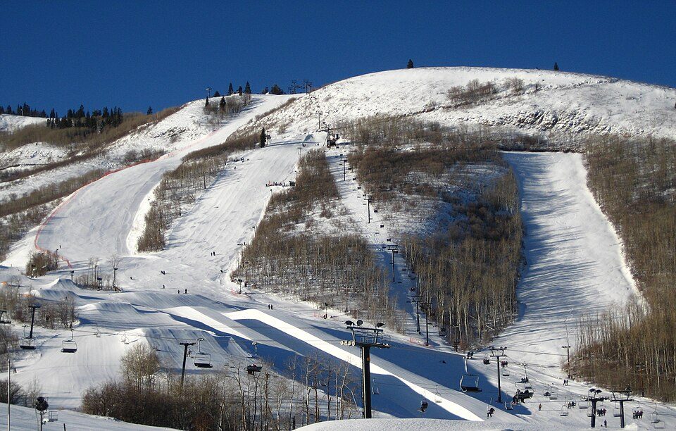
16 mi Ski areaPark City Mountain Resort393 runs · 3,100 ft verticalDelta Center: Lomrjyo, CC BY-SA 4.0 · Rice–Eccles Stadium: Brenton Walker, CC BY 2.0 · Lake Bonneville: Wilson44691, Public domain · America First Field: Scott Catron, CC BY-SA 2.0 · Temple Square: Carol M. Highsmith, Public domain · Park City Mountain Resort: Rudi Riet from Washington, DC, United States, CC BY-SA 2.0
Who provides power, water and the rest in Millcreek, and how to reach them.
EPA SDWIS (Oct 9, 2026) · HIFLD + EIA-861 2025 · Census 2020 ZCTAs · NCES 2024–25 · registration: vote.gov, updated Mar 13, 2026.
Ordered by what stands out in Millcreek.
71% of adults had a checkup this year in Millcreek, close to Utah’s towns (72%) and below U.S. towns (79%). 6.9% of adults smoke cigarettes in Millcreek. Millcreek beats the Utah average on 6 of 32 CDC measures and trails it on 2.
| Millcreek | Utah towns | U.S. towns | |
|---|---|---|---|
| Yearly checkup (CDC PLACES) | 71% | 72% | 79% |
| Smoke cigarettes (CDC PLACES) | 6.9% | 8% | 14% |
| Obesity (CDC PLACES) | 28% | 31% | 35% |
| Binge drink (CDC PLACES) | 15% | 11% | 16% |
| What stands out | Millcreek | UT |
|---|---|---|
| Fewer uninsured adults | 8.8% | 10.5% |
| Fewer smokers | 6.9% | 8.1% |
| More binge drinkers | 15.2% | 12.4% |
CDC PLACES 2025 · modeled estimates for adults · CMS · HRSA
Its public schools are run by the Granite District. Three of its 20 schools are below, each with why it’s listed.
| School | Level | Students | Letter |
|---|---|---|---|
| Wasatch Jr HighLargest public middle schoolGrades 6–8 | Grades 6–8 | 829 | A− |
| Skyline HighLargest public high schoolGrades 7–12 | Grades 7–12 | 2,186 | A |
| Eastwood SchoolTop results in townGrades PK–5 | Grades PK–5 | 300 | A+ |
NCES · EDFacts · graded within UT on state tests and graduation
One flood insurance claim has been paid in Millcreek since 2022.
FEMA flood insurance claims · FEMA National Risk Index · OpenFEMA
13 miles of trail in 14 parks and preserves. Uinta-Wasatch-Cache National Forest, at 372 acres with 5.1 miles of trail, is the biggest park or preserve. At 1.0 miles per square mile, Millcreek’s trail density is near the Utah town median (1.1) and above the median of U.S. towns (0.4).
| Millcreek | Utah towns | U.S. towns | |
|---|---|---|---|
| Miles of trail per square mile | 1.0 miles per square mile | 1.1 | 0.4 |
| Conserved land | 4.3% | 3.4% | 4.3% |
| Biggest places to walk | Trails | Acres |
|---|---|---|
| 1. Uinta-Wasatch-Cache National Forest | 5.1 mi | 372 |
| 2. Big Cottonwood Regional Park | 2.5 mi | 127 |
| 3. Canyon Rim Park | 1 mi | 16 |
Trails & parks © OpenStreetMap contributors · Conserved land: USGS PAD-US
Millcreek has chilly, snowy winters and warm summers, with very little rain. Millcreek’s July high is 91°F.
NOAA U.S. Climate Normals, 1991–2020
The typical Millcreek home is worth about $632,000, up 3.3% in a year, 19% above the Utah typical home. 61% of Millcreek households own their home.
| Millcreek | Utah towns | U.S. towns | |
|---|---|---|---|
| Households that own their home | 61% | 79% | 73% |
| Median rent | $1,492 a month | $1,542 a month | $1,185 a month |
| Renters paying 30%+ of income on rent | 48% | 45% | 48% |
Census ACS, 2020–24 · Zillow Home Value Index · Redfin Data Center
Jobs based here fell from 41,484 in 2013 to 24,923.
Most working residents leave Millcreek for work: only 7% work in town. Since 2013, Millcreek has lost 16,561 jobs, to 24,923 in 2023. The average trip to work in Millcreek is 21 minutes.
| Millcreek | Utah towns | U.S. towns | |
|---|---|---|---|
| Work from home | 23% | 16% | 11% |
| Average trip to work | 21 minutes | 22 minutes | 25 minutes |
| Median household income | $98,000 | $101,000 | $80,000 |
| Below the poverty line | 7.8% | 6.2% | 9.6% |
Census LEHD 2023 · ACS
8 within 15 miles of the center of Millcreek
About 8 of every 100 Millcreek residents are enrolled in college, about the same as Utah.
13 places in Millcreek on the National Register of Historic Places.
City in Utah, United States
Millcreek is a city in Salt Lake County, Utah, United States, and part of the Salt Lake City metropolitan area. The population as of the 2020 census was 63,380. Prior to its incorporation on December 28, 2016, Millcreek was a census-designated place (CDP) and township.
From Wikipedia, licensed CC BY-SA 4.0 · facts via Wikidata (CC0)
5 towns share a border with Millcreek.
| Town | UT rank | Overall | Cost | Safety | Schools | Health |
|---|---|---|---|---|---|---|
| Millcreek | #95 | B− | C− | — | C− | A |
| Salt Lake City | #114 | C− | C | D− | C− | A− |
| Murray | #103 | C+ | C+ | D | C | A |
| Holladay | #89 | B | C | — | C− | A+ |
| Taylorsville | #109 | C | C+ | C | C− | B+ |
| South Salt Lake | #117 | D | C | D− | C− | B |
Millcreek and Holladay report no FBI crime data of their own. Compare Millcreek with a neighbor →
Short answers, built from the data on this page.
Millcreek grades B− overall, better than 49% of U.S. towns and #95 of 118 in Utah. It grades A for health and C− for schools. Hazard risk is its weak spot, with a D.
Yes. That is 6.4 years of the area's median household income ($98,083 across the Salt Lake City-Murray, UT metro area). Cost of living, which also weighs rents, property taxes and how many households pay 30% or more of their income for housing, grades C−.