Guest, Sign inJoin

Post to Sandy

We’ll email a one-tap link to publish your post. No password, and nothing is public until you click it.
Already a member? Sign in
Sandy, Utah city hall
Utah›Salt Lake County
Photo: Scott Catron from Sandy, Utah, USA · CC BY-SA 2.0
Photo of Sandy

Sandy, UT · Photo: Scott Catron from Sandy, Utah, USA · CC BY-SA 2.0 · Source ↗

Is Sandy a good place to live?

Sandy grades B+ overall, 68th of 118 graded towns in Utah, with clear strengths and some subjects that lag. The median household earns $112K and CDC estimates put its residents' health ahead of 90% of the country. It also does better than most on schools: its public schools beat 75% of Utah towns on state tests and graduation. Its lowest everyday mark is in cost of living: the typical home is worth about $657K, 6.7 years of the Salt Lake City metro’s $98K median household income. Sandy’s trail network density is 2.2 miles per square mile, against 1.1 in Utah’s towns and 0.4 across U.S. towns. Its National Register listings include Sandy Tithing Office and William D. Kuhre House. On the outdoors, just 17 of Utah’s 173 towns do better.

What makes Sandy stand out

Where Sandy beats most towns.

Sandy Tithing Office
Sandy Tithing Office · National Register of Historic Places
Sandy’s story

155 years in pictures

Its 55 National Register listings are more than in 95% of Utah towns with a listing.

Census counts: 488 in 1880, 96,904 in 2020. The archive holds 15 old photos and papers going back to 1874 and 4 maps from 1952 on.

  • 1871Sandy is settled
Explore the history →

How Sandy grades

Each subject compared with towns across the country (schools within Utah), ordered by how far Sandy is from typical.

How grading works
Character Graded, but not part of the overall grade.
Described, not graded Taste, not quality: snow or an older crowd is neither good nor bad.

How TownRatings grades towns →

Nearby attractions

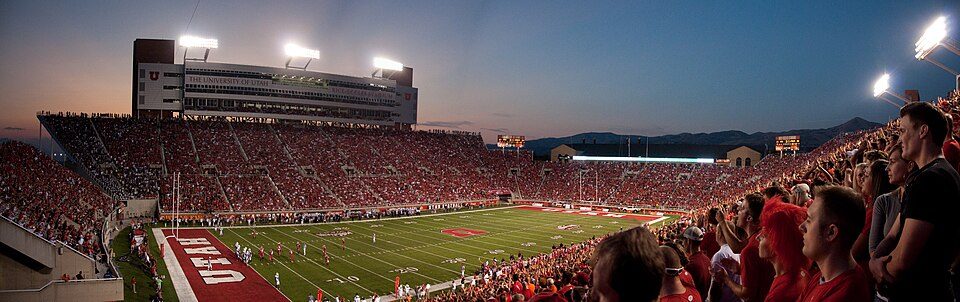
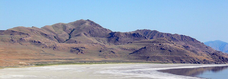
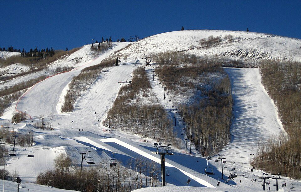
Delta Center and 67 more within 40 miles

Museums, parks, gardens and other places to visit around Sandy. Close and well known come first.

All 77 attractions →
Sources: National Park Service · ski areas © OpenSkiMap / OpenStreetMap contributors · Wikidata · Wikipedia readership · photos via Wikimedia Commons
Photo credits

Delta Center: Lomrjyo, CC BY-SA 4.0 · America First Field: Scott Catron, CC BY-SA 2.0 · Rice–Eccles Stadium: Brenton Walker, CC BY 2.0 · Lake Bonneville: Wilson44691, Public domain · Park City Mountain Resort: Rudi Riet from Washington, DC, United States, CC BY-SA 2.0

Getting set up

Moving to Sandy: who provides what

Who provides power, water and the rest in Sandy, and how to reach them.

The full setup list →
PowerRocky Mountain Power13.5¢/kWh · EIA 2025HIFLD · EIA
WaterSandy City Water SystemNo health-based violations in 5 years · EPAEPA
Internet9 providers100% of addresses get 100/20 MbpsFCC
Trash & dumpFrom the town’s siteTrash and recycling rulesTown site
SchoolsCanyons School DistrictWhich school depends on your addressNCES
Register to voteOnlineIn Utah you can register online until 11 days before Election Day, in person up to and including Election Day, or by mail (received 11 days before).vote.gov
Who runs elections hereSalt Lake County ClerkSalt Lake County; contacts on the Handbook page.FVAP, Nov 2025
ZIP codes84070, 84092, 84094, 8409384070 30% · 84092 28% · 84094 23% · 84093 17%Census 2020

EPA SDWIS (Oct 9, 2026) · HIFLD + EIA-861 2025 · Census 2020 ZCTAs · NCES 2024–25 · registration: vote.gov, updated Mar 13, 2026.

The data

Ordered by what stands out in Sandy.

Sandy gets more snow than nearly all U.S. towns, but it reports more crime than West Jordan and its other graded neighbors and has homes that cost more against local pay than most of Utah.

OutdoorsA

In Sandy, 7.6% of the land is conserved

Walkers can cover 54 miles of trail in 40 parks and preserves. The biggest place to walk is Dimple Dell Park, 594 acres with 23.9 miles of trail. Parks and preserves in Sandy: 40, covering 1,146 acres.

#22for trails in UT
7.6%
conserved · 1,174 of 15,511 acres
54 mi
of trails · 2.2 per sq mi
Biggest places to walkTrailsAcres
1. Dimple Dell Park23.9 mi594
2. Dimple Dell Regional Park1.7 mi43
3. Quail Hollow Park1.4 mi47

Trails & parks © OpenStreetMap contributors · Conserved land: USGS PAD-US

SchoolsA−

Sandy earns an A− for schools

The public schools here belong to the Canyons District. Three of its 32 schools are shown below, with the reason for each. Public school enrollment in Sandy: 3,460 students across 6 schools.

75%of UT districts it outscoresA−School Grade
SchoolLevelStudentsLetter
Indian Hills MiddleLargest public middle schoolGrades 6–8Grades 6–81,072A−
Alta HighLargest public high schoolGrades 8–12Grades 8–122,278B
Sunrise SchoolTop results in townGrades K–5Grades K–5647A+

NCES · EDFacts · graded within UT on state tests and graduation

HealthA

Sandy earns an A for health

Within Utah it is healthier than 66% of the 118 graded towns: Utah sets a high bar.

The share of adults in Sandy who have obesity is 29%, below both the Utah town median (31%) and the median of U.S. towns (35%). Among adults in the town, 71% had a checkup this year. Of 32 CDC measures, Sandy beats the Utah average on 8 and trails it on 2. Two figures for adults locally: 7.4% smoke cigarettes, 15% binge drink.

91%healthier than U.S. townsAHealth Grade
SandyUtah townsU.S. towns
Yearly checkup (CDC PLACES)71%72%79%
Smoke cigarettes (CDC PLACES)7.4%8%14%
Binge drink (CDC PLACES)15%11%16%
Obesity (CDC PLACES)29%31%35%
32 measures vs. Utah
8 better22 too close to call2 worse
What stands outSandyUT
Fewer uninsured adults8.7%10.5%
Fewer adults without reliable transportation5.9%6.9%
More binge drinkers15.2%12.4%
Intermountain Health Alta View Hospital
0.5 mi away · emergency room
1 of 3
care shortages: mental health
66th
percentile among UT towns

CDC PLACES 2025 · modeled estimates for adults · CMS · HRSA

SafetyC

Sandy sees more crime per resident than seven in ten U.S. towns

Each of the 4 graded towns on its borders reports less crime per resident, from West Jordan (C) to South Jordan (B). Reported crimes fell from 2,422 to 1,861 over the last three FBI years, a drop beyond ordinary year-to-year swings.

Only 5 of the 62 Utah towns we compare have a higher property crime rate than Sandy. Its violent crime rate comes in at 1.7 per 1,000 residents.

30%of U.S. towns report more crimeCSafety Grade
SandyUtah townsU.S. towns
Property crimes per 1,000 (2023)24.9 per 1,000 residents11.713.1
Violent crimes per 1,000 (2023)1.7 per 1,000 residents1.51.8

Violent crime per 1,000 residents

Sandy1.7
Utah2.4
U.S.3.9

Property crime per 1,000 residents

Sandy24.9
Utah16.6
U.S.19.5
30th
percentile among U.S. towns we grade
20th
percentile among UT towns
151
violent crimes reported in 2023
2,271
property crimes reported in 2023

FBI crime data, 2023 · crimes reported to police

HousingCost of living grade C

Sandy earns a C for cost of living

At 6.7 years of the Salt Lake City metro’s $98K median household income, the typical home (about $657K) costs more against local pay than in 77% of Utah towns; that ratio is one input to that grade.

For Sandy, the going rate for rent is $1,777 a month. Zillow values the typical Sandy home at about $657,000, up 2% in a year, 23% above the Utah typical home. A home in Sandy typically sold within 28 days of listing.

$657KZillow home value

Typical home value

Sandy$657K
Utah$533K
Market temperature
Seller’s marketA seller's marketBuyer’sSeller’s
28
days on market
99.3%
sale-to-list price
+2%
value change, 1 year
89
homes sold in May

Census ACS, 2020–24 · Zillow Home Value Index · Redfin Data Center

Climate

Expect snowy winters and hot summers in Sandy

The Cottonwood Weir weather station, 5 miles away, records that 82 inches of snow fall in a normal winter, more than in 95% of U.S. towns.

The peak summer temperature in Sandy is 91°F.

82″snow a winter

Typical low → high °F

Winter23–40°
Spring39–62°
Summer60–88°
Fall41–65°
Oct 22
typical first frost
Apr 29
typical last frost
+1.7°
vs. the 20th-century average

NOAA U.S. Climate Normals, 1991–2020

Who lives here

Fewer young adults than Utah overall

Adults 18 to 34 are 20% of residents (26% statewide); adults 35 to 64 are 38% of residents (34% statewide). Sandy has lost 5.2% of its people since 2020, down to 92,386 in the Census Bureau’s 2025 estimate. In Sandy, 46% of adults 25 and older hold a bachelor’s degree or more.

37.6median age · UT 32
SandyUtah townsU.S. towns
Bachelor’s degree or more, 25+46%36%29%
Under 1826%30%22%
Median age37.6 years32.6 years40.5 years
Aged 65 or older16%11%18%
SandyUtahUnited States

Ages · share of residents

Education · adults 25 and older

No diploma4%
High school18%
Some college23%
Associate’s9%
Bachelor’s29%
Graduate17%

Women and men · all residents

50% women, 50% men

That’s an even split within the survey’s margin of ±1.1 points. Across Utah, 49.3% of residents are women. Median age: women 38.5, men 36.5.

Ages and education in Sandy
SandyUTU.S.
Under 1014.1%14.6%11.6%
10 to 1712.3%13.2%10.3%
18 to 246.8%11.6%9.1%
25 to 3412.8%14.8%13.7%
35 to 4414.7%13.8%13.2%
45 to 5411.7%11%12.2%
55 to 6411.9%9.1%12.7%
65 to 7410.1%7.3%10.2%
75 and older5.7%4.6%7%
No diploma4%6.6%10.4%
High school18.4%22.3%26%
Some college22.9%23.5%19.1%
Associate’s8.6%9.9%8.8%
Bachelor’s29.1%24.7%21.6%
Graduate16.9%13%14.1%

Census population estimates, 2025 · U.S. Census Bureau · ACS 2020-2024 5-year estimates

Work & commuteJobs & income grade A

About one in eight working residents works right in Sandy

Sandy has about as many jobs (48,625) as working residents, but only 5,852 people both live and work here. Jobs based here grew from 37,000 in 2013 to 48,625.

For most workers, Sandy is a place to come home to: only 13% work in town. Between 2013 and 2023, jobs in the town rose by 11,625, to 48,625. The share of residents in Sandy who live below the poverty line: 5.5%. The top destinations are Salt Lake City (23%), Draper (7%) and Murray (5%).

13%work in town
SandyUtah townsU.S. towns
Work from home23%16%11%
Median household income$112,000$101,000$80,000
Working residents who work in town13%8.2%8%
Below the poverty line5.5%6.4%9.6%

Where working residents work

In Sandy13%
Salt Lake City23%
Draper7%
Murray5%
West Valley City5%
9 mi
median commute distance
48,625
jobs based in Sandy
Balanced
jobs vs. working residents
A−
Walkability grade: more walkable than 84% of U.S. towns

Census LEHD 2023 · ACS

Natural hazardsHazard risk grade B−

Moderate risk in Sandy, with earthquakes at the top

Paid flood insurance claims in Sandy since 1982: 4. On expected storm and flood damage, Sandy sits below just over half of U.S. communities. 76% of the town’s expected losses from natural hazards come from earthquakes, followed by inland flooding at 19%. Federal disaster aid has reached households in Sandy once, in 2020.

49risk score of 100
FEMA risk score
49Moderate riskLowerHigher
EarthquakesInland flooding
4
paid flood claims since 1982
1
federal disasters paid out here

FEMA flood insurance claims · FEMA disaster declarations and aid · FEMA National Risk Index · OpenFEMA

Keep exploring

Everything we know about Sandy

20pages on Sandy
After high school

Colleges nearby

9 within 15 miles of the center of Sandy

A growing town

Sandy has grown 5% since 2010

87,461 counted in 2010 and 96,904 in 2020; an estimated 92,386 in 2025.

Since 2020 the trend has turned: down 5.2%, after 10.8% growth in the decade before.

87,4612010
96,9042020
92,3862025 est.

U.S. Census 2010 & 2020 counts · Census Bureau estimate, July 1, 2025

Landmarks

55 places in Sandy on the National Register of Historic Places.

All landmarks →

Famous people from Sandy

16 notable people were born in Sandy.

See all 16 →

About Sandy

City in Salt Lake County, Utah, United States

Official town website ↗

Sandy is a city in the Salt Lake City metropolitan area, located in Salt Lake County, Utah, United States. The population was 96,904 according to the 2020 United States census. Sandy is home to the Shops at South Town shopping mall; the Jordan Commons entertainment, office and dining complex; and the Mountain America Exposition Center. It is also the location of the soccer-specific America First Field (formerly known as Rio Tinto Stadium), which hosts Real Salt Lake and Utah Royals FC home games, and opened on October 8, 2008. The city is currently developing a walkable and transit-oriented city center called The Cairns. A formal master plan was adopted in January 2017 to accommodate region…

From Wikipedia, licensed CC BY-SA 4.0 · facts via Wikidata (CC0)

Established
1871
Area
24 sq mi
Elevation
4,449 ft
ZIP code
84070, 84090, 84091
Area code
385, 801

Sandy’s neighbors

6 towns share a border with Sandy.

Explore the map →
How the neighbors grade
TownUT rankOverallCostSafetySchoolsHealth
Sandy#68B+CCA−A
Granite——————
Midvale#61A−C—A−A−
Cottonwood Heights#48A−CB−A−A
Draper#57A−DB−A−A
South Jordan#36AC−BBA
West Jordan#87BCCBA−

Midvale reports no FBI crime data of its own. Granite isn’t graded (fewer than 1,000 residents, or not enough data). Compare Sandy with a neighbor →

Questions about Sandy

Short answers, built from the data on this page.

Is Sandy, UT a good place to live?

By most measures, yes. Sandy grades B+ overall, better than 73% of U.S. towns and #68 of 118 in Utah. It grades A for health, C for safety and A− for schools.

Is Sandy, UT expensive?

Cost of living, which also weighs rents, property taxes and how many households pay 30% or more of their income for housing, grades C.

What is Sandy, UT known for?

16 notable people were born here, including Michele Vasconcelos and Dee Benson.