Guest, Sign inJoin

Post to Salt Lake City

We’ll email a one-tap link to publish your post. No password, and nothing is public until you click it.
Already a member? Sign in
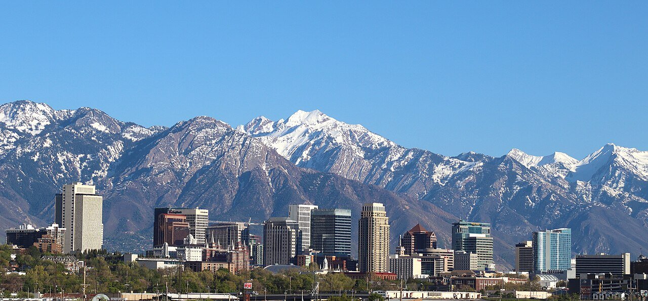
SLC Skyline 2024Photo: Invictus323 · CC BY 4.0
A−Outdoors
Outdoors in Salt Lake City

10% of Salt Lake City’s land is conserved, and 98% of residents live within a half mile of a park

158 miles of mapped trail cross Salt Lake City, 1.4 per square mile of land. 10% of Salt Lake City’s land is conserved, about 7,067 acres. The biggest trail networks: Uinta-Wasatch-Cache National Forest (58.5 mi), Salt Lake City Regional Athletic Complex (2.8 mi), This is the Place Heritage Park (2.1 mi).

Ahead of 84% of U.S. towns · #23 of 119 in Utah. What drives it

Conserved land
10%
7,067 acres · of 110.9 sq mi of land
Trails
158 mi
1.4 per sq mi of land
Park land
1,717 ac
8.3 acres per 1,000 residents
Near a park
98%
of residents within ½ mile
Bike routes
263 mi
162 mi lanes · 66 mi paths
Highest peak
9,403 ft
Grandview Peak
Lakes & rivers
22
3 boat launches

What kind of outdoors town is Salt Lake City?

Read from the map. The page puts what stands out first.

Outdoors grade

How much outdoors does Salt Lake City have?

On conserved land, trails, park land and how close residents live to a park, Salt Lake City is ahead of 84% of U.S. towns, #23 of 119 in Utah. Trail miles hold the grade up; park acres per resident pull it down.

A−
OutdoorsA character grade: shown, never part of Salt Lake City’s overall grade.
All U.S. towns we grade (21,298)Ahead of 84%
LessMore
Utah towns of 2,500+ (119)Ahead of 81%

Among the 400 U.S. cities of 100,000 or more, Salt Lake City ranks #136 on Outdoors.

How sure. Graded on any three of the four inputs instead, the letter would range from A− to A. Trails and many small parks come from OpenStreetMap, mapped by volunteers, so coverage varies from town to town; the half mile is a straight line from each census block, so a river or highway in the way isn’t counted against it.

PAD-US, OpenStreetMap (© OpenStreetMap contributors), Census 2025 Gazetteer and 2020 blocks; details in Sources below. How TownRatings grades the outdoors →

The map

Conserved land, trails & bike routes

Tap a number to zoom to a park. Tap a layer to hide it.

12345678
Easements protect land from building but are usually private.© OpenStreetMap contributors · USGS PAD-US
Places to walk

Pick a walk

The longest trail network is Uinta-Wasatch-Cache National Forest, with 58.5 miles. Directions go to the nearest trailhead or public parking.

Uinta-Wasatch-Cache National Forest

Managed by United States Forest Service
12,489 acres58.5 mi of trail
Grandview Peak TrailMeadows TrailBlack Mountain TrailCity Creek Trail+1
No dogs
Directionsto the trailhead

Salt Lake City Regional Athletic Complex

Park
98 acres2.8 mi of trail
Dog rules not recorded
Directionsto the trailhead

This is the Place Heritage Park

Managed by This Is The Place Foundation
128 acres2.1 mi of trail
Dogs on leash
Directionsto the trailhead

Liberty Park

Managed by Salt Lake City
97 acres1.4 mi of trail
Dogs on leash
Directionsto the parking lotWebsite ↗

Temple Square

Managed by The Church of Jesus Christ of Latter-day Saints
13 acres0.9 mi of trail
Dog rules not recorded
Directionsto the parking lot
All 88 parks & preserves
Uinta-Wasatch-Cache National Forest12,489 acres · 58.5 mi of trail · United States Forest Service
Directions
Salt Lake City Regional Athletic Complex98 acres · 2.8 mi of trail
Directions
This is the Place Heritage Park128 acres · 2.1 mi of trail · This Is The Place Foundation
Directions
Liberty Park97 acres · 1.4 mi of trail · Salt Lake City
Directions
Temple Square13 acres · 0.9 mi of trail · The Church of Jesus Christ of Latter-day Saints
Directions
Jordan Park33 acres · 0.7 mi of trail
Directions
Riverside Park28 acres · 0.6 mi of trail
Directions
Sunnyside Park30 acres · 0.5 mi of trail
Directions
International Peace Gardens10 acres · 0.5 mi of trail
Directions
North Gateway Park6 acres · 0.5 mi of trail
Directions
Glendale Park14 acres · 0.4 mi of trail
Directions
Wasatch Hollow Park6 acres · 0.4 mi of trail
Directions
Ensign Downs Park6 acres · 0.4 mi of trail
Directions
Lee Charles Miller Bird Refuge and Nature Park5 acres · 0.4 mi of trail · Salt Lake City
Directions
Tanner Park10 acres · 0.3 mi of trail · Salt Lake County Parks & Recreation
Directions
Fife Wetland Preserve7 acres · 0.3 mi of trail
Directions
Hidden Hollow6 acres · 0.3 mi of trail
Directions
Wasatch Hollow Nature Area4 acres · 0.3 mi of trail
Sugar House Park115 acres · 0.2 mi of trail
Directions
Cottonwood Park20 acres · 0.2 mi of trail
Directions
Lindsey Gardens Park16 acres · 0.2 mi of trail
Directions
17th South River Park11 acres · 0.2 mi of trail
Directions
9th South River Park6 acres · 0.2 mi of trail
Directions
Poplar Grove Park6 acres · 0.2 mi of trail
Directions
Bonneville Glen3 acres · 0.2 mi of trail · LDS Salt Lake Bonneville Stake
Directions
Meadows Park2 acres · 0.2 mi of trail
Directions
Rosewood Park27 acres · 0.1 mi of trail
Directions
Fairmont Park25 acres · 0.1 mi of trail
Directions
Constitution Park19 acres · 0.1 mi of trail · Salt Lake County
Directions
Pioneer Park13 acres · 0.1 mi of trail
Directions
Herman L Franks Park10 acres · 0.1 mi of trail
Directions
Rotary Glen Park7 acres · 0.1 mi of trail
Directions
Sorenson Multicultural and Unity Fitness Center7 acres · 0.1 mi of trail
Directions
Jefferson Park4 acres · 0.1 mi of trail
Directions
Three Creeks Confluence2 acres · 0.1 mi of trail
Directions
Imperial Park1 acres · 0.1 mi of trail
Gilgal Sculpture Garden1 acres · 0.1 mi of trail
Directions
Miami Park1 acres · 0.1 mi of trail · Salt Lake City
Faultline Gardens Park1 acres · 0.1 mi of trail
Directions
Ensign Peak Memorial Garden1 acres · 0.1 mi of trail
Directions
Westpointe Park23 acres
Directions
Donner Trail Park14 acres
Directions
11th Avenue Park13 acres
Directions
Sherwood Park12 acres
Directions
Washington Square10 acres
Directions
Warm Springs Park10 acres · Salt Lake City Parks
Directions
Library Square10 acres
Directions
Modesto Park8 acres
Directions
Allen Park7 acres · Salt Lake City
Directions
Popperton Park7 acres
Directions
Reservoir Park7 acres
Directions
Dilworth Park5 acres
Directions
Presidents Circle5 acres
Directions
Gallivan Center4 acres
Directions
Bend in the River4 acres
Directions
Memory Grove Park4 acres · Salt Lake City
Directions
Stratford Park4 acres
Directions
Parley's Way Park3 acres
Directions
Redwood Meadows Park3 acres
Brigham Young Historic Park2 acres
Directions
City Creek Park2 acres
Directions
Wasatch Elementary School Playground2 acres
Directions
Richmond Park2 acres
Directions
Madsen Park2 acres
Directions
Chapel Glen2 acres
Directions
Hillcrest Park2 acres
Directions
Backman Community Open Space1 acres · Salt Lake City
Directions
Laird Park1 acres
Blaine Natural Area1 acres
Directions
Kimball-Whitney Cemetery Park1 acres
Directions
Kay Rees Park1 acres · Salt Lake City
Jackson Park1 acres · Salt Lake City
Olympic Legacy Plaza1 acres
Directions
Steenblik Park1 acres · Salt Lake City Parks
Swede Town Park1 acres
Davis Park1 acres
Taufer Park1 acres
Directions
Guadalupe Park1 acres
Directions
Navajo Circle1 acres
Directions
The Episcopal Church Center of Utah1 acres · Episcopal Diocsese of Utah
Directions
Fifth Ave Park1 acres
Directions
Kilowatt Commons Park1 acres
Directions
Peoples Freeway Park1 acres
Directions
MeadUp1 acres
Directions
6th East Park1 acres
Directions
Pugsley Ouray Park1 acres
Directions
Kletting Park1 acres
Directions
Shipp Park1 acres
Who protects it

7,067 conserved acres

10% of Salt Lake City’s land. Who manages Salt Lake City’s conserved land, from the USGS Protected Areas Database. Approximate, because parcels can overlap.

U.S. Forest Service4,316 ac
State fish & wildlife1,287 ac
Town or city747 ac
State parks385 ac
County223 ac
Other state land125 ac
Regional agency107 ac
National Forest · 4,316 acState Conservation Area · 1,287 acLocal Park · 835 acState Park · 501 acUnknown Easement · 106 ac
Good to know

Conserved doesn’t always mean open to visitors. 116 acres are conservation easements, usually private land. Public access isn’t recorded for 1 of 106 parcels. The walks above are places people visit.

The biggest protected parcels
Parcel (PAD-US)Managed byAcresPublic access
Wasatch National Forest
National Forest
U.S. Forest Service4,316Open
Lee Kay State Wildlife Center
State Conservation Area
State fish & wildlife1,137Restricted
Pioneer Trail State Park
State Park
State parks197Open
Jordan River OHV/ Modelport State Park
State Park
State parks166Open
Utah State Department of Wildlife Resources 519
State Conservation Area
State fish & wildlife144Restricted
Regional Athletic Complex
Local Park
Town or city126Open
Sugarhouse Park
Local Park
County103Open
Liberty Park
Local Park
Town or city91Open
Parleys Canyon Bst
Local Other or Unknown
County76Open
Utah State Fair Park
State Park
Other state land60Open

5 smaller protected places aren’t shown.

Things to do

307 places to go in Salt Lake City

Beaches, playgrounds, peaks, falls and more. Pick a kind.

Picnic areas in Salt Lake City
#1 - RaspberryFee
Directions
#10 - Birch GroveFee · In Uinta-Wasatch-Cache National Forest
Directions
#11 - PipelineFee · In Uinta-Wasatch-Cache National Forest
Directions
#12 - Pleasant ValleyFee · In Uinta-Wasatch-Cache National Forest
Directions
#13 - Barney's HollowFee · In Uinta-Wasatch-Cache National Forest
Directions
#14 - Sugar BowlFee · In Uinta-Wasatch-Cache National Forest
Directions
#15 - PinesFee · In Uinta-Wasatch-Cache National Forest
Directions
#16 - Hidden SpringsFee · In Uinta-Wasatch-Cache National Forest
Directions
22 more picnic areas
#17 - Lodge PoleFee · In Uinta-Wasatch-Cache National Forest
Directions
#18 - Box ElderFee · In Uinta-Wasatch-Cache National Forest
Directions
#19 - ShadybrookFee · In Uinta-Wasatch-Cache National Forest
Directions
#2 - Hidden FallsFee
Directions
#20 - Sparkling SpringsFee · In Uinta-Wasatch-Cache National Forest
Directions
#21 - Maple GroveFee · In Uinta-Wasatch-Cache National Forest
Directions
#25 - Club ServiceIn Uinta-Wasatch-Cache National Forest
Directions
#26 - Vocational ServiceIn Uinta-Wasatch-Cache National Forest
Directions
#28 - International ServiceFee · In Uinta-Wasatch-Cache National Forest
Directions
#29 - Weeping RockFee · In Uinta-Wasatch-Cache National Forest
Directions
#3 - Cherry Tree GroveFee
Directions
#4 - Box ElderFee
Directions
#5 - Elbow TurnFee · In Uinta-Wasatch-Cache National Forest
Directions
#6 - WatercrestFee · In Uinta-Wasatch-Cache National Forest
Directions
#7 - Eagle RestFee · In Uinta-Wasatch-Cache National Forest
Directions
#8 - Hidden GroveFee · In Uinta-Wasatch-Cache National Forest
Directions
#9 - Lower Birch GroveFee · In Uinta-Wasatch-Cache National Forest
Directions
22 - Freeze HollowIn Uinta-Wasatch-Cache National Forest
Directions
23 - North ForkIn Uinta-Wasatch-Cache National Forest
Directions
24 - Freedom & BrotherhoodIn Uinta-Wasatch-Cache National Forest
Directions
27 - Community ServiceFee · In Uinta-Wasatch-Cache National Forest
Directions
Secret Wayside
Directions

52 picnic areas are on OpenStreetMap in all; the list shows named ones from the first 30.

Trails & water

25 named trails and 22 lakes & rivers

Named trails
Open to bikes · 46.9 miHorses · 1.8 miUnpaved · 122.7 mi
Grandview Peak Trail5.6 mi
Bonneville Shoreline Trail - Parley's Point Section3.6 mi
Meadows Trail3.5 mi
Black Mountain Trail3.4 mi
City Creek Trail2.3 mi
Avenues Ridge Trail2.2 mi
Bonneville Shoreline Trail - West City Creek Section2.2 mi
Bonneville Shoreline Trail - Twin Peaks Section2.1 mi
Bobsled Trail2.1 mi
Lower City Creek Loop2.0 mi
15 more trails
Bonneville Shoreline Trail - Valleyview Section
1.9 mi
Lakeline Trail
1.9 mi
City Creek Pipeline Trail
1.9 mi
Tower Connector
1.9 mi
Skyline Trail East
1.8 mi
Bonneville Shoreline Trail - North Salt Lake section
1.6 mi
City Creek - Rudy's Connector Trail
1.6 mi
Bonneville Shoreline Trail - Mount Wire Section
1.5 mi
Bonneville Shoreline Trail - East City Creek Section
1.4 mi
Bonneville Shoreline Trail - Mount Van Cott Section
1.4 mi
Terraces Trail
1.3 mi
Bonneville Shoreline Trail - Dry Creek Section
1.3 mi
Lost Lad Trail
1.2 mi
Smuggler's Gap Trail
1.2 mi
Victory Switchbacks
1.2 mi
Lakes & rivers tap for directions
Biking & sports

263 miles of bike routes

Bike lanes are often missing from the map in smaller towns, so that number is likely low.

162 mi
painted or protected bike lanes
66 mi
off-road bike paths
34 mi
shoulders & shared lanes
Jordan River Trail DetourBike route
0.3 mi
Courts & fields
100Tennis
86Basketball
51Soccer
43Baseball
39Pickleball
11Volleyball
9Beach volleyball
9Football

Includes school and college facilities, which aren’t always open to the public.

History along the way

233 places on the National Register, 5 of them National Historic Landmarks

The country’s official list of places worth saving (National Park Service). The map also marks 80 historic points from OpenStreetMap: plaques, memorials and old buildings.

History →
★
Brigham Young ComplexNational Historic Landmark · Building · listed 1966
About it
★
Emigration CanyonNational Historic Landmark · Site · listed 1966
About it
★
Temple SquareNational Historic Landmark · District · listed 1966
About it
★
Fort DouglasNational Historic Landmark · District · listed 1970
About it
★
Council HallNational Historic Landmark · Building · listed 1971
About it
Beehive HouseBuilding · listed 1970
About it
Thomas Kearns Mansion and Carriage HouseBuilding · listed 1970
About it
Isaac Chase MillBuilding · listed 1970
About it
Salt Lake City and County BuildingBuilding · listed 1970
About it
St. Mark's Episcopal CathedralBuilding · listed 1970
About it
Z.C.M.I. Cast Iron FrontBuilding · listed 1970
About it
Cathedral of the MadeleineBuilding · listed 1971
About it

221 more on the History page.

When to get out

The best walking months in Salt Lake City: April to June and September

NOAA’s 1991–2020 normals for the town and the daylight at its latitude. Outlined months have long days, highs of 59 to 86 °F and little rain for the place.

JanFebMarAprMayJunJulAugSepOctNovDec
Daylight (h)9.610.611.813.214.415.114.813.812.411.09.89.3
High (°F)384454617283929080655139
Rain (in)1.61.51.92.52.31.10.60.71.31.61.41.6

July is the driest month (0.6 in) and the warmest (highs of 92 °F). 2.5 inches fall in April, the wettest month. Summer highs reach 92 °F, too hot for the outline. The climate in Salt Lake City →

Next door

Salt Lake City and its neighbors

Salt Lake City has the most mapped trails of the 7 towns around it. Tap a town to see its outdoors.

TownConserved
of land
Trail mi
per sq mi
Park acres
per 1,000
Near a park
½ mile
Outdoors
Salt Lake City10%1.4898%A−
Millcreek4%1.0475%B
South Salt Lake1%0.6295%B−
Magna100%0.31199%A−
West Valley City2%0.8496%B
North Salt Lake13%1.7491%A−
Emigration Canyon32%1.41723%A−

The four inputs of the Outdoors grade, from the engine; shares are of land, not water.

Questions about parks and trails in Salt Lake City

Where can I hike in Salt Lake City?

The longest trail networks: Uinta-Wasatch-Cache National Forest, 58.5 miles; Salt Lake City Regional Athletic Complex, 2.8 miles; This is the Place Heritage Park, 2.1 miles; Liberty Park, 1.4 miles. Each one is on the map above, with directions to the nearest trailhead or parking.

How much of Salt Lake City is conserved land?

10% of its land, against a typical 3% for an Utah town and 4% nationally (PAD-US). Conserved doesn’t always mean open to visitors: easements are usually private land.

Are dogs allowed on Salt Lake City’s trails?

OpenStreetMap records dogs as welcome at This is the Place Heritage Park (on leash), Liberty Park (on leash) and Sunnyside Park (on leash). For the rest, check the signs at the trailhead.

Where can I bike in Salt Lake City?

263 miles of bike routes are on the map: 162 of painted or protected lanes, 66 of off-road paths and 34 of shoulders and shared lanes. Named routes: Jordan River Trail Detour.

Is there public land near Salt Lake City?

56,981 acres of parks and open public land lie inside Salt Lake City or within 10 miles of it (PAD-US), 5,818 of them inside the city line.

How much outdoors does Salt Lake City have?

Ahead of 84% of U.S. towns on the Outdoors grade, #23 of 119 in Utah. The grade combines the share of land that is conserved, miles of mapped trail per square mile of land, park acres per 1,000 residents and the share of residents within a half mile of a park. It’s a character grade, so it isn’t part of the overall grade. How it works.

Trail talk

Conditions, parking and favorite walks from Salt Lake City neighbors.

Town Square →
Share a tip
Sources

Where this page comes from

Conserved and public land: USGS Protected Areas Database of the United States (PAD-US), service updated July 2026. Parks, trails, playgrounds, beaches and other places: OpenStreetMap (© OpenStreetMap contributors, ODbL), map data as of 2026-10-28. Land and water area: Census 2025 Gazetteer. Residents near a park: 2020 Census blocks. National Register: National Park Service. How TownRatings grades the outdoors →