East BasinUT
A town of 4,002.
Is East Basin a good place to live?
For most people who can afford it, yes. East Basin grades A− overall, ranked 59th of 118 in Utah. It is among the healthiest towns in the country on CDC estimates. The median household earns $146K and its schools rank ahead of 77% of Utah towns. The trade-off is money: homes are expensive, about $1.3 million for a typical one and 10.3 times the Heber area’s $127K median household income. 80% of adults 25 and older hold a bachelor’s degree or more in East Basin, above both the Utah town median (36%) and the median of U.S. towns (29%). On history, just 10 of Utah’s 173 towns do worse. The biggest place to walk is Trailside Park, 79 acres with 1.5 miles of trail.
What makes East Basin stand out
Where East Basin beats most towns.
| Widest gap | East Basin | UT |
|---|---|---|
| Fewer adults facing food insecurity | 5.7% | 12.4% |
| School | Grades | Students |
|---|---|---|
| Trailside School | K–5 | 360 |
| Silver Summit School | K–5 | 55 |
| Silver Summit Academy | 6–12 | 104 |
How East Basin grades
Each subject compared with towns across the country (schools within Utah), ordered by how far East Basin is from typical.
How TownRatings grades towns →
Delta Center and 62 more within 40 miles
Museums, parks, gardens and other places to visit around East Basin. Close and well known come first.
 Big draw23 mi Stadium & arenaDelta Center
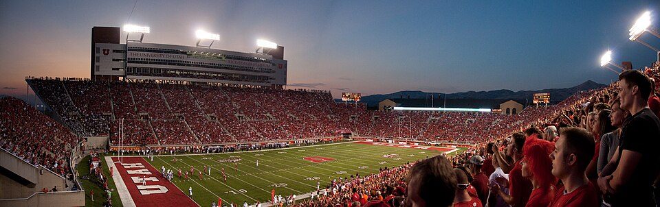 20 mi Stadium & arenaRice–Eccles Stadium
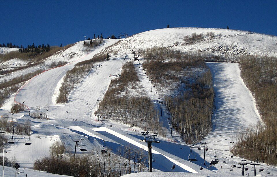 7 mi Ski areaPark City Mountain Resort393 runs · 3,100 ft vertical
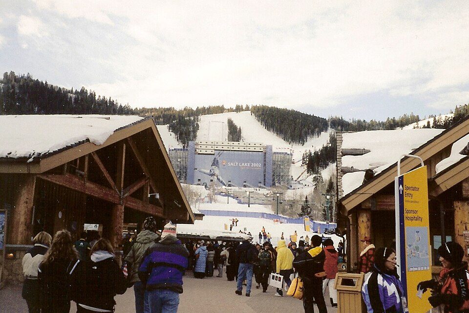 8 mi Ski areaDeer Valley Resort351 runs · 3,110 ft vertical
 25 mi Stadium & arenaAmerica First Field31 mi Theme parkEvermore Park
Photo credits
Delta Center: Lomrjyo, CC BY-SA 4.0 · Rice–Eccles Stadium: Brenton Walker, CC BY 2.0 · Park City Mountain Resort: Rudi Riet from Washington, DC, United States, CC BY-SA 2.0 · Deer Valley Resort: Ken Lund from Las Vegas, Nevada, USA, CC BY-SA 2.0 · America First Field: Scott Catron, CC BY-SA 2.0


Moving to East Basin: who provides what
East Basin is unincorporated, so Summit County and regional agencies provide most services.
EPA SDWIS (Oct 9, 2026) · HIFLD + EIA-861 2025 · Census 2020 ZCTAs · NCES 2024–25 · registration: vote.gov, updated Mar 13, 2026.
The data
Ordered by what stands out in East Basin.
East Basin is the healthiest town in Utah and is a second-home town, but it carries more natural-hazard risk than most of Utah (mostly avalanches).
East Basin has set aside 3.4% of its land for conservation
24 miles of trail in 1 park or preserve. East Basin’s trail density is 2.7 miles per square mile.
| East Basin | Utah towns | U.S. towns | |
|---|---|---|---|
| Miles of trail per square mile | 2.7 miles per square mile | 1.1 | 0.4 |
| Conserved land | 3.4% | 3.5% | 4.3% |
| Biggest places to walk | Trails | Acres |
|---|---|---|
| 1. Trailside Park | 1.5 mi | 79 |
Trails & parks © OpenStreetMap contributors · Conserved land: USGS PAD-US
East Basin’s grade for schools is an A−
Its public schools are run by the Park City District. Two of its 4 schools are below, each with why it’s listed.
| School | Level | Students | Letter |
|---|---|---|---|
| Trailside SchoolLargest public elementary schoolGrades K–5 | Grades K–5 | 360 | B+ |
| Silver Summit AcademyLargest public high schoolGrades 6–12 | Grades 6–12 | 104 | B+ |
NCES · EDFacts · graded within UT on state tests and graduation
A smaller share of adults in East Basin have obesity than in the typical Utah or U.S. town
It is the healthiest of the 118 Utah towns we grade on the CDC estimates behind the Health Grade. Its widest gap with Utah is food insecurity: 5.7% of its 2,257 adults worry about having enough food, against 12.4% statewide.
19% of East Basin adults have obesity. Among 118 Utah towns, just 3 have a lower share of adults who have been diagnosed with depression than East Basin. 26% of East Basin adults have high blood pressure.
| East Basin | Utah towns | U.S. towns | |
|---|---|---|---|
| Obesity (CDC PLACES) | 19% | 31% | 35% |
| Sleep under 7 hours (CDC PLACES) | 26% | 34% | 36% |
| Feel lonely (CDC PLACES) | 26% | 33% | 33% |
| Frequent mental distress (CDC PLACES) | 13% | 17% | 17% |
| What stands out | East Basin | UT |
|---|---|---|
| Fewer adults facing food insecurity | 5.7% | 12.4% |
| Fewer uninsured adults | 5.3% | 10.5% |
| More adults who have had cancer | 8.6% | 7.2% |
CDC PLACES 2025 · modeled estimates for adults · CMS · HRSA
Avalanches leads a very high hazard risk in East Basin
FEMA rates its natural-hazard risk higher than 93% of Utah towns; that rating is what its C for hazard risk is built on.
The FEMA risk score in East Basin is 81 of 100.
FEMA National Risk Index · OpenFEMA
East Basin stands out in Utah and nationally: a typical July afternoon there is cooler
The Snyderville weather station, 5 miles away, records that 153 inches of snow fall in a normal winter, more than in 99% of U.S. towns.
Among 119 Utah towns, just 3 have a lower July high than East Basin. East Basin has cold, snowy winters and pleasant summers, with very little rain.
Typical low → high °F
NOAA U.S. Climate Normals, 1991–2020
Most working residents commute out of East Basin
East Basin has about as many jobs (1,708) as working residents, but only 70 people both live and work here. Jobs based here grew from 1,026 in 2013 to 1,708.
Most working residents leave East Basin for work: only 4% work in town. Jobs based in East Basin grew to 1,708 in 2023, 682 more than in 2013. Only 6 of the 119 Utah towns we compare have a higher median household income than East Basin.
| East Basin | Utah towns | U.S. towns | |
|---|---|---|---|
| Median household income | $146,000 | $101,000 | $80,000 |
| Working residents who work in town | 3.8% | 8.5% | 8% |
| Average trip to work | 25 minutes | 22 minutes | 25 minutes |
| Below the poverty line | 7.5% | 6.2% | 9.6% |
Where working residents work
Census LEHD 2023 · ACS
The median home in East Basin sells for about $2.79M
At 10.3 years of the Heber area’s $127K median household income, the typical home costs more against local pay than in 98% of Utah towns; that ratio is one input to its D for cost of living. The median property tax bill is $4,262, against $2,525 across Utah, another input to its cost-of-living grade.
Only 1 of the 117 Utah towns we compare have a higher median rent than East Basin. 84% of households own their home in East Basin.
| East Basin | Utah towns | U.S. towns | |
|---|---|---|---|
| Median rent | $3,501 a month | $1,538 a month | $1,185 a month |
| Households that own their home | 84% | 79% | 73% |
Census ACS, 2020–24 · Zillow Home Value Index · Redfin Data Center
Everything we know about East Basin
Colleges nearby
None within 15 miles of East Basin; the nearest are
About 4 of every 100 East Basin residents are enrolled in college, against 8 across Utah.
About East Basin
Census-designated place in Utah, United States
East Basin is an unincorporated area and census-designated place (CDP) in Summit County, Utah, United States. It was first listed as a CDP prior to the 2020 census, of which the population was 3,023. It is in the southwest part of the county, bordered to the northwest by Silver Summit and to the southwest by Snyderville. It is 8 miles (13 km) northeast of Park City. Interstate 80 forms the northwest border of the CDP; the highway leads northeast 15 miles (24 km) to Coalville and west 26 miles (42 km) to Salt Lake City. U.S. Routes 40 and U.S. Route 189 turn south from I-80 at Silver Creek Junction along the northwest edge of the CDP; the U.S. highways lead south 16 miles (26 km) to Heber Ci…
From Wikipedia, licensed CC BY-SA 4.0 · facts via Wikidata (CC0)
- Elevation
- 6,516 ft
East Basin’s neighbors
2 towns share a border with East Basin.
| Town | UT rank | Overall | Cost | Safety | Schools | Health |
|---|---|---|---|---|---|---|
| East Basin | #59 | A− | D | — | A− | A+ |
| Snyderville | #25 | A | C− | — | A− | A+ |
| Silver Summit | — | — | D | — | A− | A+ |
Silver Summit has fewer than 2,500 residents, so it gets subject grades but no overall grade. East Basin, Snyderville and Silver Summit report no FBI crime data of their own. Compare East Basin with a neighbor →
Questions about East Basin
Short answers, built from the data on this page.
Is East Basin, UT a good place to live?
For most people who can afford it, yes. East Basin grades A− overall, better than 76% of U.S. towns and #59 of 118 in Utah. It grades A+ for health and A− for schools. Cost of living is its weak spot, with a D.
Is East Basin, UT expensive?
Yes. The typical home is worth about $1,306,000, 145% above the Utah typical home. Cost of living, which also weighs rents, property taxes and how many households pay 30% or more of their income for housing, grades D.