 II*
Public · listed 1950Bewdley Town HallOn the list as The Town HallPhoto: Richard Symonds · CC BY-SA 3.0
 The Town Hall · Photo: Richard Symonds · CC BY-SA 3.0
AHistory Grade
History of Bewdley · Historic England
279 listed buildings, 9 of them Grade II*
On the Historic England list, all of them stand inside Bewdley’s built-up area, 337 for every 10,000 residents. Grade II covers 270 of Bewdley’s listed buildings. We have photos of 10 of its listed buildings and 1 old view of the town. 20% of its homes were built before 1919. Bewdley grades A for history: #1 of 22 in Worcestershire.
Listed buildings
279
337 per 10,000 residents
Grade I
0
exceptional interest
Grade II*
9
more than special interest
Scheduled monuments
0
nationally important sites
Homes built before 1919
20%
typical UK town 15%
In pictures
Bewdley in 11 photos and old views
Nearly every Grade I and II* building, photographed, and the town before 1950. Tap a photo to step through them full screen.
 Beales CornerGrade II* listed
 Bailiff's HouseGrade II* listed
 The Hop Pole InnGrade II listed
 Church of All SaintsGrade II listed
 Railway Viaduct and Adjoining Revetments Immediately North West of Bewdley Railway StationGrade II listed+6See all photos
Photos from Wikimedia Commons and Geograph, copied to our own server, each credited to its photographer with its licence; names open the building’s page or its official list entry.
Through time
Bewdley in old photos
1 old photo or postcard, in date order. All public domain, made before 1950.
 c. 1900
Public domain, from Wikimedia Commons, copied to our own server. Each credit opens the image’s page with its full description and history.
The map
Where Bewdley’s history is
Every Grade I and II* building, monument and historic park, over the age of each neighbourhood’s homes.
Grade II*
Homes built before 1919, by neighbourhoodunder 10%10–25%25–50%50%+
1 of 7neighbourhoods have mostly pre-1919 homes; in the oldest, 53% were built before 1919.
Hover a dot for its name; tap one with a photo to open it.
279 listed buildings by grade
0 Grade I9 Grade II*270 Grade II
Historic England lists buildings in three grades: Grade I for buildings of exceptional interest (about 2.5% of all listed buildings), Grade II* for particularly important buildings of more than special interest (about 5.8%), and Grade II for buildings of special interest (about 91.7%). Listing protects the whole building, inside and out.
Every entry on the National Heritage List for England whose point lies inside the ONS 2022 built-up-area boundary. One list entry can cover a terrace or a group of buildings. Neighbourhood dots: the population-weighted centre of each Census 2021 output area, coloured by its neighbourhood’s (LSOA’s) share of homes built before 1919 (Valuation Office Agency, March 2025).
Grade II*
The 9 Grade II* listed buildings in Bewdley
Particularly important buildings of more than special interest. 7 are photographed. Each opens its own page, with the official list entry.
 II*
House · listed 1950Beales CornerPhoto: Richard Symonds · CC BY-SA 3.0
 II*
House · listed 1950Bailiff's HousePhoto: Jonathan Thacker · CC BY-SA 2.0
 II*
Church · listed 1950Church of St AnnePhoto: Richard Symonds · CC BY-SA 3.0
 II*
Street furniture · listed 1950Number 62 (The Manor House) and Attached RailingsPhoto: Jonathan Thacker · CC BY-SA 2.0
 II*
House · listed 197013 and 14, Load StreetPhoto: Richard Symonds · CC BY-SA 3.0
 II*
House · listed 19705, 7 and 9, Stourport RoadPhoto: Richard Symonds · CC BY-SA 3.0
Church · listed 1950The Church of the Holy FamilyOn the list as Roman Catholic Church of The Holy Family
House · listed 1950Tickenhill PalaceOn the list as Tickenhill
Historic streets
Load Street has the most listed buildings
Streets by the listed entries with an address on them. One entry can be a whole terrace, so long rows count once.
Load Street43 listed · 1 II*

High Street30 listed
Welch Gate22 listed
Wyre Hill14 listed
Severn Side South9 listed
Kidderminster Road7 listed
Lax Lane6 listed
Severn Side North6 listed
Burlton Terrace3 listed
Lower Park3 listed
Sandy Bank3 listed
Westbourne Street3 listed
Of the 279 entries, 160 are named by a street address; the rest are named buildings such as churches, halls and bridges.
What’s protected
Most of Bewdley’s listed buildings are homes
Every listed building sorted by what its list name says it is.
Houses, terraces & villas225
Inns, shops & warehouses15
Public & civic buildings13
Churches, chapels & priories9
Walls, gates & bridges9
Street furniture7
Memorials, crosses & tombs1
225 entries (81%) are houses, terraces and villas. 9 are churches, chapels and priories.
Buildings are sorted by words in each entry’s name (church, gate, inn, memorial…): the list’s open data has no building type. An entry named only by its address counts as a house.
Grade II
270 Grade II listed buildings
Most listed buildings are in this grade, which covers buildings of special interest. Open any building to read its official list entry.
The first 150 of 270 Grade II listed buildings, A to Z
Alveston HouseBaptist ChapelBeales CornerBeales CornerBlack and White CottageBlair HouseBrass Foundary at Rear of Number 17Bridgewater CottageBrunel Court and The CobblesBurltons AlmshousesCastle CottagesCherry CottageChurch of All SaintsChurchyard CrossChurchyard Walls and Lychgate at Church of All SaintsCoach House About 30 Metres South East of the RectoryCoach House, TickenhillCock and Magpie Public HouseEna CottageFairfield TerraceFriends Meeting HouseFront Garden Walls, Gate Piers and Gates of Glenhurst, Wood Eaves and Pleasant HarbourGarage About 5 Metres South of Number 2Garage about 25 metres north of The Malt HouseGatepiers, Gates, Wall and Railings to East of the RectoryGibraltar HouseGlenhurst, Wood Eaves and Pleasant HarbourHafren CourtHarfen HouseHorn and Trumpet Public HouseJasmine CottageK4 Telephone Kiosk South of Main Station BuildingsK6 Telephone KioskKateshill HouseKimberley HouseLankester HouseLaurel CottageLaxford HouseMalt House RowMaquetsMethodist ChapelMinster HouseNo 10 (River House) and attached railingsNorthern Part of Number 12Nos. 1-4 Park FlatsNumber 1 and 2 (Including Number 79 Welch Gate)Number 1 and 3 (Severn View)Number 12 (The Mug House Public House) and Number 13Number 2 and 2A and Baldwin ChambersNumber 26 and Attached RailingsNumber 29 (Wee Wee Cottage) 30 and 31 (Peggitty)Number 48 (The Antiquary) and Attached GarageNumber 6 (Borough House Including Flats 1-5 Consecutively)Number 63 and Attached RailingsNumber 64 and Garages to RearNumber 8 and 9 (The Old Bank) and Attached RailingsNumbers 15, 16, 17 and 18 and Attached RailingsNumbers 2 (Cartersville) and Number 3Numbers 56, 57 (Jasmine Cottage) and 58Numbers 6 and 7 and Attached RailingsNumbers 91 (The Little Shop) and 92Outbuilding About 10 Metres North of the RectoryPark CottagePark HousePark HousePark Lodge Flats 1-6Part of Styles Warehouse Attached to Nos 1 and 2 Minster HousePleasant PlaceQuay CottageQuay Side on South Side of River Severn, Extending South from Severn Bridge for About 290 Metres Including Four Flights of StepsRailings and Garden Wall About 3 Metres South West of Park FlatsRailway Viaduct and Adjoining Revetments Immediately North West of Bewdley Railway StationRedthorne CourtRiverside CafeRopework CottagesSaracen HouseSayers AlmshousesSevern HeightsSouthern Part of Number 12Southern Part of the Red Lion Public HouseSt Annes CottageStoreroom About 10 Metres North-East of the Black Boy HotelSydney PlaceThe Bewdley HotelThe Bewdley InstituteThe Black Boy Public HouseThe CottageThe Dog WheelThe Free Grammar SchoolThe George HotelThe HawthornsThe Hop Pole InnThe Malt HouseThe Merchants HouseThe Old Town HallThe Pack Horse InnThe RectoryThe Shambles and Old Prison CellsThe Talbot InnThurston HotelVictoria HouseVine CottageVine HouseWall Extending About 75 Metres South West from South West Corner of Number 42A High StreetWall of Churchyard of Friends Meeting House with OutbuildingWar Memorial North West of Church of All SaintsWhartons Park FarmhouseWinbrook HouseWood Colliers Arms Public House and Attached RailingsWoodbine CottageWyre CottageWyre Court1 and 2, Welch Gate1, High Street1, Load Street1-5 Cookes Almshouses10, 11 and 12, Welch Gate10, High Street10, Kidderminster Road108 and 110, Kidderminster Road11 and 12, Burlton Terrace11, Severn Side North111, Kidderminster Road12 and 13, Severn Side South12, 13 and 14, Wyre Hill12, Kidderminster Road12, Load Street13 and 14, Dog Lane14 and 15, High Street14, 16 and 18, Westbourne Street14, Severn Side North15 and 16, Severn Side North15, Lower Park15, Welch Gate15, Wyre Hill16, High Street16, Severn Side South17, High Street17, Welch Gate18, High Street18, Welch Gate19 and 19B, Welch Gate19 and 20, Load Street19, 20 and 21, High Street2 and 4, Wyre Hill2, High Street2, Lower Park2, Severn Side South20 and 21, Lax Lane21, Stourport Road
Conservation areas
1 conservation area covers 14% of Bewdley
Areas the council protects as a whole: demolition and changes to how buildings look need consent, and trees are protected.
Bewdley 196834 ha
34 hain conservation areas, of 254 ha inside the built-up area.
263 of the 279 listed buildings stand in one.
Historic England’s conservation areas layer, supplied by councils (incomplete in places, so a page fact, never graded). Hectares are the part of each area inside the built-up area.
How the list grew
90 of Bewdley’s 279 listed buildings were added in 1975
The year each building now on the list was first listed.
1975 · 901950 · 831970 · 64
19501960197019801990200020102020
The first 83 entries were listed in 1950. 90 came in 1975, in the national resurvey of the 1970s and 80s. Only 0 have been added in the last 15 years.
History Grade
Bewdley grades A for history
Protected heritage and the age of the town’s homes, against all UK towns.
Protected heritage, for its size and in all (288 points, 348 per 10,000 residents)More than 95% of UK towns
Homes built before 1919 (20%)More than 60% of UK towns
Two measures, each ranked against every UK town of 1,000 or more, with protected heritage counting twice as much as the age of homes. Protected heritage counts each listed building by its grade (Grade I three points, II* two, II one), each scheduled monument and battlefield two, and each registered park or garden by its grade; it is ranked both per 10,000 residents and as a total, so a village with one fine church doesn’t outrank a historic city. The second measure is the share of homes built before 1919, from the Valuation Office Agency’s council tax records. History is a character grade: it describes the town and isn’t part of the overall grade.
Born here
4 notable people born in Bewdley before 1900
Their lives on one timeline, earliest first.
Mary Sidney
John Beddoe
Stanley Baldwin
Brian Turner Tom Lawrence
155016001650170017501800185019001950

Stanley Baldwin1867–1947 · British statesman (1867–1947)

Mary Sidney1561–1621 · Countess of Pembroke, poet, and literary patron

John Beddoe1826–1911 · English ethnologist (1826–1911)
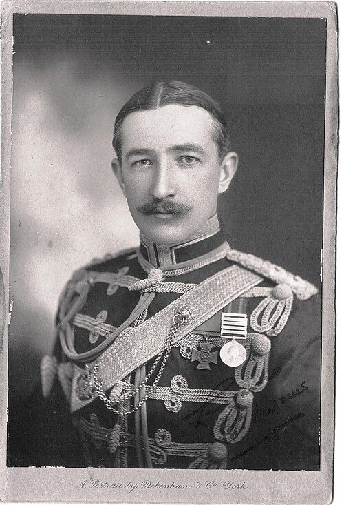
Brian Turner Tom Lawrence1873–1949 · British Army enlisted member and equestrian (1873-1949)
Everyone born in Bewdley → Birthplaces from Wikidata; portraits from Wikimedia Commons.
Neighbours
Listed buildings in the places around Bewdley
| Town | People | Listed | Grade I | History |
|---|---|---|---|---|
| Bewdley | 8,285 | 279 | 0 | A |
| Stourport-on-Severn | 20,302 | 102 | 0 | B |
| Kidderminster | 57,567 | 81 | 1 | B− |
| Wolverley | 1,208 | 13 | 0 | B |
| Waresley | 1,526 | 19 | 0 | A− |
| Cookley | 1,971 | 5 | 0 | C− |
| Alveley | 1,505 | 19 | 0 | B− |
| Highley | 3,305 | 8 | 0 | B− |
In brief
Bewdley in brief
Few towns are as rich in listed heritage as Bewdley: per resident it has more than 95% of UK towns. All told, the list holds 279 listed buildings, including Bewdley Town Hall. On Load Street alone there are 43 listed buildings. A conservation area has protected part of it since 1968.
Of the whole list, 81% are houses, terraces and villas. Stanley Baldwin (1867), Mary Sidney (1561) and John Beddoe (1826) are among the 4 people born here before 1900. The rest is about typical: like most towns its size, it has no Grade I building; and 20% of its homes were built before 1919, close to the 15% in the typical UK town.
Questions about Bewdley’s history
How many listed buildings are there in Bewdley?
Historic England lists 279 buildings inside Bewdley’s built-up area: 0 Grade I, 9 Grade II* and 270 Grade II.
Which street in Bewdley has the most listed buildings?
Load Street (43), High Street (30) and Welch Gate (22) have the most listed entries named by an address. One entry can be a whole terrace.
How many conservation areas are there in Bewdley?
1, covering about 34 hectares of the town. The largest is Bewdley.
When were Bewdley’s buildings listed?
The first in 1950; the most, 90, in 1975.
Are there old photos of Bewdley?
Yes: 1 public-domain photo or postcard from 1900 to 1900, all on this page.
Who was born in Bewdley?
Among people born before 1900: Stanley Baldwin (1867), Mary Sidney (1561), John Beddoe (1826) and Brian Turner Tom Lawrence (1873).
How old are the homes in Bewdley?
20% of homes were built before 1919 and 27% before 1940, from the Valuation Office Agency’s council tax records (March 2025).
© Historic England 2026. Contains Ordnance Survey data © Crown copyright and database right 2026. The National Heritage List for England is the official, up-to-date register of all nationally protected historic buildings and sites in England; check an entry on Historic England’s website before relying on it.
Sources: Historic England, National Heritage List for England (listed buildings, scheduled monuments, registered parks and gardens, battlefields, World Heritage Sites), October 2026, inside the ONS 2022 built-up-area boundary · Valuation Office Agency, Council Tax: stock of properties by build period (31 March 2025) · TownRatings grades: our own summary of the data, ranked against UK towns only · Historic England conservation areas (supplied by local planning authorities; October 2026). All under the Open Government Licence v3.0.
Contains public sector information licensed under the Open Government Licence v3.0. Contains HM Land Registry data © Crown copyright and database right 2026. Contains OS data © Crown copyright and database right 2026 (ONS boundaries). Northern Ireland: Source: NISRA; contains Land & Property Services data and Ordnance Survey of Northern Ireland information, © Crown copyright, licensed under the Open Government Licence v3.0. Scotland: contains National Records of Scotland data, Registers of Scotland data and SEPA data, © Crown copyright / © SEPA 2025, licensed under the Open Government Licence v3.0.