Farnley Hall
Grade I listed country house in Farnley, North Yorkshire, England, UK.
Each edition grades its towns against each other only.

The built-up area has no place on our list of its own; 6 are within 5 km of its edge. They include 3 museums, a historic house and a garden. Travel 6.6 km and you reach Harewood House.
The rest of the best known are 3 museums, a garden and an attraction.
 Historic houseFarnley Hall3.2 km outside town, to the northwestMuseumMuseumOtley Museum3.7 km outside town, to the west
 GardenYork Gate Garden5 km outside town, to the southeastMuseumMuseumThe Ron Kitching Library3.7 km outside town, to the westMuseumMuseumSecond World War Experience Centre3.8 km outside town, to the westAttractionAttractionAlmscliffe Crag4.1 km outside town, to the northeast
Each has a page of its own: what it is, who runs it, the weather month by month and what else is near it.
Close by, the 6 mostly lie to the west.
The dashed line is Pool-in-Wharfedale’s built-up area; orange marks its middle (where most people live). Numbers match the list below. © OpenStreetMap contributors · ONS built-up area 2022
The list holds 3 museums, a historic house and a garden.
Green: inside Pool-in-Wharfedale. Grey: within 5 km of its edge.
Everything here is within 5 km of its edge, 6 places in all.
Close and well known first. Churches and listed buildings are on the History page, not here.
7 listed buildings are on Pool-in-Wharfedale’s History page → · Parks, footpaths and green space in Pool-in-Wharfedale →
Of the 12 day trips, Harewood House (6.6 km) is the best known.
 Historic houseHarewood House6.6 km east
 Abbey or priory · English HeritageFountains Abbey23 km north
 Garden · National TrustStudley Royal Park24 km north
 ChurchYork Minster36 km east
 MuseumNational Science and Media Museum15 km southwest · 442K visitors a year (2015)
 Abbey or prioryKirkstall Abbey (Ruins)9.2 km south
 CathedralLeeds Cathedral13 km southeastMuseumBig drawMuseumNational Railway Museum35 km east · 808K visitors a year
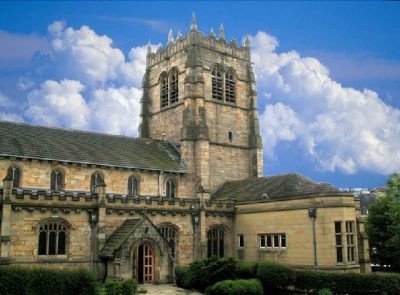 CathedralBradford Cathedral14 km southwest
 Castle · English HeritageClifford's Tower36 km east
 Castle · English HeritageSpofforth Castle13 km northeast
 MuseumYorkshire Museum36 km east · 164K visitors a year (2019)
Places well known beyond Pool-in-Wharfedale (Wikipedia articles in several languages, published visitor counts, or a National Trust, English Heritage or Cadw property), close and famous first. Distances are straight lines from the middle of the town.
No attraction is mapped inside Pool-in-Wharfedale itself. Within 5 km of it are Farnley Hall, Otley Museum, York Gate Garden and The Ron Kitching Library.
3 museums and galleries are in or within 5 km of Pool-in-Wharfedale: Otley Museum, The Ron Kitching Library and Second World War Experience Centre.
None within 5 km. The nearest well-known one on our list is Fountains Abbey (English Heritage), 23 km north.
Within 40 km: Harewood House (6.6 km), Fountains Abbey (23 km), Studley Royal Park (24 km), York Minster (36 km).
Pool-in-Wharfedale has 7 listed buildings. They are on its History page, from Historic England’s list, not repeated here.
From OpenStreetMap (museums, galleries, zoos, theme parks and attractions, castles, forts and abbeys, and historic houses and gardens that are open to visitors) and Wikidata (what each place is, who runs it, its website and visitor counts). A place counts for Pool-in-Wharfedale when it is inside the ONS 2022 built-up area, and as nearby within 5 km of its edge. Opening times and prices are not shown: check the official site.
Places: OpenStreetMap (© OpenStreetMap contributors, Open Database Licence) and Wikidata (CC0), placed in the ONS 2022 built-up area (Open Government Licence v3.0). Visitor counts are the latest Wikidata gives, with their year.
Photos: each place’s Wikidata image, from Wikimedia Commons under the licence below (our copy, resized).
Contains public sector information licensed under the Open Government Licence v3.0. Contains HM Land Registry data © Crown copyright and database right 2026. Contains OS data © Crown copyright and database right 2026 (ONS boundaries). Northern Ireland: Source: NISRA; contains Land & Property Services data and Ordnance Survey of Northern Ireland information, © Crown copyright, licensed under the Open Government Licence v3.0. Scotland: contains National Records of Scotland data, Registers of Scotland data and SEPA data, © Crown copyright / © SEPA 2025, licensed under the Open Government Licence v3.0.