




Lillian De Lissa Nursery School
Birmingham, B5 7LX · Birmingham local authority
Birmingham’s School Grade B better than 55% of towns in England
What stands out about Lillian De Lissa Nursery School
- No letter for this school: the reason is below.
- 7% of pupils are eligible for free school meals (fewer than England’s 25%)
- Ofsted report card, May 2026: achievement expected standard, safeguarding met (shown, not graded)
- Homes in its postcode sector (B5 7) sold for a median £218,000; Birmingham’s is £225,000
Who goes here
DfE school census, January 202592 pupils. SEN support is extra help in school for a special educational need; an EHC plan is the council’s legal plan for pupils who need more.
Girls and boys
No letter for Lillian De Lissa Nursery School
Nursery schools sit no national tests, so there’s no letter.
Letters go to England’s open mainstream state schools with published Key Stage 2 or GCSE results (grammar schools included), each against the schools of its own phase.
Ofsted inspections
Shown, not graded: Ofsted is never part of a letter or the School Grade.
Report card, inspection starting May 2026.
Before the report card: Graded inspection: Outstanding, December 2021.
Living near Lillian De Lissa Nursery School
For families thinking of moving: what homes cost around the school, and the other schools close by.
Home prices in B5 7, the school’s postcode sector
Birmingham property prices →Median sale price each year, 2010 to 2025
By type, the 36 months to August 2026
Homes in B5 7 sell for a little under Birmingham’s typical price. HM Land Registry Price Paid, standard sales. Catchments aren’t published, so the postcode sector stands in for “around the school”.
Schools within 1.6 miles
31 state schoolsLocation
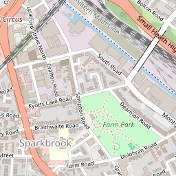
Directions ↗Birmingham, B5 7LX
Lillian De Lissa Nursery School: common questions
What is Lillian De Lissa Nursery School’s Ofsted rating?
Its latest inspection (May 2026) gave a report card: achievement expected standard, safeguarding met. Ofsted stopped giving one-word overall grades in September 2024.
How much do houses cost near Lillian De Lissa Nursery School?
Homes in its postcode sector, B5 7, sold for a median £218,000 over the 36 months to August 2026 (139 sales).
Sources: DfE Get Information about Schools (16 October 2026), Key Stage 2 performance tables (2023–2025, three-year average) and Key Stage 4 (2025/26, provisional); Ofsted state-funded school inspections as at 30 September 2026. All under the Open Government Licence v3.0.
Also: DfE Key Stage 4 performance, schools data (2023/24 and 2024/25 final, 2025/26 provisional) and Key Stage 2 performance tables 2024/25 by subject; DfE school census, January 2025; DfE school-level applications and offers, September 2019 to 2026 entry; HM Land Registry Price Paid by postcode sector, 2010 to August 2026.
A school’s letter is our own summary of its published results against England’s schools of the same phase; Birmingham’s School Grade is a separate grade, built from the results of the schools in and around the town against other towns. Map: © OpenStreetMap contributors.
Contains public sector information licensed under the Open Government Licence v3.0. Contains HM Land Registry data © Crown copyright and database right 2026. Contains OS data © Crown copyright and database right 2026 (ONS boundaries). Northern Ireland: Source: NISRA; contains Land & Property Services data and Ordnance Survey of Northern Ireland information, © Crown copyright, licensed under the Open Government Licence v3.0. Scotland: contains National Records of Scotland data, Registers of Scotland data and SEPA data, © Crown copyright / © SEPA 2025, licensed under the Open Government Licence v3.0.