 II*
Church · listed 1976Beulah Welsh Calvinistic Methodist ChapelOn the list as Beulah Calvinistic Methodist ChapelPhoto: Jaggery · CC BY-SA 2.0
 Aberavon Bridge (partly in Aberavon community) · Photo: FruitMonkey · CC BY-SA 4.0
BHistory Grade
History of Port Talbot · Cadw
32 listed buildings, 4 of them Grade II*
Cadw counts them inside Port Talbot’s built-up area, 10 for every 10,000 residents. 26% of its homes were built before 1919. We have photos of 7 of its listed buildings and 3 old views of the town. Port Talbot grades B for history: #6 of 19 in West Glamorgan.
Listed buildings
32
10 per 10,000 residents
Grade I
0
exceptional interest
Grade II*
4
more than special interest
Scheduled monuments
0
1 registered park or garden
Homes built before 1919
26%
typical UK town 15%
In pictures
Port Talbot in 10 photos and old views
Nearly every Grade I and II* building, photographed, and the town before 1950. Tap a photo to step through them full screen.
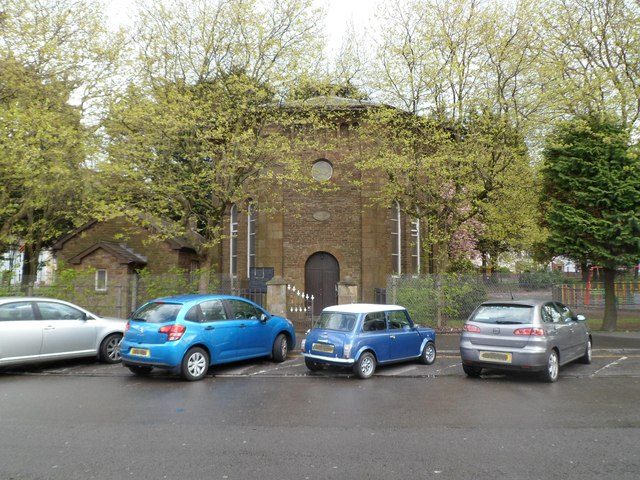 Beulah Calvinistic Methodist ChapelGrade II* listed
 Church of St TheodoreGrade II* listed
 War MemorialGrade II* listed
 Plaza CinemaGrade II listed
 Carnegie Free LibraryGrade II listed+5See all photos
Photos from Wikimedia Commons and Geograph, copied to our own server, each credited to its photographer with its licence; names open the building’s page or its official list entry.
Through time
Port Talbot from 1905 to 1905
3 old photos and postcards, in date order. All public domain, made before 1950.
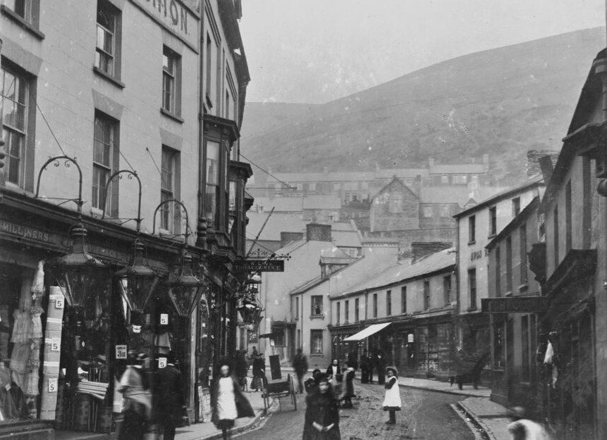 1905
 1905
 1905
Public domain, from Wikimedia Commons, copied to our own server. Each credit opens the image’s page with its full description and history.
The map
Where Port Talbot’s history is
Every Grade I and II* building, monument and historic park, over the age of each neighbourhood’s homes.
Grade II*Park or garden
Homes built before 1919, by neighbourhoodunder 10%10–25%25–50%50%+
5 of 22neighbourhoods have mostly pre-1919 homes; in the oldest, 96% were built before 1919.
Hover a dot for its name; tap one with a photo to open it.
32 listed buildings by grade
0 Grade I4 Grade II*28 Grade II
Cadw lists buildings of special architectural or historic interest in three grades: Grade I for buildings of exceptional interest, Grade II* for particularly important buildings of more than special interest, and Grade II for buildings of special interest. Listing protects the whole building, inside and out.
Every entry on Cadw’s register of listed buildings whose point lies inside the ONS 2022 built-up-area boundary. One list entry can cover a terrace or a group of buildings. Neighbourhood dots: the population-weighted centre of each Census 2021 output area, coloured by its neighbourhood’s (LSOA’s) share of homes built before 1919 (Valuation Office Agency, March 2025).
Grade II*
The 4 Grade II* listed buildings in Port Talbot
Particularly important buildings of more than special interest. Every one is photographed. Each opens its own page, with the official list entry.
 II*
Church · listed 1975St Theodore's ChurchOn the list as Church of St TheodorePhoto: John Lord · CC BY-SA 2.0
 II*
Memorials · listed 2000Port Talbot War MemorialOn the list as War MemorialPhoto: Sean Pursey · CC BY-SA 3.0
 II*
Church · listed 1980Ebenezer Welsh Baptist ChapelOn the list as Ebenezer ChapelPhoto: Jaggery · CC BY-SA 2.0
What’s protected
The largest group of Port Talbot’s listed buildings is churches and chapels
Every listed building sorted by what its list name says it is.
Churches, chapels & priories14
Walls, gates & bridges5
Houses, terraces & villas5
Memorials, crosses & tombs4
Public & civic buildings3
Inns, shops & warehouses1
5 entries (16%) are houses, terraces and villas. 14 are churches, chapels and priories.
Buildings are sorted by Cadw’s broad class for each building, else by words in its name; an entry named only by its address counts as a house.
Grade II
28 Grade II listed buildings
Most listed buildings are in this grade, which covers buildings of special interest. Open any building to read its official list entry.
All 28 Grade II listed buildings, A to Z
Aberavon Bridge (partly in Aberavon community)Aberavon Bridge (partly in Port Talbot community)Afan Masonic TempleBandstandBethany ChapelCarnegie Free LibraryCatholic Church of St JosephChurch of St MaryDyffryn ChapelForecourt Walls, Railings and Gates to Ebenezer ChapelFormer Harbour HouseFountain in Honour of John Hopkin DaviesGates, Piers and Railings at Beulah ChapelGateway to Talbot Memorial ParkGibeon ChapelGrove Place ChapelHarbour CourtHoly Cross ChurchLodge 1, Talbot Memorial ParkLodge 2, Talbot Memorial ParkMilepostMilepost at Tollgate ParkPlate-Girder BridgePlaza CinemaSunrayTabernacle ChapelVestry at Beulah ChapelWar Memorial
How the list grew
More than half of Port Talbot’s listed buildings were added in one year, 2000
The year each building now on the list was first listed.
2000 · 26
19501960197019801990200020102020
The first 1 entry was listed in 1975. 26 came in 2000. Only 0 have been added in the last 15 years.
Monuments & landscapes
Monuments, parks and gardens
Designations that overlap the town by a tenth of their area or half a hectare.
1 registered park or garden
Talbot Memorial Park, Port TalbotGrade II · Urban public park
History Grade
Port Talbot grades B for history
Protected heritage and the age of the town’s homes, against all UK towns.
Protected heritage, for its size and in all (37 points, 12 per 10,000 residents)More than 45% of UK towns
Homes built before 1919 (26%)More than 75% of UK towns
Two measures, each ranked against every UK town of 1,000 or more, with protected heritage counting twice as much as the age of homes. Protected heritage counts each listed building by its grade (Grade I three points, II* two, II one), each scheduled monument and battlefield two, and each registered park or garden by its grade; it is ranked both per 10,000 residents and as a total, so a village with one fine church doesn’t outrank a historic city. The second measure is the share of homes built before 1919, from the Valuation Office Agency’s council tax records. History is a character grade: it describes the town and isn’t part of the overall grade.
Homes by age
26% of Port Talbot’s homes were built before 1919
Every home by when it was built, from council tax records, against England & Wales (the dark tick).
6.8%
Before 1900
19%
1900–18
6.2%
1919–29
9.4%
1930s
13%
1945–54
21%
1955–64
2.8%
1965–72
4.2%
1973–82
2.3%
1983–92
4.2%
1993–99
5.7%
2000–08
2.5%
2009–15
2.2%
2016–25
Port TalbotEngland & Wales
6.8% of homes are Victorian or older, against 16% across England and Wales. The busiest period since was 1955–64, which added 21% of today’s homes.
Valuation Office Agency, council tax stock of properties by build period, 31 March 2025, for the neighbourhoods (LSOAs) that make up the town, split by where their residents live. Homes with no recorded build period (0 here) are left out; 1939–44 is not a period in the data.
Born here
3 notable people born in Port Talbot before 1900
Their lives on one timeline, earliest first.
Dic Penderyn
Daniel Jones
William Davies
1800182518501875190019251950

Dic Penderyn1807–1831 · Welshman involved in the Merthyr Rising of 1831
WD
William Davies1890–1967 · Welsh rugby union and rugby league footballer (1890-1967)
DJ
Daniel Jones1875–1959 · Welsh rugby union player
Everyone born in Port Talbot → Birthplaces from Wikidata; portraits from Wikimedia Commons.
Neighbours
Listed buildings in the places around Port Talbot
In brief
Port Talbot in brief
Old houses are part of Port Talbot’s character: 26% of its homes were built before 1919, against 15% in the typical UK town. In all there are 32 listed buildings, including Beulah Welsh Calvinistic Methodist Chapel. Dic Penderyn (1807), William Davies (1890) and Daniel Jones (1875) were all born here before 1900. The big year was 2000, when 26 of the 32 went on the list. Otherwise the figures are ordinary: it has no Grade I building, where the middle town its size has 1; and per resident it sits near the middle of UK towns.
Questions about Port Talbot’s history
How many listed buildings are there in Port Talbot?
Cadw lists 32 buildings inside Port Talbot’s built-up area: 0 Grade I, 4 Grade II* and 28 Grade II.
When were Port Talbot’s buildings listed?
The first in 1975; the most, 26, in 2000.
Are there old photos of Port Talbot?
Yes: 3 public-domain photos and postcards from 1905 to 1905, all on this page.
Who was born in Port Talbot?
Among people born before 1900: Dic Penderyn (1807), William Davies (1890) and Daniel Jones (1875).
How old are the homes in Port Talbot?
26% of homes were built before 1919 and 41% before 1940, from the Valuation Office Agency’s council tax records (March 2025).
Listed buildings, scheduled monuments and historic parks and gardens: Cadw, © Crown copyright, via DataMapWales.
Sources: Cadw listed buildings, scheduled monuments and registered historic parks and gardens via DataMapWales, October 2026, inside the ONS 2022 built-up-area boundary · Valuation Office Agency, Council Tax: stock of properties by build period (31 March 2025) · TownRatings grades: our own summary of the data, ranked against UK towns only. All under the Open Government Licence v3.0.
Contains public sector information licensed under the Open Government Licence v3.0. Contains HM Land Registry data © Crown copyright and database right 2026. Contains OS data © Crown copyright and database right 2026 (ONS boundaries). Northern Ireland: Source: NISRA; contains Land & Property Services data and Ordnance Survey of Northern Ireland information, © Crown copyright, licensed under the Open Government Licence v3.0. Scotland: contains National Records of Scotland data, Registers of Scotland data and SEPA data, © Crown copyright / © SEPA 2025, licensed under the Open Government Licence v3.0.