

 I
House · listed 1969Sulgrave ManorOn the list as The Manor House and Attached BrewhousePhoto: Christina Burford · CC BY-SA 2.0
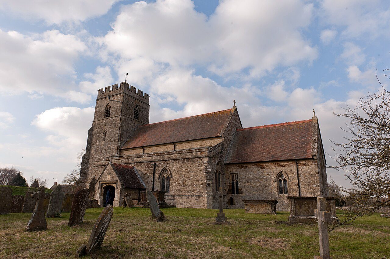 Photo: U.S. Air Force photo by Staff Sgt. Brian Stives · Public domain
–Not graded
History of Sulgrave · Historic England
36 listed buildings, 1 of them Grade I
Historic England counts them inside Sulgrave’s built-up area, 849 for every 10,000 residents. It also has 1 scheduled monument. 43% of its homes were built before 1919.
Listed buildings
36
849 per 10,000 residents
Grade I
1
exceptional interest
Grade II*
1
more than special interest
Scheduled monuments
1
1 registered park or garden
Homes built before 1919
43%
typical UK town 15%
In pictures
Landmarks of Sulgrave
Nearly every Grade I and II* building, photographed. Tap a photo to step through them full screen.
Photos from Wikimedia Commons and Geograph, copied to our own server, each credited to its photographer with its licence; names open the building’s page or its official list entry.
The map
Where Sulgrave’s history is
Every Grade I and II* building, monument and historic park.
Grade IGrade II*Scheduled monumentPark or garden
Hover a dot for its name; tap one with a photo to open it.
36 listed buildings by grade
1 Grade I1 Grade II*34 Grade II
Historic England lists buildings in three grades: Grade I for buildings of exceptional interest (about 2.5% of all listed buildings), Grade II* for particularly important buildings of more than special interest (about 5.8%), and Grade II for buildings of special interest (about 91.7%). Listing protects the whole building, inside and out.
Every entry on the National Heritage List for England whose point lies inside the ONS 2022 built-up-area boundary. One list entry can cover a terrace or a group of buildings.
Grade I
The Grade I listed building in Sulgrave
Buildings of exceptional interest, about 2.5% of all listed buildings. Every one is photographed. Each opens its own page, with the official list entry.
Grade II*
The Grade II* listed building in Sulgrave
Particularly important buildings of more than special interest. Every one is photographed.
 II*
Church · listed 1969Church of St James the LessOn the list as Church of St JamesPhoto: U.S. Air Force photo by Staff Sgt. Brian Stives · Public domain
What’s protected
Most of Sulgrave’s listed buildings are homes
Every listed building sorted by what its list name says it is.
Houses, terraces & villas22
Churches, chapels & priories8
Walls, gates & bridges3
Inns, shops & warehouses2
Public & civic buildings1
22 entries (61%) are houses, terraces and villas. 8 are churches, chapels and priories.
Buildings are sorted by words in each entry’s name (church, gate, inn, memorial…): the list’s open data has no building type. An entry named only by its address counts as a house.
Grade II
34 Grade II listed buildings
Most listed buildings are in this grade, which covers buildings of special interest. Open any building to read its official list entry.
All 34 Grade II listed buildings, A to Z
Bentley's FarmhouseChest Tomb Approximately 1 Metre East of South Porch of Church of St JamesChest Tomb Approximately 2 Metres North of North East Corner of North Aisle of Church of St JamesChest Tomb Approximately 4 Metres North of North East Corner of North Aisle of Church of St JamesChest Tomb Approximately 4 Metres South of Chancel of Church of St JamesChest Tomb Approximately 8 Metres North of North Porch on East Side of Path at Church of St JamesCorner HouseDellsideDial HouseDove CottageEagle House and Garden WallEast (Left) Gatepier at Entrance to Manor HouseForge CottageHeadstone Approximately 1 Metre North of North Aisle of Church of St JamesHeadstone Approximately 1 Metre West of North Porch of Church of St JamesHill FarmhouseKiln FarmhouseLeft Gatepier and Stone Wall Approximately 10 Metres South of Corner HouseManor CottageMill HollowRectory Farmhouse and StablesRight Gatepier Approximately 8 Metres South of Corner HouseStocksStores and House AttachedThe Old BakehouseThe Old FarmhouseThe Old VicarageThe Star Inn Public HouseThe Thatched HouseThe Wool House and Attached WallThreewaysVillage HallWest (Right) Gatepier at Entrance to Manor HouseYew Tree House
Conservation areas
1 conservation area covers 16% of Sulgrave
Areas the council protects as a whole: demolition and changes to how buildings look need consent, and trees are protected.
Sulgrave 196919 ha
19 hain conservation areas, of 120 ha inside the built-up area.
35 of the 36 listed buildings stand in one.
Historic England’s conservation areas layer, supplied by councils (incomplete in places, so a page fact, never graded). Hectares are the part of each area inside the built-up area.
How the list grew
More than half of Sulgrave’s listed buildings were added in one year, 1985
The year each building now on the list was first listed.
1985 · 291969 · 7
19501960197019801990200020102020
The first 7 entries were listed in 1969, 1 of the 1 Grade I buildings among them. 29 came in 1985, in the national resurvey of the 1970s and 80s. Only 0 have been added in the last 15 years.
Monuments & landscapes
Monuments, parks and gardens
Designations that overlap the town by a tenth of their area or half a hectare.
1 scheduled monument
Nationally important archaeological sites and monuments, protected by law; work on them needs consent from the Secretary of State, advised by Historic England.
1 registered park or garden
Sulgrave ManorGrade II
Homes by age
43% of Sulgrave’s homes were built before 1919
Every home by when it was built, from council tax records, against England & Wales (the dark tick).
40%
Before 1900
2.6%
1900–18
3.7%
1919–29
2.6%
1930s
8.9%
1945–54
2.6%
1955–64
5.2%
1965–72
9.9%
1973–82
7.3%
1983–92
3.7%
1993–99
3.7%
2000–08
7.3%
2009–15
2.6%
2016–25
SulgraveEngland & Wales
40% of homes are Victorian or older, against 16% across England and Wales. The busiest period since was 1973–82, which added 9.9% of today’s homes.
Valuation Office Agency, council tax stock of properties by build period, 31 March 2025, for the neighbourhoods (LSOAs) that make up the town, split by where their residents live. Homes with no recorded build period (7 here) are left out; 1939–44 is not a period in the data.
Neighbours
Listed buildings in the places around Sulgrave
| Town | People | Listed | Grade I | History |
|---|---|---|---|---|
| Sulgrave | 424 | 36 | 1 | — |
| Middleton Cheney | 4,127 | 39 | 1 | B |
| Woodford Halse | 4,288 | 20 | 0 | B |
| Brackley | 16,180 | 76 | 1 | B− |
| Byfield | 1,303 | 28 | 1 | A |
| Kings Sutton | 2,306 | 19 | 1 | B |
| Silverstone | 2,542 | 14 | 0 | C+ |
| Banbury | 52,041 | 215 | 1 | B |
In brief
Sulgrave in brief
Old houses are part of Sulgrave’s character: 43% of its homes were built before 1919, against 15% in the typical UK town. In all there are 36 listed buildings, 1 of them Grade I. A conservation area has protected part of it since 1969.
Of the whole list, 61% are houses, terraces and villas. More than half went on the list in a single year, 1985: 29 of 36. Otherwise the figures are ordinary: it also has a scheduled monument.
Questions about Sulgrave’s history
How many listed buildings are there in Sulgrave?
Historic England lists 36 buildings inside Sulgrave’s built-up area: 1 Grade I, 1 Grade II* and 34 Grade II.
What are the Grade I listed buildings in Sulgrave?
One: The Manor House and Attached Brewhouse.
Are there scheduled monuments in Sulgrave?
Yes, 1 scheduled monument, including Castle Hill ringwork west of St James's Church.
How many conservation areas are there in Sulgrave?
1, covering about 19 hectares of the town. The largest is Sulgrave.
When were Sulgrave’s buildings listed?
The first in 1969; the most, 29, in 1985.
How old are the homes in Sulgrave?
43% of homes were built before 1919 and 49% before 1940, from the Valuation Office Agency’s council tax records (March 2025).
Sulgrave has no History Grade.
© Historic England 2026. Contains Ordnance Survey data © Crown copyright and database right 2026. The National Heritage List for England is the official, up-to-date register of all nationally protected historic buildings and sites in England; check an entry on Historic England’s website before relying on it.
Sources: Historic England, National Heritage List for England (listed buildings, scheduled monuments, registered parks and gardens, battlefields, World Heritage Sites), October 2026, inside the ONS 2022 built-up-area boundary · Valuation Office Agency, Council Tax: stock of properties by build period (31 March 2025) · TownRatings grades: our own summary of the data, ranked against UK towns only · Historic England conservation areas (supplied by local planning authorities; October 2026). All under the Open Government Licence v3.0.
Contains public sector information licensed under the Open Government Licence v3.0. Contains HM Land Registry data © Crown copyright and database right 2026. Contains OS data © Crown copyright and database right 2026 (ONS boundaries). Northern Ireland: Source: NISRA; contains Land & Property Services data and Ordnance Survey of Northern Ireland information, © Crown copyright, licensed under the Open Government Licence v3.0. Scotland: contains National Records of Scotland data, Registers of Scotland data and SEPA data, © Crown copyright / © SEPA 2025, licensed under the Open Government Licence v3.0.