Cathedral of St Michael and St George, Aldershot
Catholic cathedral in Rushmoor, Hampshire, England, UK.
Each edition grades its towns against each other only.

Visitors to Aldershot can choose from 9 museums, 7 attractions and 2 abbeys or priories. Mapped inside Aldershot’s built-up area is one place to visit, and within 5 km of its edge another 22. Here, 2 places are kept up by English Heritage. A day out reaches Windsor Castle, 28 km away.
Next to Cathedral of St Michael and St George, the best known are 2 abbeys or priories, 2 museums and a castle.
 CathedralCathedral of St Michael and St George, Aldershotin town
 Castle · English HeritageFarnham Castle2.8 km outside town, to the southwest
 Abbey or priory · English HeritageWaverley Abbey3.5 km outside town, to the south
 Abbey or priorySaint Michael’s Abbey3.8 km outside town, to the north
 MuseumMuseum of Military Medicine2.9 km outside town, to the northeast
 MuseumFarnborough Air Science Trust Museum2.2 km outside town, to the north
Each has a page of its own: what it is, who runs it, the weather month by month and what else is near it.
Look to the north for most of the 22 just outside.
The dashed line is Aldershot’s built-up area; orange marks its middle (where most people live). Numbers match the list below. © OpenStreetMap contributors · ONS built-up area 2022
Museums or galleries lead the count with 10; 7 are other attractions.
Green: inside Aldershot. Grey: within 5 km of its edge.
2 places are cared for by English Heritage (Farnham Castle and Waverley Abbey).
One in town leads, with 22 more within 5 km of its edge after it.
Catholic cathedral in Rushmoor, Hampshire, England, UK.
Grade I listed historic house museum in Farnham, Surrey, England, UK.
Military museum in Mytchett, Surrey, United Kingdom.
Aviation museum in Hampshire, England, United Kingdom.
Museum in Aldershot, United Kingdom.
The one inside Aldershot comes first, then the places within 5 km, close and well known first. Churches and listed buildings are on the History page, not here.
57 listed buildings are on Aldershot’s History page → · Parks, footpaths and green space in Aldershot →
Windsor Castle, at 28 km, heads the 12 day trips.
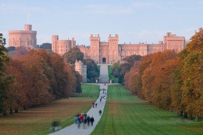 CastleWindsor Castle28 km north
 Historic house · Historic Royal PalacesHampton Court Palace34 km northeast
 Historic houseBagshot Park Mansion15 km north
 CathedralGuildford Cathedral12 km eastTheme parkBig drawTheme parkThorpe Park24 km northeast · 1.6M visitors a year (2024)
 Big drawTheme parkLegoland Windsor25 km north · 2.3M visitors a year (2024)
 Garden · National TrustRunnymede26 km northeast
 MuseumWatts Gallery9.4 km east
 MuseumJane Austen's House Museum20 km southwest
 Abbey or prioryAbbey Ruins27 km northwest
 Historic house · National TrustOsterley House39 km northeast · 350K visitors a year
 Historic houseFrogmore House28 km northeast
Places well known beyond Aldershot (Wikipedia articles in several languages, published visitor counts, or a National Trust, English Heritage or Cadw property), close and famous first. Distances are straight lines from the middle of the town.
The place to visit inside Aldershot’s built-up area is Cathedral of St Michael and St George, Aldershot. In all, 1 place to visit is mapped inside the town, and 22 more within 5 km.
10 museums and galleries are in or within 5 km of Aldershot: Museum of Military Medicine, Farnborough Air Science Trust Museum, Royal Army Physical Training Corps Museum and Aldershot Military Museum.
Yes. In or within 5 km of Aldershot, 2 places are cared for by English Heritage (Farnham Castle and Waverley Abbey).
Within 40 km: Windsor Castle (28 km), Hampton Court Palace (34 km), Bagshot Park Mansion (15 km), Guildford Cathedral (12 km).
Aldershot has 57 listed buildings. They are on its History page, from Historic England’s list, not repeated here.
From OpenStreetMap (museums, galleries, zoos, theme parks and attractions, castles, forts and abbeys, and historic houses and gardens that are open to visitors) and Wikidata (what each place is, who runs it, its website and visitor counts). A place counts for Aldershot when it is inside the ONS 2022 built-up area, and as nearby within 5 km of its edge. Opening times and prices are not shown: check the official site.
Places: OpenStreetMap (© OpenStreetMap contributors, Open Database Licence) and Wikidata (CC0), placed in the ONS 2022 built-up area (Open Government Licence v3.0). Visitor counts are the latest Wikidata gives, with their year.
Photos: each place’s Wikidata image, from Wikimedia Commons under the licence below (our copy, resized).
Contains public sector information licensed under the Open Government Licence v3.0. Contains HM Land Registry data © Crown copyright and database right 2026. Contains OS data © Crown copyright and database right 2026 (ONS boundaries). Northern Ireland: Source: NISRA; contains Land & Property Services data and Ordnance Survey of Northern Ireland information, © Crown copyright, licensed under the Open Government Licence v3.0. Scotland: contains National Records of Scotland data, Registers of Scotland data and SEPA data, © Crown copyright / © SEPA 2025, licensed under the Open Government Licence v3.0.
 7
 8
 9
 10
