Frampton on Severn’s biggest
The Green
Park or garden
4.1 ha (10 acres)0.4 km of path
6 pitchesfootball pitches would fit
Centralin the middle of Frampton on Severn
Directionsto the nearest entrance
Each edition grades its towns against each other only.
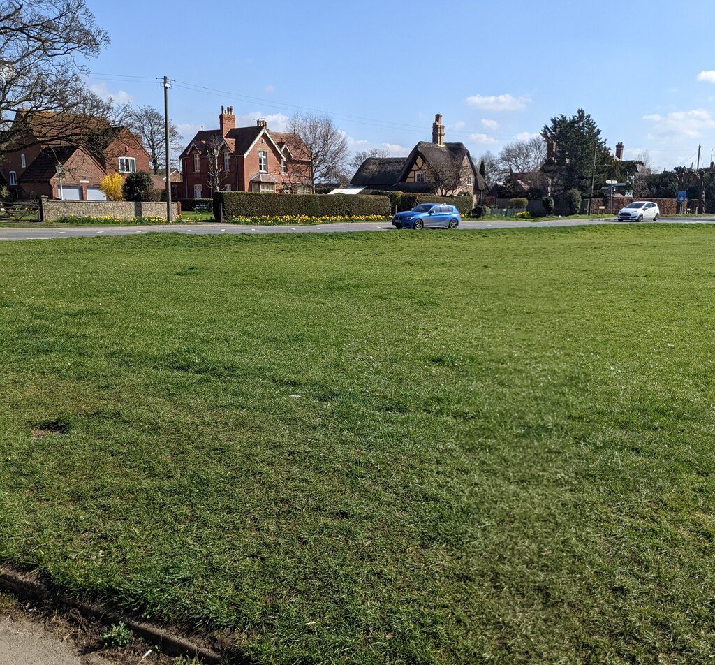 Photo: Jaggery · CC BY-SA 2.0
The sea makes up 15% of the area within 5 km. Parks and playing fields in Frampton on Severn add up to 11.0 ha for every 1,000 residents; the typical UK town has 2.1. The Cotswolds National Landscape begins 3.2 mi from the village’s edge. Frampton on Severn grades A+ for the outdoors. A character grade: it isn’t part of the overall grade.
Read from the data: what stands out first, good and bad.
Frampton on Severn’s strongest suit is the sea, followed by plenty of park space.
Each chart is every UK town of 1,000 or more on one measure: the green bar is Frampton on Severn, the dashed line the typical town. The number is the share of towns it beats; the five are averaged and the average ranked again.
Graded, never part of the overall grade (like History and Civic life). It measures what is mapped: OS Open Greenspace leaves out woodland and open-access land that isn’t a park, and OpenStreetMap’s rural paths are more complete in some places than others.
The 60 UK towns and cities of 1,000 to 1,100 people with an Outdoors Grade. Hover a dot for its figures; tap one for its page.
Against villages its size, Frampton on Severn stands out most for park space per resident: only 3 of the other 59 have more.
| Town | Outdoors | Green space | Near a park | Path per km² | Protected | |
|---|---|---|---|---|---|---|
| 1 | Giggleswick North Yorkshire | A+ | 14.2 | 100% | 4.1 | 75% |
| 2 | Lympne Kent | A+ | 4 | 100% | 2.7 | 34% |
| 3 | Frampton on Severn Gloucestershire | A+ | 11 | 100% | 3.6 | 0% |
| 4 | Bromham Wiltshire | A+ | 5.8 | 100% | 3.3 | 13% |
| 5 | Blagdon Somerset | A | 3.3 | 100% | 2.9 | 62% |
| 6 | Colney Heath Hertfordshire | A | 8.7 | 100% | 7.4 | 0% |
| 7 | Alston Cumbria | A | 5.8 | 100% | 2.1 | 100% |
| 8 | Newnham Gloucestershire | A | 4.2 | 100% | 3.2 | 0% |
| 9 | Heather Leicestershire | A | 16.9 | 100% | 4.7 | 0% |
| 10 | Blockley Gloucestershire | A | 2.9 | 100% | 2.5 | 86% |
| 11 | Silverdale Lancashire | A | 2.3 | 46% | 3.9 | 76% |
| 12 | North Curry Somerset | A | 6.2 | 100% | 3.5 | 0% |
| 13 | Furness Vale Derbyshire | A− | 2 | 78% | 5 | 36% |
| 14 | Old Langho Lancashire | A− | 7.6 | 73% | 2.9 | 20% |
| 15 | Plumpton Green East Sussex | A− | 4.6 | 54% | 3.6 | 37% |
| 16 | Winford Isle of Wight | A− | 1.7 | 0% | 4.4 | 39% |
| 17 | Cwmgwrach West Glamorgan | B+ | 3.2 | 100% | 1.7 | 6% |
| 18 | Calver Derbyshire | B+ | 2.2 | 44% | 4.8 | 99% |
| 19 | Groombridge East Sussex | B+ | 2.3 | 77% | 2.8 | 92% |
| 20 | Crowlas Cornwall | B+ | 3.3 | 73% | 1.1 | 23% |
| 21 | Blackfordby Leicestershire | B+ | 3.5 | 100% | 2.6 | 0% |
| 22 | Five Ash Down East Sussex | B+ | 2.8 | 0% | 4.1 | 43% |
| 23 | Avening Gloucestershire | B | 0.9 | 100% | 2.3 | 97% |
| 24 | Flamstead Hertfordshire | B | 2.1 | 82% | 2.7 | 33% |
| 25 | Fishtoft Lincolnshire | B | 2.3 | 100% | 1.1 | 0% |
| 26 | Holt Clwyd | B | 0.9 | 100% | 5.1 | 0% |
| 27 | Pentre Halkyn Clwyd | B | 1.3 | 59% | 3.6 | 3% |
| 28 | Nanpean Cornwall | B | 4.4 | 100% | 1.5 | 0% |
| 29 | Sharnford Leicestershire | B− | 1.9 | 100% | 2.9 | 0% |
| 30 | Tackley Oxfordshire | B− | 1.9 | 100% | 2.8 | 0% |
| 31 | Twyning Gloucestershire | B− | 1 | 100% | 2.5 | 10% |
| 32 | Ettington Warwickshire | B− | 3.3 | 100% | 1.6 | 0% |
| 33 | South Wingfield Derbyshire | B− | 5.4 | 75% | 2.8 | 0% |
| 34 | Coopersale Essex | B− | 1.1 | 100% | 3.5 | 0% |
| 35 | Carleton-in-Craven North Yorkshire | C+ | 0.4 | 100% | 2.3 | 10% |
| 36 | Chillington Devon | C+ | 0.6 | 78% | 1.3 | 55% |
| 37 | Milford Derbyshire | C+ | 1.4 | 100% | 2.8 | 0% |
| 38 | Draycott Somerset | C+ | 2.1 | 68% | 2.1 | 46% |
| 39 | Sutterton Lincolnshire | C+ | 2.8 | 100% | 0.4 | 0% |
| 40 | Upper Basildon Berkshire | C+ | 2.3 | 0% | 2 | 97% |
| 41 | Weston Staffordshire | C+ | 1.3 | 100% | 1 | 4% |
| 42 | Simister Greater Manchester | C | 16.6 | 0% | 2.7 | 0% |
| 43 | Huby (Hambleton) North Yorkshire | C | 2.4 | 75% | 1.5 | 2% |
| 44 | Charlton Marshall Dorset | C | 0.5 | 78% | 2 | 50% |
| 45 | Kimbolton Cambridgeshire | C− | 2.4 | 50% | 2.8 | 0% |
| 46 | Pattishall and Astcote Northamptonshire | C− | 2.9 | 39% | 2.4 | 0% |
| 47 | Stebbing Essex | C− | 2.4 | 70% | 2 | 0% |
| 48 | North Leverton with Habblesthorpe Nottinghamshire | C− | 0.5 | 100% | 1.4 | 0% |
| 49 | Tolleshunt Knights Essex | C− | 3.4 | 41% | 1.8 | 0% |
| 50 | Gorefield Cambridgeshire | D | 2.9 | 67% | 0.5 | 0% |
| 51 | Snitterfield Warwickshire | D | 2.4 | 63% | 0.8 | 0% |
| 52 | Crundale Dyfed | D | 1.5 | 57% | 0.5 | 5% |
| 53 | Napton on the Hill Warwickshire | D | 0.4 | 69% | 2.5 | 0% |
| 54 | Aberporth Dyfed | D | 0.6 | 38% | 0.8 | 0% |
| 55 | Wisbech St Mary Cambridgeshire | D | 1.8 | 69% | 0.2 | 0% |
| 56 | Hockliffe Bedfordshire | D− | 1.2 | 49% | 1.8 | 0% |
| 57 | South Hykeham Lincolnshire | D− | 0.2 | 0% | 2.3 | 0% |
| 58 | Pencader Dyfed | D− | 1.2 | 30% | 0.1 | 0% |
| 59 | Netheravon Wiltshire | D− | 0.4 | 0% | 1.3 | 0% |
| 60 | Leeming Bar North Yorkshire | D− | 0.7 | 0% | 0.9 | 0% |
Tap a number to zoom to a park. Tap a layer to hide it. The dashed line is Frampton on Severn’s built-up area.
The biggest is The Green, 4.1 ha (10 acres). Directions go to the park’s nearest public entrance where Ordnance Survey maps one.
Each square is 1 in 100 residents: green lives within 400 m of a public park, garden or playing field (Census 2021 output areas against OS Open Greenspace).
Playing fields count, so a park within reach isn’t always one with paths or trees; 5 playgrounds are mapped in and around the village, about one for every 214 residents.
Protected landscapes within 30 km, by direction and distance from the edge of the built-up area; circle size shows each one’s area. National Landscapes were called Areas of Outstanding Natural Beauty until 2023.
Protected landscape begins just outside the 5 km ring the Outdoors Grade measures, so Frampton on Severn scores 0% on it even though the Cotswolds National Landscape is 3.2 mi away.
37 km of footpaths, bridleways and rights of way are mapped in Frampton on Severn and the kilometre around it, 3.6 km for every square kilometre (the typical UK town has 3.0). Bars show each route’s kilometres within 2 km of the village.
2 regional routes pass through, including the Severn Way (3) Worcester to Bristol and Thames & Severn Way.
Waymarked walks are OpenStreetMap walking routes. Public rights of way are only as complete as the map in each area.
Historic England’s register of parks and gardens, and the listed buildings and scheduled monuments that stand inside Frampton on Severn’s named parks.
A listed building or monument counts when it sits inside the park’s OS Open Greenspace outline (to about 15 m), so a few at the boundary are included. Historic England, National Heritage List for England.
The village’s 1991–2020 averages (Met Office HadUK-Grid) and the daylight at its latitude. Outlined months have 12½+ hours of daylight, highs of 15 °C or more and little rain for the town.
| Jan | Feb | Mar | Apr | May | Jun | Jul | Aug | Sep | Oct | Nov | Dec | |
|---|---|---|---|---|---|---|---|---|---|---|---|---|
| Daylight (h) | 8.3 | 9.9 | 11.7 | 13.8 | 15.6 | 16.7 | 16.2 | 14.6 | 12.6 | 10.5 | 8.7 | 7.8 |
| High (°C) | 8 | 9 | 11 | 14 | 17 | 20 | 22 | 22 | 19 | 15 | 11 | 8 |
| Rain (mm) | 78 | 53 | 50 | 50 | 57 | 56 | 57 | 66 | 56 | 80 | 82 | 81 |
April is the driest month (50 mm) and July the warmest (highs of 22 °C). Winter days are short, about 8 hours of daylight in December, and 82 mm of rain falls in November, the wettest month. Frost comes on about 40 nights a year. The climate in Frampton on Severn →
15% of the area within 5 km of Frampton on Severn is sea.
Sea: the area outside the ONS coastline (mean high water). Bathing water quality is published by the Environment Agency (England) and Natural Resources Wales; check it before swimming.
Mapped within 2 km of the village in OpenStreetMap, against the typical UK village its size per resident. Named places are listed with directions; unnamed ones are only counted.
Plus 1 picnic site without a name on the map.
Plus 5 playgrounds without a name on the map.
Plus 1 slipway without a name on the map.
The nearest towns of 1,000+ within 12 miles. Tap a town for its outdoors page.
| Town | Outdoors | Green space, ha per 1,000 | Near a park | Protected within 5 km |
|---|---|---|---|---|
| Frampton on Severn | A+ | 11.0 | 100% | 0% |
| Eastington 2.5 mi | A+ | 4.2 | 100% | 22% |
| Stonehouse 3.9 mi | A | 1.8 | 94% | 36% |
| Newnham 4.2 mi | A | 4.2 | 100% | 0% |
| Quedgeley and Hardwicke 4.7 mi | A | 2.1 | 99% | 21% |
| Leonard Stanley and King's Stanley 4.8 mi | A | 2.0 | 100% | 51% |
| Blakeney 5.0 mi | B− | 2.1 | 68% | 0% |
Frampton on Severn grades higher for the outdoors than every neighbour in the table.
The Green, 4.1 ha (10 acres). 1 named park, garden or playing field is in the village or within 400 m of it.
The nearest protected landscape is the Cotswolds National Landscape, 3.2 mi east of the village’s edge. It covers 2,041 km² and was designated in 1966.
2 waymarked walking routes pass within 2 km of the village, including the Severn Way (3) Worcester to Bristol and Thames & Severn Way.
100% of residents live within 400 m, about a 5-minute walk, of a public park, garden or playing field (Census 2021 output areas against OS Open Greenspace). The typical UK town is 83%.
May to July and September: the longest days, the warmest afternoons and the least rain of the year, from the Met Office 1991–2020 averages.
Frampton Court (Grade II*) is on Historic England’s register of parks and gardens.
For paths, yes: 3.6 km of footpath and right of way per square kilometre, more than 74% of UK towns. For park space per person it beats 97% (11.0 ha per 1,000 residents).
From five measures, each placed among UK towns of 1,000 or more: public green space per resident, the share living near a park, National Park or National Landscape within 5 km, footpaths per square kilometre, and the sea within 5 km. It is a character grade and isn’t part of Frampton on Severn’s overall grade.
Contains public sector information licensed under the Open Government Licence v3.0. Contains HM Land Registry data © Crown copyright and database right 2026. Contains OS data © Crown copyright and database right 2026 (ONS boundaries). Northern Ireland: Source: NISRA; contains Land & Property Services data and Ordnance Survey of Northern Ireland information, © Crown copyright, licensed under the Open Government Licence v3.0. Scotland: contains National Records of Scotland data, Registers of Scotland data and SEPA data, © Crown copyright / © SEPA 2025, licensed under the Open Government Licence v3.0.