One weak subject stands out against an otherwise good record. Its strongest subject is jobs & income: mean household income £55,557; 1.7% of 16 to 64s claim unemployment benefits. What counts against it is cost of living — the median home sold for £360,000, 5.9 years of area income. All told, that adds up to a B overall and a rank of #22 of 48 in Gloucestershire. Set against the rest, it does better than 60% of UK towns. Its other grades sit near the middle: B− for safety, B for schools and B for walkability.
Figures: income, ONS · claimants, DWP · prices, HM Land Registry, the last three years · crime, police.uk, averaged Sep 2023 to Aug 2026 · commuting, Census 2021.
Each subject compared with the 2,160 UK towns with an overall grade (schools within England), ordered by how far Chipping Sodbury is from typical. American towns are graded separately.
Data highlights are ordered by what stands out in Chipping Sodbury.
Who lives here
Older residents shape Chipping Sodbury: 28% are 65 or over, above Gloucestershire’s towns and England’s towns
48.3median age
The share of residents under 15 is 15%. Young adults of 15 to 24 are 9.4% of residents, below Gloucestershire’s towns (11%) and England’s towns (12%) alike. Half of Chipping Sodbury is older than 48.3, half younger.
Chipping SodburyGloucestershireEngland
Ages · share of residents
28%
Under 1515–2425–4445–6465+
Qualifications · residents 16 and older
No qualifications15%
Apprenticeship7%
A levels or similar18%
Degree level33%
Women and men · all residents
52% women, 48% men
WomenEnglandMen
About 93 men for every 100 women. Across England, 51% of residents are women. Women live longer than men, so towns with many older residents have more women.
ONS Census 2021 · Gloucestershire and England: all residents of their built-up areas · OGL
SchoolsB
Exam results at Chipping Sodbury’s schools top 61% of towns in England
BSchool Grade
Between them, two primaries and one secondary teach 1,566 pupils in Chipping Sodbury. Two of its 3 schools are below, each with the reason it’s listed. Attainment 8 at the 3 secondary schools within 3 km averages 48.8, and nearly half of pupils get grade 5 or above in English and maths.
Department for Education · GIAS, Key Stage 2 and GCSE resultsSee all 3 schools →
HousingCost of living grade C−
More households own their home in Chipping Sodbury than in Gloucestershire’s towns or across England’s towns: 79%
£360Kmedian sale
10% rent privately, lower than both Gloucestershire’s towns (17%) and England’s towns (21%). Behind the median of £360,000: 414 standard sales inside Chipping Sodbury’s built-up area, September 2023 to August 2026. Private rents average £1,464 a month across the South Gloucestershire council area.
Median sale price · Sep 2023 to Aug 2026
Chipping Sodbury£360K
Typical UK town£277K
By type
Median
Sales
Detached
£500,000
153
Semi-detached
£330,000
131
Terraced
£315,000
48
Flat or maisonette
£237,475
82
79%
of households own their home · England 61%
10%
rent privately · England 21%
£1,464
average private rent a month, South Gloucestershire council area
HM Land Registry Price Paid · ONS private rents · MHCLG / Welsh Government council tax · ONS Census 2021 tenure · OGL
Health
Life expectancy in Chipping Sodbury is longer than in 86% of UK towns
82%good or very good healthB+Health Grade
The nearest A&E to Chipping Sodbury is Southmead Hospital, 8.8 miles away. Seeing a GP means leaving Chipping Sodbury: the nearest practice is 0.9 miles away. 18% of residents have a disability, above Gloucestershire’s towns (17%) and close to England’s towns (17%).
ONS Census 2021, general health and disability · OHID Fingertips, life expectancy 2019–23 · OGL · These shares come straight from the census, without allowing for age, and young towns benefit; the Health Grade instead weighs age-adjusted measures, including life expectancy and early deaths.
History
1 Grade I buildings among Chipping Sodbury’s 126 listed
126listed buildingsB+History Grade
The heritage lists give each building’s grade but not its age, so we don’t say which is oldest.
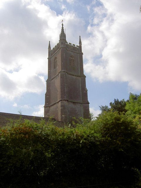
Chipping Sodbury’s listed buildings include the Parish Church of St John the Baptist, Grade I. Relative to its size, Chipping Sodbury keeps 157 listed buildings per 10,000 residents. 6% of its homes were built before 1919, below Gloucestershire’s towns (19%) and England’s towns (16%) alike. Grade II* covers 15 of them, Grade I 1.
Historic England list, October 2026 · Valuation Office Agency, homes by build period · OGL
Work & commuteJobs & income grade A−
Walking, cycling and public transport carry fewer commuters in Chipping Sodbury than in Gloucestershire’s towns or England’s towns: 17%
17%walk, cycle or ride
The Census was taken on 21 March 2021, in lockdown, so 36% of workers were mainly at home; shares here are of those who travelled.
Driving is how 81% of commuters got to work at the census. Short trips to work, under 5 km: 38%, below Gloucestershire’s towns (45%) and England’s towns (45%) alike. Work in town: a tenth of resident commuters. For every resident in work, Chipping Sodbury has 0.9 jobs.
ONS Census 2021, method of travel and distance to work · ONS small-area income · DWP claimant count · OGL
Safety
Chipping Sodbury records more crime per resident than 53% of UK towns
23.9violent and sexual offences per 1,000 a yearB−Safety Grade
Over the year to August 2026, 360 offences were reported in Chipping Sodbury, along with 57 incidents of anti-social behaviour. Burglary and damage came to 9.9 per 1,000 residents a year, above Gloucestershire’s towns (8.1) and England’s towns (9.4) alike.
Compared with UK towns its sizeLess crime per resident than 47% of the 1,308 UK towns of 2,500 to 10,000 people: about the middle for its size. Context only, not part of the grade.
More crimeLess crime
Reports by type · Sep 2025 to Aug 2026
Violence & sexual191
Public order39
Damage & arson34
Other theft31
Burglary24
Shoplifting13
Vehicle crime9
Other crime8
Anti-social57
Not gradedAnti-social behaviour, shoplifting and other theft are shown but left out of the Safety Grade, which counts violence and crimes against homes and vehicles per resident.
23.9
violent and sexual offences per 1,000 residents a year, averaged Sep 2023 to Aug 2026
9.9
burglary, vehicle crime and damage per 1,000 a year, averaged Sep 2023 to Aug 2026
8.1
anti-social behaviour reports per 1,000 (not graded)
Simon Blackburn: Bengt Oberger, CC BY-SA 4.0 · Wallace Watts: Hudson & Kearns, CC BY-SA 2.0
About Chipping Sodbury
Town in Gloucestershire, England
Chipping Sodbury is a built-up area of 8,026 people, in the South Gloucestershire council area. TownRatings uses ONS’s 2022 built-up areas as towns: the physical town, as people mean the word, rather than a council district, so its figures cover the town itself.
Wickwar, Hawkesbury Upton, Wick and Marshfield have fewer than 2,500 residents, so they get subject grades but no overall grade. People: Census 2021. Miles: centre to centre.
Questions about Chipping Sodbury
How many listed buildings are there in Chipping Sodbury?
That is 6.4 times the typical UK town for its size. Its Grade I building is Parish Church of St John the Baptist.
Does Chipping Sodbury flood?
Surface water isn’t included. Check a specific address on GOV.UK’s flood risk service.
Is Chipping Sodbury expensive to live in?
Homes cost more than in most UK towns: the median sale over three years was £360,000, against £277,000 in the typical UK town. By type: flats £237,475, terraced houses £315,000, semi-detached houses £330,000 and detached houses £500,000.
Sources: ONS Census 2021, output areas summed to the ONS 2022 built-up area · HM Land Registry Price Paid (standard sales, September 2023 to August 2026) · ONS Price Index of Private Rents (August 2026, by council) · MHCLG and Welsh Government council tax, Band D 2026–27 (with parish precepts in England) · data.police.uk street-level crime, 36 months to August 2026, points inside the built-up-area boundary · ONS small-area life expectancy and healthy life expectancy, 2019 to 2023 (England and Wales), OHID Fingertips small-area indicators (England) and Census 2021 health, adjusted for age · ONS small-area income estimates (financial year ending 2023) · DWP claimant count via Nomis (January to August 2026) · Historic England, National Heritage List for England (listed buildings, scheduled monuments, registered parks and gardens, battlefields, World Heritage Sites), October 2026, inside the ONS 2022 built-up-area boundary · Valuation Office Agency, Council Tax: stock of properties by build period (31 March 2025) · TownRatings grades: our own summary of the data, ranked against UK towns only. All under the Open Government Licence v3.0.