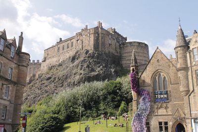
Edinburgh’s strongest subject is walkability: 55% of commuters get to work on foot, by bike or by public transport. The median home sold for £272,000, 5.2 times what households in the City of Edinburgh council area earn in a year. Where it falls short is health: life expectancy 78.3 for men, 82.5 for women. Natural hazards weigh more here (C): 1.6% of homes face a high or medium risk of river or sea flooding.
Figures: commuting, Census 2022 · life expectancy and incomes, ONS · prices, HM Land Registry, the last three years · flood risk, SEPA. Edinburgh has no Safety Grade, because Police Scotland doesn’t publish street-level crime, and so no overall grade. Its other subjects are graded below.
Each subject compared with the 2,160 UK towns with an overall grade (schools within Scotland), ordered by how far Edinburgh is from typical. American towns are graded separately.
Edinburgh has no Safety Grade, because Police Scotland doesn’t publish street-level crime, and so no overall grade. Its other subjects are graded below.
Scottish National Portrait Gallery: Original uploader was Maccoinnich at en.wikipedia, CC BY-SA 3.0, Wikimedia Commons
The data
Data highlights are ordered by what stands out in Edinburgh.
Work & commute
Edinburgh is more walkable than almost every UK town
Scotland’s Census was taken on 20 March 2022, a year after England and Wales’s lockdown census; 39% of workers were mainly at home, and shares here are of those who travelled.
The car took 43% of commuters, close to City of Edinburgh council area’s towns (43%) and below Scotland’s towns (70%). 56% of commuters travelled under 5 km to work. Work in town: 83% of resident commuters. Each working resident is matched by 1.5 jobs here.
55%walk, cycle or ride
How commuters got to work · March 2022
Driving43%
Bus25%
On foot20%
Bicycle6%
Train2%
Underground, tram1%
56%
of commuters travel under 5 km · Scotland 44%
39%
worked mainly from home in March 2022
2.8%
of 16 to 64s claim unemployment benefits (2026)
A+
Walkability: more walkable than almost every UK town
Scottish Government · school statistics and leavers’ results · The grade uses the secondaries its children go to; Scotland publishes no primary results by school.See all 118 schools →
Health
People in Edinburgh live shorter lives than in 75% of UK towns
Asked at the census, 84% of residents of Edinburgh said they were in good or very good health. 4.9% of residents described their health as bad or very bad, close to City of Edinburgh council area’s towns (4.9%) and below Scotland’s towns (7.2%). A disability affects 20% of people in the town.
Scotland’s Census 2022, general health and disability · Public Health Scotland life expectancy by intermediate zone, 2020–24 · OGL · A young population flatters these answers, which are not age-adjusted; the Health Grade instead uses measures that allow for age, such as life expectancy and early deaths.
History
Listed buildings in Edinburgh: 4,435, with 849 at Category A
The heritage lists give each building’s grade but not its age, so we don’t say which is oldest.
Conservation areas cover a fifth of Edinburgh’s land, above Scotland’s towns (1%). It is part of the Old and New Towns of Edinburgh World Heritage Site. Per 10,000 residents, Edinburgh counts 90 listed buildings. The town’s listed buildings include the Abbey Strand, Eastern Building, 'Abbey Sanctuary', Category A.
4,435listed buildings
Listed buildings by grade · Historic Environment Scotland
Historic Environment Scotland list, October 2026 · OGL
HousingCost of living grade B
Edinburgh gets a B for cost of living grade
24% of households rent privately. The social rented sector houses 16% of households. Private rents average £1,507 a month across the Lothian council area.
£272Kmedian sale
Median sale price · 2023 to 2025, at early-2025 prices
Edinburgh£272K
Typical UK town£277K
58%
of households own their home · Scotland 60%
24%
rent privately · Scotland 13%
£1,507
average private rent a month, Lothian council area
Registers of Scotland data-zone sale prices · Scottish Government council tax · Scotland’s Census 2022 tenure · OGL · The Scottish median is our estimate from data-zone sales, brought to early-2025 prices.
Who lives here
A typical mix of ages for Scotland
Degrees are held by 50% of adults, about level with City of Edinburgh council area’s towns (50%) and above Scotland’s towns (32%). Young adults of 15 to 24 account for 16% of the town. The town has a median age of 37.2. Under 15: 13% of residents.
37.2median age
EdinburghCity of Edinburgh council areaScotland
Ages · share of residents
16%
Under 1515–2425–4445–6465+
Qualifications · residents 16 and older
No qualifications10%
Apprenticeship4%
Highers or similar12%
Degree level50%
Women and men · all residents
52% women, 48% men
WomenScotlandMen
About 94 men for every 100 women. Across Scotland, 51% of residents are women.
Arthur Conan Doyle: Walter Benington, Public domain · Alexander Graham Bell: Moffett Studio, Public domain · David Hume: Allan Ramsay, Public domain · Tony Blair: Pavel Golovkin, CC BY 4.0 · Robert Louis Stevenson: Henry Walter Barnett, Public domain
Edinburgh’s neighbours
The nearest towns and villages, from National Records of Scotland’s 2022 localities. See them on the map →
No Scottish town has a Safety Grade or an overall grade yet: Police Scotland doesn’t publish street-level crime. People: Census 2022. Miles: centre to centre.
Questions about Edinburgh
How many listed buildings are there in Edinburgh?
That is 3.7 times the typical town in England and Wales for its size. Its Category A buildings include Abbey Strand, Eastern Building, 'Abbey Sanctuary'. It also has 30 scheduled monuments. Part of it is in the Old and New Towns of Edinburgh World Heritage Site.
How much is council tax in Edinburgh?
Band D council tax in Edinburgh is £1,626 for 2026–27, less than in 94% of UK towns (council, county, police and fire). Your own bill depends on your home’s band; check it on GOV.UK.
Does Edinburgh flood?
Surface water isn’t included. Check a specific address on GOV.UK’s flood risk service.
About Edinburgh
City in City of Edinburgh, Scotland
Edinburgh is a locality of 493,794 people, in the City of Edinburgh council area. TownRatings uses National Records of Scotland’s 2022 localities as Scotland’s towns: the physical town, as people mean the word, rather than a council area, so its figures cover the town itself. Localities split the big settlements into their towns, as ONS’s 2022 boundaries split conurbations in England and Wales.
Built from NRS geography and Census 2022
Population
493,794 (Census 2022)
Council
City of Edinburgh
Nation
Scotland
Area
47.8 sq mi (123.7 km²)
NRS code
S52000233
Sources: Scotland’s Census 2022 (National Records of Scotland), output areas summed to the NRS 2022 locality · Registers of Scotland house price statistics, medians and quartiles of residential sales by 2022 data zone, 2004 to 2025 (the 2023 to 2025 headline brought to early-2025 prices with each council’s medians) · Scottish Government, Council Tax by band 2026-27; Scottish Water charges 2026-27 · Scottish Government, Recorded Crime in Scotland (crimes, offences and clear-up rates by council area, 2016-17 to 2025-26); Scottish Index of Multiple Deprivation 2020v2 crime domain and SIMD crime indicators (2014/15, 2017/18), 2011 data zones with Census 2022 residents · ONS gross disposable household income by council (2022), scaled to household income on England and Wales’s councils, with Scotland’s Census 2022 households · DWP / ONS Claimant Count via Nomis (2022 data zones, January to August 2026), over residents aged 16 to 64 at Scotland’s Census 2022; council series since 2015 · Scottish Government school contact list (31 July 2026) and school summary statistics (pupil census, September 2025); School Information Dashboard leavers’ attainment by school, 2022-23 to 2024-25 (data.gov.scot) · TownRatings grades: our own summary of the data, ranked against UK towns only. All under the Open Government Licence v3.0.