 Rose Cottage, Southside and Towersyard Farm · Photo: Peter Broster · CC BY-SA 4.0
12 listed buildings
On the Historic England list, all of them stand inside Poynton’s built-up area, 9.2 for every 10,000 residents. All of Poynton’s listed buildings are Grade II. 7.7% of its homes were built before 1919. We have photos of 6 of its listed buildings. Poynton grades D for history: #38 of 46 in Cheshire.
Poynton in 6 photos
Tap a photo to step through them full screen.
 Church of St GeorgeGrade II listed
 Worth CloughGrade II listed
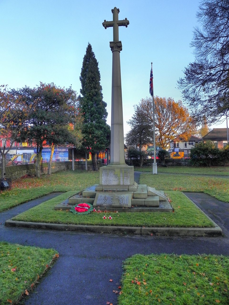 Poynton War MemorialGrade II listed
 Wards End Old FarmGrade II listed
 HaybrookGrade II listed+1See all photos
Photos from Wikimedia Commons and Geograph, copied to our own server, each credited to its photographer with its licence; names open the building’s page or its official list entry.
Where Poynton’s history is
Every Grade I and II* building, monument and historic park, over the age of each neighbourhood’s homes.
Hover a dot for its name; tap one with a photo to open it.
Historic England lists buildings in three grades: Grade I for buildings of exceptional interest (about 2.5% of all listed buildings), Grade II* for particularly important buildings of more than special interest (about 5.8%), and Grade II for buildings of special interest (about 91.7%). Listing protects the whole building, inside and out.
Every entry on the National Heritage List for England whose point lies inside the ONS 2022 built-up-area boundary. One list entry can cover a terrace or a group of buildings. Neighbourhood dots: the population-weighted centre of each Census 2021 output area, coloured by its neighbourhood’s (LSOA’s) share of homes built before 1919 (Valuation Office Agency, March 2025).
12 Grade II listed buildings
Most listed buildings are in this grade, which covers buildings of special interest. Open any building to read its official list entry.
All 12 Grade II listed buildings, A to Z
1 conservation area covers 99% of Poynton
Areas the council protects as a whole: demolition and changes to how buildings look need consent, and trees are protected.
12 of the 12 listed buildings stand in one.
Historic England’s conservation areas layer, supplied by councils (incomplete in places, so a page fact, never graded). Hectares are the part of each area inside the built-up area.
More than half of Poynton’s listed buildings were added in one year, 1983
The year each building now on the list was first listed.
The first 10 entries were listed in 1983. Only 1 has been added in the last 15 years.
Poynton grades D for history
Protected heritage and the age of the town’s homes, against all UK towns.
Two measures, each ranked against every UK town of 1,000 or more, with protected heritage counting twice as much as the age of homes. Protected heritage counts each listed building by its grade (Grade I three points, II* two, II one), each scheduled monument and battlefield two, and each registered park or garden by its grade; it is ranked both per 10,000 residents and as a total, so a village with one fine church doesn’t outrank a historic city. The second measure is the share of homes built before 1919, from the Valuation Office Agency’s council tax records. History is a character grade: it describes the town and isn’t part of the overall grade.
7.7% of Poynton’s homes were built before 1919
Every home by when it was built, from council tax records, against England & Wales (the dark tick).
6.5% of homes are Victorian or older, against 16% across England and Wales. The busiest period since was 1973–82, which added 27% of today’s homes.
Valuation Office Agency, council tax stock of properties by build period, 31 March 2025, for the neighbourhoods (LSOAs) that make up the town, split by where their residents live. Homes with no recorded build period (0 here) are left out; 1939–44 is not a period in the data.
Listed buildings in the places around Poynton
| Town | People | Listed | Grade I | History |
|---|---|---|---|---|
| Poynton | 13,015 | 12 | 0 | D |
| Woodford | 2,241 | 10 | 0 | C |
| Hazel Grove | 20,163 | 7 | 0 | C− |
| Bramhall | 17,201 | 10 | 1 | D |
| High Lane | 4,617 | 19 | 0 | C+ |
| Cheadle Hulme | 24,782 | 6 | 0 | D |
| Disley | 3,891 | 41 | 0 | A− |
| Bollington | 7,236 | 43 | 0 | A− |
Poynton in brief
Poynton has 12 listed buildings, including Rose Cottage, Southside and Towersyard Farm. A conservation area protects part of it. Its homes are mostly newer: 7.7% were built before 1919, against 15% in the typical UK town. More than half went on the list in a single year, 1983: 10 of 12. Beyond that, per resident it sits near the middle of UK towns; and James Meunier (1885) was born here before 1900.
Questions about Poynton’s history
How many listed buildings are there in Poynton?
Historic England lists 12 buildings inside Poynton’s built-up area: 0 Grade I, 0 Grade II* and 12 Grade II.
How many conservation areas are there in Poynton?
1, covering about 417 hectares of the town. The largest is No data available for publication by HE.
When were Poynton’s buildings listed?
The first in 1983; the most, 10, in 1983.
How old are the homes in Poynton?
7.7% of homes were built before 1919 and 21% before 1940, from the Valuation Office Agency’s council tax records (March 2025).
© Historic England 2026. Contains Ordnance Survey data © Crown copyright and database right 2026. The National Heritage List for England is the official, up-to-date register of all nationally protected historic buildings and sites in England; check an entry on Historic England’s website before relying on it.
Sources: Historic England, National Heritage List for England (listed buildings, scheduled monuments, registered parks and gardens, battlefields, World Heritage Sites), October 2026, inside the ONS 2022 built-up-area boundary · Valuation Office Agency, Council Tax: stock of properties by build period (31 March 2025) · TownRatings grades: our own summary of the data, ranked against UK towns only · Historic England conservation areas (supplied by local planning authorities; October 2026). All under the Open Government Licence v3.0.
Contains public sector information licensed under the Open Government Licence v3.0. Contains HM Land Registry data © Crown copyright and database right 2026. Contains OS data © Crown copyright and database right 2026 (ONS boundaries). Northern Ireland: Source: NISRA; contains Land & Property Services data and Ordnance Survey of Northern Ireland information, © Crown copyright, licensed under the Open Government Licence v3.0. Scotland: contains National Records of Scotland data, Registers of Scotland data and SEPA data, © Crown copyright / © SEPA 2025, licensed under the Open Government Licence v3.0.