
Chequers and more near Stoke Mandeville
Visitors to Stoke Mandeville can choose from 5 museums, 3 forts and 2 historic houses. There is no place to visit inside Stoke Mandeville’s built-up area; there are 16 within 5 km of its edge. Here, one place is kept up by the National Trust. Windsor Castle lies 36 km out, the pick for a day trip.
The first to see around Stoke Mandeville
2 museums, a historic house and a fort follow Chequers.
 Historic houseChequers2.7 km outside town, to the south
 Historic houseHalton House2.6 km outside town, to the east
 FortCymbeline's Castle2.6 km outside town, to the south
 CastleDinton Folly2.8 km outside town, to the west
 MuseumBuckinghamshire County Museum1.8 km outside town, to the northwest
 MuseumRoald Dahl Children's Gallery1.8 km outside town, to the northwest
Each has a page of its own: what it is, who runs it, the weather month by month and what else is near it.
Plotted on the map
The outermost point is St Mary Magdalene, Little Hampden, at 7.5 km.
The dashed line is Stoke Mandeville’s built-up area; orange marks its middle (where most people live). Numbers match the list below. © OpenStreetMap contributors · ONS built-up area 2022
Grouped by kind
The two biggest groups: castles or historic places (6) and museums or galleries (5).
Green: inside Stoke Mandeville. Grey: within 5 km of its edge.
1 place is cared for by the National Trust (Pulpit Hill Nature Reserve).
All 16 on the list
16 places make the list, every one within 5 km of its edge.
Halton House
Country house in the Chiltern Hills above the village of Halton in Buckinghamshire, England, UK.
Cymbeline's Castle
Motte-and-bailey castle in Ellesborough, Buckinghamshire, England, UK.
Dinton Folly
Castle located just north of the village of Dinton, in Buckinghamshire, England, UK.
Buckinghamshire County Museum
Museum in Aylesbury, England, United Kingdom.
Roald Dahl Children's Gallery
Children's museum in Aylesbury, England.
 8
National Paralympic Heritage Centre
Sports museum in Aylesbury, Buckinghamshire, England, United Kingdom.
Close and well known first. Churches and listed buildings are on the History page, not here.
31 listed buildings are on Stoke Mandeville’s History page → · Parks, footpaths and green space in Stoke Mandeville →
Further away
Top of the 12 day trips: Windsor Castle, at 36 km.
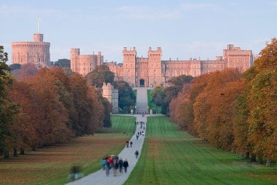 CastleWindsor Castle36 km south
 MuseumNatural History Museum at Tring8.8 km east · 134K visitors a year (2022)
 MuseumBletchley Park23 km north
 MuseumAshmolean Museum33 km west
 Historic house · National TrustWaddesdon Manor12 km northwest
 Historic houseBlenheim Palace40 km west
 CathedralSt Albans Cathedral31 km east
 Historic houseMentmore Towers11 km northeastHistoric houseHistoric houseWoburn Abbey25 km northeast
 ZooWhipsnade Zoo18 km east
 MuseumOxford University Museum of Natural History32 km west
 Castle · English HeritageBerkhamsted Castle16 km east
Places well known beyond Stoke Mandeville (Wikipedia articles in several languages, published visitor counts, or a National Trust, English Heritage or Cadw property), close and famous first. Distances are straight lines from the middle of the town.
What people ask about Stoke Mandeville
What is there to see near Stoke Mandeville?
No attraction is mapped inside Stoke Mandeville itself. Within 5 km of it are Chequers, Halton House, Cymbeline's Castle and Dinton Folly.
Does Stoke Mandeville have a museum?
5 museums and galleries are in or within 5 km of Stoke Mandeville: Buckinghamshire County Museum, Roald Dahl Children's Gallery, Trenchard Museum and National Paralympic Heritage Centre.
Is there a National Trust or English Heritage property near Stoke Mandeville?
Yes. In or within 5 km of Stoke Mandeville, 1 place is cared for by the National Trust (Pulpit Hill Nature Reserve).
What are the best-known days out near Stoke Mandeville?
Within 40 km: Windsor Castle (36 km), Natural History Museum at Tring (8.8 km), Bletchley Park (23 km), Ashmolean Museum (33 km).
Where are Stoke Mandeville’s historic buildings listed?
Stoke Mandeville has 31 listed buildings, 1 of them Grade I. They are on its History page, from Historic England’s list, not repeated here.
How is this list made?
From OpenStreetMap (museums, galleries, zoos, theme parks and attractions, castles, forts and abbeys, and historic houses and gardens that are open to visitors) and Wikidata (what each place is, who runs it, its website and visitor counts). A place counts for Stoke Mandeville when it is inside the ONS 2022 built-up area, and as nearby within 5 km of its edge. Opening times and prices are not shown: check the official site.
Places: OpenStreetMap (© OpenStreetMap contributors, Open Database Licence) and Wikidata (CC0), placed in the ONS 2022 built-up area (Open Government Licence v3.0). Visitor counts are the latest Wikidata gives, with their year.
Photos: each place’s Wikidata image, from Wikimedia Commons under the licence below (our copy, resized).
Photo credits (18)
- Chequers: Stephen Simpson, Public domain, Wikimedia Commons
- Halton House: Public domain, Wikimedia Commons
- Cymbeline's Castle: Rob Farrow, CC BY-SA 2.0, Wikimedia Commons
- Dinton Folly: D Gore, CC BY-SA 2.0, Wikimedia Commons
- Buckinghamshire County Museum: Nigel Cox, CC BY-SA 2.0, Wikimedia Commons
- Roald Dahl Children's Gallery: Nigel Cox, CC BY-SA 2.0, Wikimedia Commons
- National Paralympic Heritage Centre: Lee Vilenski, CC BY-SA 4.0, Wikimedia Commons
- Windsor Castle: Diliff, CC BY 2.5, Wikimedia Commons
- Natural History Museum at Tring: Rob Farrow. Rob Farrow, CC BY-SA 2.0, Wikimedia Commons
- Bletchley Park: DeFacto, CC BY-SA 4.0, Wikimedia Commons
- Ashmolean Museum: Lewis Clarke, CC BY-SA 2.0, Wikimedia Commons
- Waddesdon Manor: Mattlever, CC BY-SA 3.0, Wikimedia Commons
- Blenheim Palace: Jvhertum, Public domain, Wikimedia Commons
- St Albans Cathedral: Diliff, CC BY-SA 3.0, Wikimedia Commons
- Mentmore Towers: The original uploader was Swanker at English Wikipedia., CC BY-SA 3.0, Wikimedia Commons
- Whipsnade Zoo: Mike Pennington, CC BY-SA 2.0, Wikimedia Commons
- Oxford University Museum of Natural History: The original uploader was MykReeve at English Wikipedia., CC BY-SA 3.0, Wikimedia Commons
- Berkhamsted Castle: Winstainforth at English Wikipedia, CC BY-SA 3.0, Wikimedia Commons
Contains public sector information licensed under the Open Government Licence v3.0. Contains HM Land Registry data © Crown copyright and database right 2026. Contains OS data © Crown copyright and database right 2026 (ONS boundaries). Northern Ireland: Source: NISRA; contains Land & Property Services data and Ordnance Survey of Northern Ireland information, © Crown copyright, licensed under the Open Government Licence v3.0. Scotland: contains National Records of Scotland data, Registers of Scotland data and SEPA data, © Crown copyright / © SEPA 2025, licensed under the Open Government Licence v3.0.