Sierra Blanca’s post office opened in 1882, and 1 of its places is on the National Register
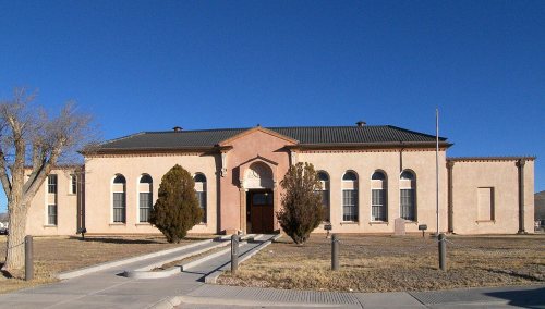
Most of Sierra Blanca was built recently: 3% of its homes predate 1940 and the median home dates from 1977. Its Register listing is the Hudspeth County Courthouse. Below: 6 old photos and papers, maps from 1964 on, and the census since 2000.
The town was founded in 1881 at the completion point of a southern transcontinental railway. Sierra Blanca has served as the junction of the Southern Pacific and Texas and Pacific railroads. Hudspeth County was formed in 1917 from El Paso County. Sierra Blanca was named the county seat, and has the only adobe courthouse in Texas.
Nothing in the archives for these yearsWeddings on Main Street, storms, parades, school pictures, the old store. If it’s in your family album, it belongs here.
Nothing in the archives for these yearsWeddings on Main Street, storms, parades, school pictures, the old store. If it’s in your family album, it belongs here.
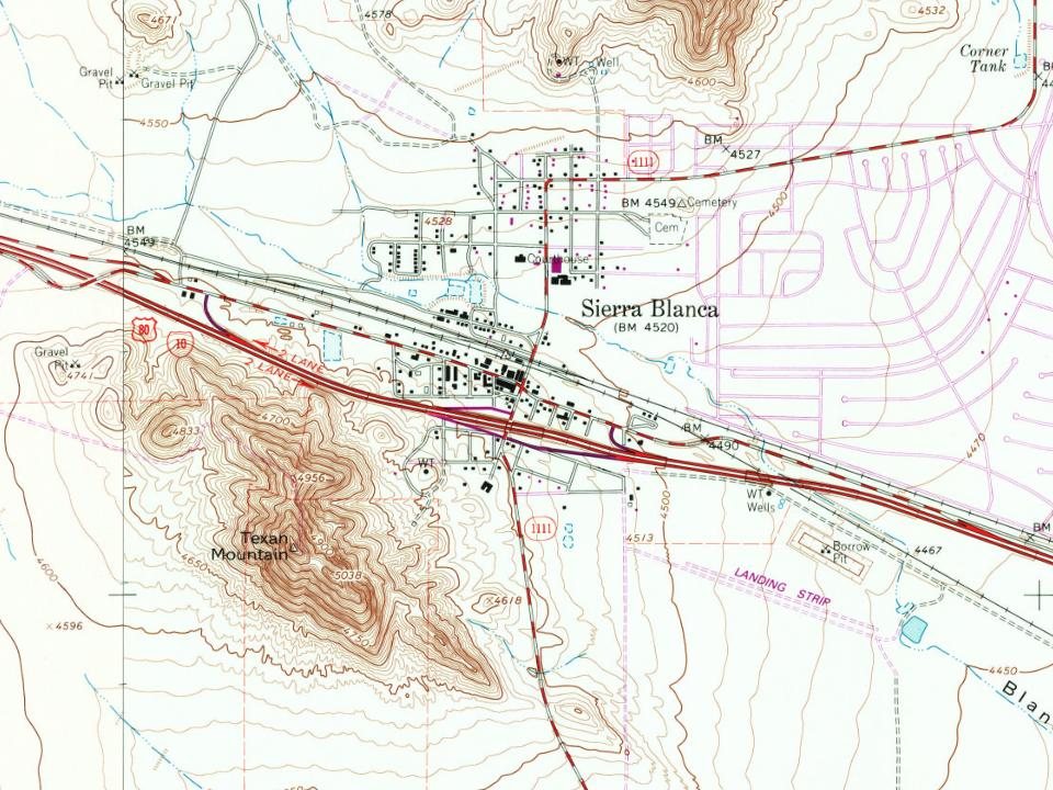
Every edition of the U.S. Geological Survey’s map of Sierra Blanca. Tap a year, or press play to watch the town change.
1964Sierra Blanca sheet · 1:24,000
U.S. Geological Survey historical topographic maps (public domain), via Esri’s collection of the scans. The red ring marks the center of Sierra Blanca.
Then & now
Stand where they stood
No then-and-now pairs yet. Take a photo from the same spot as an old one and they appear here side by side.
Retake this viewFMIB 34845 Habitat of Couch's and Hammond's Spadefoots and of Two Toads (Bufo woodhousii and Bufo compactilis), Sierra …, 1919
Find the spot, match the angle, and add your photo. It becomes the first then-and-now pair on Sierra Blanca’s page.
Founding dates: Wikidata, Wikipedia, the U.S. post office records of Blevins & Helbock (CC0) and the Census. Homes by year built: Census ACS 2020–24. National Register of Historic Places: National Park Service (list of May 22, 2026). Old photos, postcards and papers: Wikimedia Commons, the Library of Congress and other public archives, credited on each item’s page. Maps: U.S. Geological Survey historical topographic maps (via Esri) and Sanborn fire-insurance maps (Library of Congress). History text and census tables: Wikipedia (CC BY-SA 4.0). Places that used to be: USGS Geographic Names Information System (2021). How TownRatings grades history →
From Wikimedia Commons (6), the National Register of Historic Places (1), Wikipedia, U.S. Geological Survey historical maps, U.S. Census counts (via Wikipedia), the US Post Offices dataset (Blevins & Helbock) and the USGS Geographic Names Information System. Archive images are copied here with their credits and licenses, shown on each photo’s page. Refreshed monthly.


 1969
 1969
 1969
 1969