Guest, Sign inJoin

Post to San Marcos

We’ll email a one-tap link to publish your post. No password, and nothing is public until you click it.
Already a member? Sign in
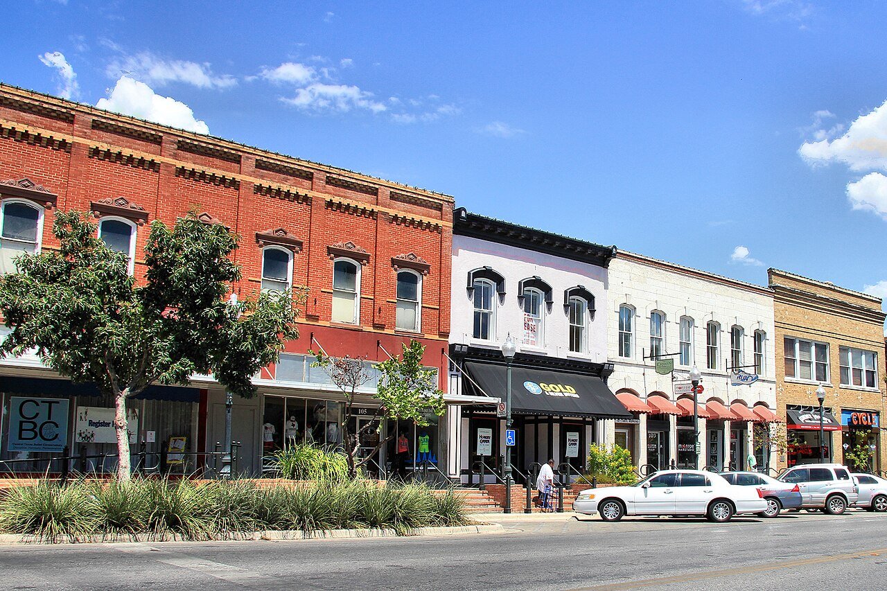
Hays county courthouse historic district 2013Photo: Larry D. Moore · CC BY 4.0
AOutdoors
Outdoors in San Marcos

11% of San Marcos’ land is conserved: 2,850 acres

37 miles of mapped trail cross San Marcos, 0.9 per square mile of land. The biggest trail networks: Purgatory Creek Greenspace (8.7 mi), Spring Lake Preserve (6.4 mi), Ringtail Ridge Natural Area (2 mi). 89% of residents live within a half mile of a park.

Ahead of 87% of U.S. towns · #41 of 642 in Texas. What drives it

Conserved land
11%
2,850 acres · of 40.4 sq mi of land
Trails
37 mi
0.9 per sq mi of land
Park land
1,617 ac
23 acres per 1,000 residents
Near a park
89%
of residents within ½ mile
Bike routes
30 mi
12 mi lanes · 14 mi paths
Lakes & rivers
10

What kind of outdoors town is San Marcos?

Read from the map. The page puts what stands out first.

Outdoors grade

How much outdoors does San Marcos have?

On conserved land, trails, park land and how close residents live to a park, San Marcos is ahead of 87% of U.S. towns, #41 of 642 in Texas. All four inputs are above most U.S. towns; conserved land ranks highest, park acres per resident lowest.

A
OutdoorsA character grade: shown, never part of San Marcos’ overall grade.
All U.S. towns we grade (21,298)Ahead of 87%
LessMore
Texas towns of 2,500+ (642)Ahead of 94%

Few Texas towns conserve much land (a typical one, 2%; the U.S., 4%), so San Marcos’ 11% is ahead of 91% of Texas towns, while its trails per square mile lead 87% of them.

How sure. Graded on any three of the four inputs instead, the letter would range from A− to A. Trails and many small parks come from OpenStreetMap, mapped by volunteers, so coverage varies from town to town; the half mile is a straight line from each census block, so a river or highway in the way isn’t counted against it.

PAD-US, OpenStreetMap (© OpenStreetMap contributors), Census 2025 Gazetteer and 2020 blocks; details in Sources below. How TownRatings grades the outdoors →

The map

Conserved land, trails & bike routes

Tap a number to zoom to a park. Tap a layer to hide it.

12345678
Easements protect land from building but are usually private.© OpenStreetMap contributors · USGS PAD-US
Places to walk

Pick a walk

The longest trail network is Purgatory Creek Greenspace, with 8.7 miles. Directions go to the nearest trailhead or public parking.

Purgatory Creek Greenspace

Nature preserve
474 acres8.7 mi of trail
DanteBeatrice TrailParaisoRipheus+1
Dog rules not recorded
Directionsto the parking lotWebsite ↗

Spring Lake Preserve

Nature preserve
247 acres6.4 mi of trail
Grey FoxBlue StemTonkawaRoadrunner+1
Dog rules not recorded
Directionsto the parking lotWebsite ↗

Ringtail Ridge Natural Area

Nature preserve
40 acres2 mi of trail
Ridge Loopringtail ridge access trail
Dog rules not recorded
Directionsto the parking lot

Prospect Park

Park
31 acres1.6 mi of trail
Blue TrailVirgil's TrailSinon
Dog rules not recorded
Directionsto the parking lot

Blanco Shoals Natural Area

Managed by San Marcos Greenbelt Alliance
87 acres1.2 mi of trail
Dogs on leash
Directionsto the parking lotWebsite ↗

Five Mile Dam Park

Managed by Hays County
47 acres1.2 mi of trail
Dog rules not recorded
Directionsto the parking lotWebsite ↗

Meadows Center for Water and the Environment

Nature preserve
20 acres0.9 mi of trail
Dog rules not recorded
Directionsto the parking lotWebsite ↗

Schulle Canyon Natural Area

Nature preserve
19 acres0.8 mi of trail
Virginia Witte Way TrailWarbler WalkRoot Rock TrailItsy Bitsy Trail
Dog rules not recorded
No trailhead mapped yetWebsite ↗
All 37 parks & preserves
Purgatory Creek Greenspace474 acres · 8.7 mi of trail
Directions
Spring Lake Preserve247 acres · 6.4 mi of trail
Directions
Ringtail Ridge Natural Area40 acres · 2 mi of trail
Directions
Prospect Park31 acres · 1.6 mi of trail
Directions
Blanco Shoals Natural Area87 acres · 1.2 mi of trail · San Marcos Greenbelt Alliance
Directions
Five Mile Dam Park47 acres · 1.2 mi of trail · Hays County
Directions
Meadows Center for Water and the Environment20 acres · 0.9 mi of trail
Directions
Schulle Canyon Natural Area19 acres · 0.8 mi of trail
Purgatory Creek Natural Area18 acres · 0.7 mi of trail · City of San Marcos
Directions
San Marcos Aquatic Resources Center118 acres · 0.6 mi of trail · United States Fish and Wildlife Service
Directions
William And Eleanor Crook River Park16 acres · 0.5 mi of trail
Directions
Kenneth M. Copeland Memorial Park37 acres · 0.4 mi of trail
Childrens Park8 acres · 0.4 mi of trail
Directions
Memorial Park22 acres · 0.3 mi of trail
Directions
Rio Vista Park18 acres · 0.3 mi of trail
Directions
Dunbar Park10 acres · 0.2 mi of trail · City of San Marcos
Veramendi Park3 acres · 0.2 mi of trail
Directions
Sewell Park7 acres · 0.1 mi of trail
Cottonwood Creek Park57 acres
San Marcos Gary Softball Complex40 acres
Directions
Ramon Lucio Park19 acres
Directions
San Marcos City Park15 acres
Directions
Bicentennial Park12 acres
Directions
Willow Springs Park7 acres
Veteran's Park6 acres · City of San Marcos
San Marcos Plaza Park5 acres
Directions
Blanco Vista Neighborhood Park4 acres
Directions
Veteran's Plaza4 acres
Directions
River Ridge Park3 acres
Franklin Square Park3 acres
Directions
Paul Peña Park3 acres
John Stokes Park3 acres
Tejas Park2 acres
Jaycees Park2 acres
H.E.B Park1 acres
Conway Park1 acres
Swift Memorial Park1 acres
Who protects it

2,850 conserved acres

11% of San Marcos’ land. Who manages San Marcos’s conserved land, from the USGS Protected Areas Database. Approximate, because parcels can overlap.

Joint1,915 ac
Town or city1,536 ac
State parks753 ac
Land trusts & nonprofits463 ac
U.S. Fish and Wildlife Service238 ac
State fish & wildlife121 ac
County90 ac
Conservation Easement · 1,737 acLocal Conservation Area · 902 acPrivate Park · 796 acOther Easement · 775 acResearch or Educational Area · 456 ac
Good to know

Conserved doesn’t always mean open to visitors. 22 acres are conservation easements, usually private land. Public access isn’t recorded for 4 of 136 parcels. The walks above are places people visit.

The biggest protected parcels
Parcel (PAD-US)Managed byAcresPublic access
Purgatory Creek Natural Area
Local Conservation Area
Town or city499Open
San Marcos River State Scientific Area
Research or Educational Area
State parks456Restricted
Upper Purgatory Barker
Private Park
Not recorded283Open
Spring Lake Natural Area
Local Conservation Area
Town or city247Open
San Marcos Aquatic Resources Center
Federal Other or Unknown
U.S. Fish and Wildlife Service236Restricted
Windemere Ranch
Private Park
Land trusts & nonprofits235Open
A. E. Wood State Fish Hatchery
State Other or Unknown
State fish & wildlife121Restricted
Upper Purgatory Buie
Private Park
Not recorded113Open
Wwtp
Private Park
Not recorded100Open
Blanco Shoals Natural Area
Local Conservation Area
Town or city93Open

5 smaller protected places aren’t shown.

Things to do

34 places to go in San Marcos

Beaches, playgrounds, peaks, falls and more. Pick a kind.

Playgrounds in San Marcos
Crockett Elementary Playground
Directions
Franklin Square PlaygroundIn Franklin Square Park
Directions
PlayscapeIn Childrens Park
Directions
Veterans Park PlaygroundIn Veteran's Park
Directions

Plus 9 playgrounds without a name on the map.

Trails & water

25 named trails and 10 lakes & rivers

Named trails
Open to bikes · 16.1 miUnpaved · 21.7 mi
Dante3.6 mi
Beatrice Trail1.3 mi
Doline Trail1.1 mi
Blue Trail1.0 mi
Paraiso1.0 mi
Grey Fox0.8 mi
Tonkawa0.8 mi
Blue Stem0.7 mi
Roadrunner0.7 mi
Swallet Loop trail0.7 mi
15 more trails
Ridge Loop
0.7 mi
Ripheus
0.7 mi
Lower Purgatory Creek Greenspace Trail
0.6 mi
Wetland Trail
0.6 mi
Nimrod
0.5 mi
Centipede
0.5 mi
Karst Corner Loop
0.5 mi
Virginia Witte Way Trail
0.4 mi
Styx Loop
0.4 mi
ringtail ridge access trail
0.4 mi
Blue Heron
0.3 mi
Buckeye
0.3 mi
Ovid West
0.3 mi
W Malacoda
0.3 mi
Warbler Walk
0.3 mi
Lakes & rivers tap for directions
Biking & sports

30 miles of bike routes

Bike lanes are often missing from the map in smaller towns, so that number is likely low.

12 mi
painted or protected bike lanes
14 mi
off-road bike paths
4.2 mi
shoulders & shared lanes
Courts & fields
41Tennis
29Basketball
16Baseball
10Beach volleyball
9Soccer
8Pickleball
5Football
1Skate park

Includes school and college facilities, which aren’t always open to the public.

History along the way

40 places on the National Register

The country’s official list of places worth saving (National Park Service). The map also marks 57 historic points from OpenStreetMap: plaques, memorials and old buildings.

History →
Cock HouseBuilding · listed 1973
About it
First United Methodist ChurchBuilding · listed 1974
About it
Burleson-Knispel HouseBuilding · listed 1979
About it
Hays County CourthouseBuilding · listed 1980
About it
Augusta Hofheinz HouseBuilding · listed 1983
About it
Belger-Cahill Lime KilnStructure · listed 1983
About it
Caldwell HouseBuilding · listed 1983
About it
Cape HouseBuilding · listed 1983
About it
Episcopalian RectoryBuilding · listed 1983
About it
Farmers Union Gin CompanyBuilding · listed 1983
About it
Fire Station and City HallBuilding · listed 1983
About it
Goforth-Harris HouseBuilding · listed 1983
About it

28 more on the History page.

When to get out

April is the best month for walking in San Marcos

NOAA’s 1991–2020 normals for the town and the daylight at its latitude. Outlined months have long days, highs of 59 to 86 °F and little rain for the place.

JanFebMarAprMayJunJulAugSepOctNovDec
Daylight (h)10.411.111.912.913.614.113.913.212.311.410.610.2
High (°F)636773808793969791827264
Rain (in)2.41.92.82.74.33.42.22.43.54.02.62.5

February is the driest month (1.9 in) and August the warmest (highs of 97 °F). 4.3 inches fall in May, the wettest month. Summer highs reach 97 °F, too hot for the outline. The climate in San Marcos →

Next door

San Marcos and its neighbors

San Marcos has the most mapped trails of the 2 towns around it. Tap a town to see its outdoors.

TownConserved
of land
Trail mi
per sq mi
Park acres
per 1,000
Near a park
½ mile
Outdoors
San Marcos11%0.92389%A
Kyle5%0.41593%B+

The four inputs of the Outdoors grade, from the engine; shares are of land, not water.

Questions about parks and trails in San Marcos

Where can I hike in San Marcos?

The longest trail networks: Purgatory Creek Greenspace, 8.7 miles; Spring Lake Preserve, 6.4 miles; Ringtail Ridge Natural Area, 2 miles; Prospect Park, 1.6 miles. Each one is on the map above, with directions to the nearest trailhead or parking.

How much of San Marcos is conserved land?

11% of its land, against a typical 2% for a Texas town and 4% nationally (PAD-US). Conserved doesn’t always mean open to visitors: easements are usually private land.

Are dogs allowed on San Marcos’ trails?

OpenStreetMap records dogs as welcome at Blanco Shoals Natural Area (on leash). For the rest, check the signs at the trailhead.

Where can I bike in San Marcos?

30 miles of bike routes are on the map: 12 of painted or protected lanes, 14 of off-road paths and 4.2 of shoulders and shared lanes.

Is there public land near San Marcos?

8,012 acres of parks and open public land lie inside San Marcos or within 10 miles of it (PAD-US), 2,125 of them inside the city line.

How much outdoors does San Marcos have?

Ahead of 87% of U.S. towns on the Outdoors grade, #41 of 642 in Texas. The grade combines the share of land that is conserved, miles of mapped trail per square mile of land, park acres per 1,000 residents and the share of residents within a half mile of a park. It’s a character grade, so it isn’t part of the overall grade. How it works.

Trail talk

Conditions, parking and favorite walks from San Marcos neighbors.
Town Square →
Share a tip
Sources

Where this page comes from

Conserved and public land: USGS Protected Areas Database of the United States (PAD-US), service updated July 2026. Parks, trails, playgrounds, beaches and other places: OpenStreetMap (© OpenStreetMap contributors, ODbL), map data as of 2026-10-28. Land and water area: Census 2025 Gazetteer. Residents near a park: 2020 Census blocks. National Register: National Park Service. How TownRatings grades the outdoors →