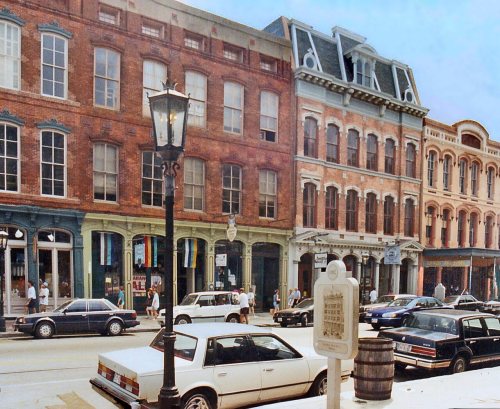
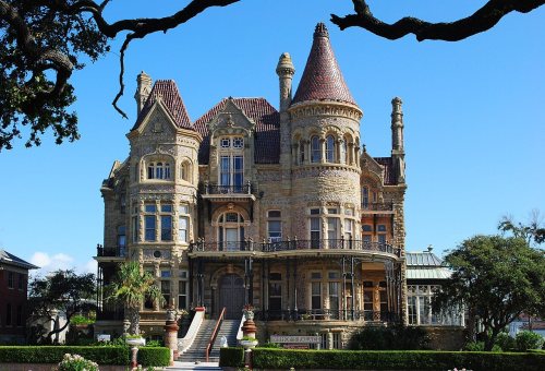
Galveston’s historic district, a National Historic Landmark, takes in 463 buildings
More historic than 94% of U.S. towns · #1 of 642 in Texas. What drives it
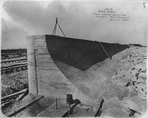
74 places in town are on the National Register, among them 3 National Historic Landmarks and eight historic districts with 1,648 buildings between them. Below: 4 old photos and papers, maps from 1885 on, and the census since 1850.
The Galveston post office opened in 1830, the earliest record of the town by name. Wikidata gives 1785, the date of an exploration of the area, not of the town.
First census: 4,177 in 18502020 census: 53,695196 years
How historic is Galveston?
A
More historic than 94% of U.S. towns, on its age, its old homes and the National Register.
Founding year: the first Galveston post office (Blevins & Helbock, CC0). Wikidata: 1785.The full story ↓
History grade
What drives Galveston’s History grade
On its age, its old homes and the National Register, Galveston is more historic than 94% of U.S. towns, #1 of 642 in Texas. All 3 inputs are above most U.S. towns; its National Register listings ranks highest and its share of homes from before 1940 lowest.
A
HistoryA character grade: shown, never part of Galveston’s overall grade.
Few Texas towns list much on the Register (a typical Texas town has 0.0 per 10,000 residents, the U.S. 2.4), so Galveston’s 321 sits above most of its state (99% of Texas towns have fewer) while its 1,715 historic buildings outnumber those of 99% of U.S. towns.
How sure. Graded on any two of the three inputs instead, the letter would range from A− to A+. The pre-1940 share (±1.4 points) is firm at this size. The founding year is the first post office, not a stated founding date; Wikidata’s 1785 falls in the same era, so the grade doesn’t depend on which one is used.
Founding year: the first post office (other dates in Quick answers). Homes: Census ACS 2020–24. National Register: National Park Service, May 2026 list; each listing counted once (boundary changes and added documentation belong to their listing), and a historic district counts its contributing buildings. How TownRatings grades history →
What stands out about Galveston’s past
Read from the archive, the National Register and the record. The page puts what stands out first.
Indigenous inhabitants of Galveston Island called the island Auia. Though there is no certainty regarding their route and their landings, Cabeza de Vaca and his crew were shipwrecked at a place he called "Isla de Malhado" in November 1528. This could have referred to Galveston Island or San Luis Island.
Passages that mention Galveston, cut from the printed page as they were published.
History of Texas, together with a biographical history of the cities of Houston and Galveston1895 · page 215Read the page →
Read the text
The mercartile transactions for 1890 were estimated at al)0ut §14,000,000 Galveston, the capital of Galveston county and chief seaport in the State, is situated on the extreme northeast end of Galveston island, at the mouth of the bay of the same name. It was laid out in 1838. The first sale of town lots took place April 20 of that year.
Text read by machine from the scan; it may contain errors.
History of Texas, together with a biographical history of the cities of Houston and Galveston1895 · page 654Read the page →
Read the text
capacity till remo\-ed by General Griffin, military commander of this district, as an impediment to reconstruction. Captain Atkins was elected Sheriff of Galveston county in 1872 and held this office for four years, having served as a peace officer in the city of Galveston altogether for a period of fifteen years. In April, 1885, he became a candi-
Text read by machine from the scan; it may contain errors.
Scans and text from the Internet Archive. Books published in 1930 or earlier, which are in the public domain.
Timeline
Galveston, 1818 to 1995
Woven from the archive, old maps, post office records, the National Register and the people born here.
Every edition of the U.S. Geological Survey’s map of Galveston. Tap a year, or press play to watch the town change.
1930Galveston sheet · 1:24,000
U.S. Geological Survey historical topographic maps (public domain), via Esri’s collection of the scans. The red ring marks the center of Galveston.
Every building
Galveston, building by building, 1885–1912
Fire insurance maps drew every building, what it was made of and what it was used for, so insurers could price the risk of fire. Pick a year, then a sheet.
Anderson WaysBay HarborFort CrockettRed Fish CoveSea IsleTerramar Beach
Gone or out of use
Dresser Industries/Magcobar HeliportairportGalveston Army Air FieldmilitaryShell Pelican Island Heliportairport
16cemeteries and burying grounds inside Galveston
B'Nai IsraelBeth JacobCalvary CatholicEvergreenGreekHebrew Benevolent SocietyLakeviewMemorialMunicipalNew CityOld CatholicOld CityOleanderRosewoodSaints Constantine and Helen Serbian OrthodoxTrinity Episcopal
US Post Offices dataset (Blevins & Helbock, CC0). Places and cemeteries from the USGS Geographic Names Information System (2021).
Stories next door
History across the town line
Each neighbor’s History grade, on the same three inputs.
The Galveston post office opened in 1830, the earliest record of the town by name (U.S. post office records). Wikidata gives 1785.
How does Galveston rank for history?
Galveston is more historic than 94% of U.S. towns, #1 of 642 in Texas. The History grade combines the town’s founding era, the share of homes built before 1940 and its National Register listings. It’s a character grade, so it isn’t part of the overall grade. How it works.
What is on the National Register in Galveston?
74 listings, 3 of them National Historic Landmarks: 57 buildings, among them the Ashbel Smith Building (listed 1969, the first), 8 historic districts with 1,648 contributing buildings, 1 site, 7 structures, and 1 object. 1,715 historic buildings in all.
How old are the homes in Galveston?
20% of Galveston’s homes were built before 1940 (Census estimate, ±1.4 points), against a typical 1.6% for a Texas town; the median home was built in 1973.
Founding dates: Wikidata, Wikipedia, the U.S. post office records of Blevins & Helbock (CC0) and the Census. Homes by year built: Census ACS 2020–24. National Register of Historic Places: National Park Service (list of May 22, 2026). Old photos, postcards and papers: Wikimedia Commons, the Library of Congress and other public archives, credited on each item’s page. Maps: U.S. Geological Survey historical topographic maps (via Esri) and Sanborn fire-insurance maps (Library of Congress). History text and census tables: Wikipedia (CC BY-SA 4.0). Places that used to be: USGS Geographic Names Information System (2021).
From Wikimedia Commons (4), the National Register of Historic Places (74), Wikipedia, Wikidata and Wikipedia for famous people, U.S. Geological Survey historical maps, U.S. Census counts (via Wikipedia), the US Post Offices dataset (Blevins & Helbock), the USGS Geographic Names Information System, Sanborn fire insurance maps (Library of Congress) and old county and town histories (Internet Archive). Archive images are copied here with their credits and licenses, shown on each photo’s page. Refreshed monthly.


 ★ Landmark
 ★ Landmark
 ★ Landmark






 1855
 1855


