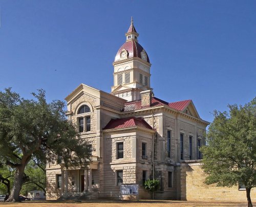
Bandera dates to 1855, and 3 of its places are on the National Register
Most of Bandera was built recently: 6% of its homes predate 1940 and the median home dates from 1986. Its Register listings are the Bandera County Courthouse and Jail, the Jureczki House and the Langford, B.F., Jr. and Mary Hay, House. Below: 3 old photos and papers, maps from 1956 on, and the census since 1890.
Bandera was founded in 1855 by Polish Roman Catholic immigrants from the Province of Silesia. They built St. Stanislaus Catholic Church, and many local residents are descended from them.
Bandera is the Spanish word for flag. How the town acquired the name is unknown. One theory is that the town is named after Bandera Pass.
Bandera was a staging area on the Great Western Cattle Trail, during the late 19th century.
The Cabaret Dance Hall opened in 1936. Throughout its history, the dance hall hosted Bob Wills, Doug Sahm, Ernest Tubb, and others. In 2008, the hall was listed as endangered by Preservation Texas. By at least 2013, the hall was closed, by 2015, it was demolished.
Nothing in the archives for these yearsWeddings on Main Street, storms, parades, school pictures, the old store. If it’s in your family album, it belongs here.
Founding dates: Wikidata, Wikipedia, the U.S. post office records of Blevins & Helbock (CC0) and the Census. Homes by year built: Census ACS 2020–24. National Register of Historic Places: National Park Service (list of May 22, 2026). Old photos, postcards and papers: Wikimedia Commons, the Library of Congress and other public archives, credited on each item’s page. Maps: U.S. Geological Survey historical topographic maps (via Esri) and Sanborn fire-insurance maps (Library of Congress). History text and census tables: Wikipedia (CC BY-SA 4.0). Places that used to be: USGS Geographic Names Information System (2021). How TownRatings grades history →
From Wikimedia Commons (12), the National Register of Historic Places (3), Wikipedia, Wikidata and Wikipedia for famous people, U.S. Geological Survey historical maps, U.S. Census counts (via Wikipedia), the US Post Offices dataset (Blevins & Helbock) and the USGS Geographic Names Information System. Archive images are copied here with their credits and licenses, shown on each photo’s page. Refreshed monthly.


 1880
 1880
 2014
 2011
 2011
 2009
 2009
 2009
 2009
 2008
 2008