13 of Lebanon’s places are on the National Register
More historic than 51% of U.S. towns · #81 of 177 in Tennessee. What drives it
Most of Lebanon was built recently: 3% of its homes predate 1940 and the median home dates from 2004. Below: 6 old photos and papers, maps from 1888 on, and the census since 1850.
On its age, its old homes and the National Register, Lebanon is more historic than 51% of U.S. towns, #81 of 177 in Tennessee. Its National Register listings hold the grade up; its share of homes from before 1940 pulls it down.
B−
HistoryA character grade: shown, never part of Lebanon’s overall grade.
Tennessee towns list more on the Register than most of the country (a typical Tennessee town has 6.1 per 10,000 residents, the U.S. 2.4), so Lebanon’s 15.9 sits above most of its state (69% of Tennessee towns have fewer) while its 71 historic buildings outnumber those of 87% of U.S. towns.
How sure. Graded on two of the three inputs, so a change in either one moves the letter more than it would with three. The pre-1940 share (±0.9 points) is firm at this size.
Founding year: our sources. Homes: Census ACS 2020–24. National Register: National Park Service, May 2026 list; each listing counted once (boundary changes and added documentation belong to their listing), and a historic district counts its contributing buildings. How TownRatings grades history →
What stands out about Lebanon’s past
Read from the archive, the National Register and the record. The page puts what stands out first.
Lost post offices, old corners, places now gone and burying grounds
Lebanon’s post office has been open since 1800. Four other post offices opened and closed inside today’s town.
Lebanon
1800–today
Tuckers Gap
1872–1902
Munsey
1899–1903
Eaganville
1901–1902
Martha
1903–1961
18001910today
Hamlets and corners on the map
Cairo BendEganForktownMaple HillMarthaMunciePennvilleTuckers GapWest End Heights
Gone or out of use
Campbell AcademyschoolCastle Heights Military AcademyschoolHerron ChurchchurchHerron SchoolschoolLebanon Female InstituteschoolLeeville High SchoolschoolMaple Hill SeminaryschoolMcFarland HospitalhospitalSeays ChurchchurchWilson County FarmlocaleWilson County Training Schoolschool
6cemeteries and burying grounds inside Lebanon
Cedar GroveChapmanEddinsGreenwoodJohnsonMemorial Park
US Post Offices dataset (Blevins & Helbock, CC0). Places and cemeteries from the USGS Geographic Names Information System (2021).
Every building
Lebanon, building by building, 1888–1920
Fire insurance maps drew every building, what it was made of and what it was used for, so insurers could price the risk of fire. Pick a year, then a sheet.
The city was incorporated in 1801, and was named after the biblical cedars of Lebanon (Cedrus libani). Local residents have called Lebanon "Cedar City", mostly a reference to the abundance of "cedar" (Juniperus virginiana) trees in the area. The city is home to Cumberland University, a small, private four-year liberal arts institution, and the Nashville Superspeedway, which hosts NASCAR and IndyCar races.
Nothing in the archives for these yearsWeddings on Main Street, storms, parades, school pictures, the old store. If it’s in your family album, it belongs here.
Lebanon is more historic than 51% of U.S. towns, #81 of 177 in Tennessee. The History grade combines the town’s founding era, the share of homes built before 1940 and its National Register listings. It’s a character grade, so it isn’t part of the overall grade. How it works.
What is on the National Register in Lebanon?
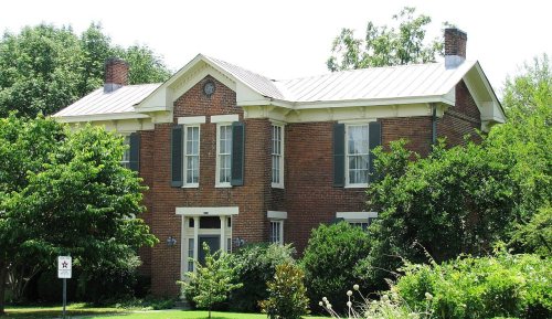
13 listings: 9 buildings, among them the Pickett Chapel Methodist Church (listed 1977, the first), 3 historic districts, the Lebanon Commercial Historic District, the Ida New and William Madison Turner Farm and the Castle Heights Academy Historic District, with 57 contributing buildings, and 1 site. 71 historic buildings in all.
How old are the homes in Lebanon?
3% of Lebanon’s homes were built before 1940 (Census estimate), against a typical 4.9% for a Tennessee town; the median home was built in 2004.
Founding dates: Wikidata, Wikipedia, the U.S. post office records of Blevins & Helbock (CC0) and the Census. Homes by year built: Census ACS 2020–24. National Register of Historic Places: National Park Service (list of May 22, 2026). Old photos, postcards and papers: Wikimedia Commons, the Library of Congress and other public archives, credited on each item’s page. Maps: U.S. Geological Survey historical topographic maps (via Esri) and Sanborn fire-insurance maps (Library of Congress). History text and census tables: Wikipedia (CC BY-SA 4.0). Places that used to be: USGS Geographic Names Information System (2021).
From Wikimedia Commons (2), the Library of Congress (4), Wikidata (6), the National Register of Historic Places (13), Wikipedia, Wikidata and Wikipedia for famous people, U.S. Geological Survey historical maps, U.S. Census counts (via Wikipedia), the US Post Offices dataset (Blevins & Helbock), the USGS Geographic Names Information System and Sanborn fire insurance maps (Library of Congress). Archive images are copied here with their credits and licenses, shown on each photo’s page. Refreshed monthly.




 1935
 1936
 1936


