More historic than 88% of U.S. towns · #5 of 177 in Tennessee. What drives it
Dated to 1786 (Wikidata), with 12% of its homes built before 1940 and 26 historic districts holding 2,722 contributing buildings. Below: 9 old photos and papers, maps from 1884 on, the census since 1800, and every listing on the Register.
Founding year: Wikidata. First post office: 1795.The full story ↓
History grade
What drives Knoxville’s History grade
On its age, its old homes and the National Register, Knoxville is more historic than 88% of U.S. towns, #5 of 177 in Tennessee. All 3 inputs are above most U.S. towns; its National Register listings ranks highest and its share of homes from before 1940 lowest.
A
HistoryA character grade: shown, never part of Knoxville’s overall grade.
Among the 400 U.S. cities of 100,000 or more, Knoxville ranks #80 on History.
Tennessee towns list more on the Register than most of the country (a typical Tennessee town has 6.1 per 10,000 residents, the U.S. 2.4), so Knoxville’s 139 sits above most of its state (92% of Tennessee towns have fewer) while its 2,722 historic buildings outnumber those of 100% of U.S. towns.
NoteThe founding year comes from Wikidata alone; no second source gives 1786.
How sure. Graded on any two of the three inputs instead, the letter would range from B+ to A+. The pre-1940 share (±0.8 points) is firm at this size.
Founding year: Wikidata (other dates in Quick answers). Homes: Census ACS 2020–24. National Register: National Park Service, May 2026 list; each listing counted once (boundary changes and added documentation belong to their listing), and a historic district counts its contributing buildings. How TownRatings grades history →
What stands out about Knoxville’s past
Read from the archive, the National Register and the record. The page puts what stands out first.
The country’s official list of buildings and places worth saving. One is a National Historic Landmark, the highest tier. Boundary changes and added documentation are counted with their listing.
The first people to form substantial settlements in what is now Knoxville were indigenous people who arrived during the Woodland period (c. 1000 B.C. to 1000 A.D.). One of the oldest artificial structures in Knoxville is a burial mound constructed during the early Mississippian culture period (c. 1000–1400 A.D.). The earthwork mound was preserved, but the University of Tennessee campus developed around it.
Passages that mention Knoxville, cut from the printed page as they were published.
Standard history of Knoxville, Tennessee, with full outline of the natural advantages, early settlement, territorial government, Indian troubles and general and particular history of the city down to the present time1900 · page 292Read the page →
Read the text
on August 25, 1890, a committee of the mayor and board of aldermen appointed for the purpose, reported that the road began at a point on the south side of the Tennessee river within one mile of the citv of Knoxville, that it was a standard gauge, steel railroad, that the southern terminus was at the state line between North Carolina and Tennessee and that the cars had run into the city of Atlanta from Knoxville and into the city of Knoxville from Atlanta. All the conditions having
Text read by machine from the scan; it may contain errors.
Standard history of Knoxville, Tennessee, with full outline of the natural advantages, early settlement, territorial government, Indian troubles and general and particular history of the city down to the present time1900 · page 126Read the page →
Read the text
The charter of the city of Knoxville, under which its government is now conducted, was enacted by the legislature of the state June 10, 1885. The first paragraph reads as follows: "The inhabitants of the city of Knoxville, Tennessee, within the present boundaries of said city, embracing nine wards as at present constituted, are hereby constituted a body politic and corporate, by the name and the style of the board of mayor and aldermen of the city of Knoxville."
Text read by machine from the scan; it may contain errors.
Scans and text from the Internet Archive. Books published in 1930 or earlier, which are in the public domain.
Timeline
Knoxville, 1786 to 1965
Woven from the archive, old maps, post office records, the National Register and the people born here.
Every edition of the U.S. Geological Survey’s map of Knoxville. Tap a year, or press play to watch the town change.
1936Knoxville sheet · 1:24,000
U.S. Geological Survey historical topographic maps (public domain), via Esri’s collection of the scans. The red ring marks the center of Knoxville.
Every building
Knoxville, building by building, 1884–1924
Fire insurance maps drew every building, what it was made of and what it was used for, so insurers could price the risk of fire. Pick a year, then a sheet.
In 1786, according to Wikidata. Knoxville’s post office opened in 1795, and the census of 1800 counted 387 people here.
How does Knoxville rank for history?
Knoxville is more historic than 88% of U.S. towns, #5 of 177 in Tennessee. The History grade combines the town’s founding era, the share of homes built before 1940 and its National Register listings. It’s a character grade, so it isn’t part of the overall grade. How it works.
What is on the National Register in Knoxville?
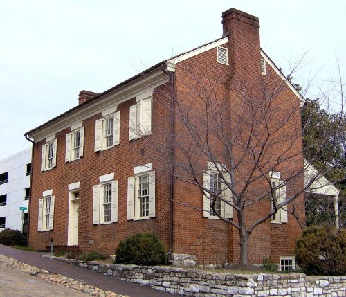
102 listings: 68 buildings, among them the William Blount Mansion (a National Historic Landmark since 1965), 26 historic districts with 2,630 contributing buildings, 7 sites, and 1 structure. 2,722 historic buildings in all.
How old are the homes in Knoxville?
12% of Knoxville’s homes were built before 1940 (Census estimate), against a typical 4.9% for a Tennessee town; the median home was built in 1974.
Founding dates: Wikidata, Wikipedia, the U.S. post office records of Blevins & Helbock (CC0) and the Census. Homes by year built: Census ACS 2020–24. National Register of Historic Places: National Park Service (list of May 22, 2026). Old photos, postcards and papers: Wikimedia Commons, the Library of Congress and other public archives, credited on each item’s page. Maps: U.S. Geological Survey historical topographic maps (via Esri) and Sanborn fire-insurance maps (Library of Congress). History text and census tables: Wikipedia (CC BY-SA 4.0). Places that used to be: USGS Geographic Names Information System (2021).
From Wikimedia Commons (8), the Library of Congress (1), Wikidata (3), the National Register of Historic Places (102), Wikipedia, Wikidata and Wikipedia for famous people, U.S. Geological Survey historical maps, U.S. Census counts (via Wikipedia), the US Post Offices dataset (Blevins & Helbock), the USGS Geographic Names Information System, Sanborn fire insurance maps (Library of Congress) and old county and town histories (Internet Archive). Archive images are copied here with their credits and licenses, shown on each photo’s page. Refreshed monthly.


 ★ Landmark








 1862
 1864
 1865
 1867
 1869


