Collierville dates to 1836, and 10 of its places are on the National Register
More historic than 61% of U.S. towns · #65 of 177 in Tennessee. What drives it
Most of Collierville was built recently: 0.8% of its homes predate 1940 and the median home dates from 1998. 10 places in town are on the National Register, among them two historic districts with 90 buildings between them. Below: maps from 1892 on and the census since 1850.
Founding year: Wikidata. First post office: 1837.The full story ↓
History grade
What drives Collierville’s History grade
On its age, its old homes and the National Register, Collierville is more historic than 61% of U.S. towns, #65 of 177 in Tennessee. Its National Register listings hold the grade up; its share of homes from before 1940 pulls it down.
B
HistoryA character grade: shown, never part of Collierville’s overall grade.
Tennessee towns list more on the Register than most of the country (a typical Tennessee town has 6.1 per 10,000 residents, the U.S. 2.4), so Collierville’s 19.8 sits above most of its state (73% of Tennessee towns have fewer) while its 102 historic buildings outnumber those of 90% of U.S. towns.
How sure. Graded on any two of the three inputs instead, the letter would range from C+ to A−. The pre-1940 share (±0.5 points) is firm at this size. Two sources give 1836.
Founding year: Wikidata (other dates in Quick answers). Homes: Census ACS 2020–24. National Register: National Park Service, May 2026 list; each listing counted once (boundary changes and added documentation belong to their listing), and a historic district counts its contributing buildings. How TownRatings grades history →
What stands out about Collierville’s past
Read from the archive, the National Register and the record. The page puts what stands out first.
The second oldest town in Shelby County, Collierville was laid out in 1836 and named after 19th century businessman Jesse R. Collier, who bought land and advertised it as "The Town of Collier". The original town was chartered in 1850 during the Richard Ramsey mayoral administration.
Two significant battles were fought at Collierville during the American Civil War. The first came on October 11, 1863, when Confederate Brigadier-General James Chalmers's division of 3,000 cavalrymen attacked the U.S. federal garrison protecting the Memphis and Charleston Railroad. The garrison, defended by U.S. Army Major-General William T. Sherman, successfully repulsed the Confederates.
Passages that mention Collierville, cut from the printed page as they were published.
History of the City of Memphis and Shelby County Tennessee1888Read the page →
Read the text
located in Memphis in 1843. The doctor practiced medicine in Houston, Tex., and was the assistant surgeon to the hospital at that place in 1838, before he had received the degree of M. D. He also practiced in Galveston, Tex., during the epidemic of yellow fever in 1839, and in Collierville, Tenn., in 1878, when that little city had some of the Memphis epidemic. In the fall of 1848 he was elected physician and surgeon to the Memphis Hospital, then a State institution, which position he held until he retired from the profession to engage in other business. Dr.
Text read by machine from the scan; it may contain errors.
Scans and text from the Internet Archive. Books published in 1930 or earlier, which are in the public domain.
Timeline
Collierville, 1836 to 1986
Woven from the archive, old maps, post office records, the National Register and the people born here.
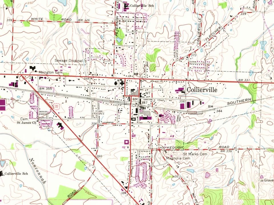
Every edition of the U.S. Geological Survey’s map of Collierville. Tap a year, or press play to watch the town change.
1943Collierville sheet · 1:62,500
U.S. Geological Survey historical topographic maps (public domain), via Esri’s collection of the scans. The red ring marks the center of Collierville.
Every building
Collierville, building by building, 1892–1913
Fire insurance maps drew every building, what it was made of and what it was used for, so insurers could price the risk of fire. Pick a year, then a sheet.
1892Sheet 1 of 1
Edition
Sheets
BrickWoodStone
Sanborn Map Company, via the Library of Congress. Editions published in 1930 or earlier, which are in the public domain.
People over time
Collierville, census by census
Grew from 236 people in 1850 to 51,324 in 2020, more than tenfold.
17 censuses, 1850–2020.
U.S. Census Bureau decennial counts, from the census table on Collierville’s Wikipedia page.
Famous people
6 famous people were born in Collierville
Writers, athletes, leaders and more, ranked by how widely they’re known.
In 1836, according to Wikidata. Collierville’s post office opened in 1837, and the census of 1850 counted 236 people here.
How does Collierville rank for history?
Collierville is more historic than 61% of U.S. towns, #65 of 177 in Tennessee. The History grade combines the town’s founding era, the share of homes built before 1940 and its National Register listings. It’s a character grade, so it isn’t part of the overall grade. How it works.
What is on the National Register in Collierville?
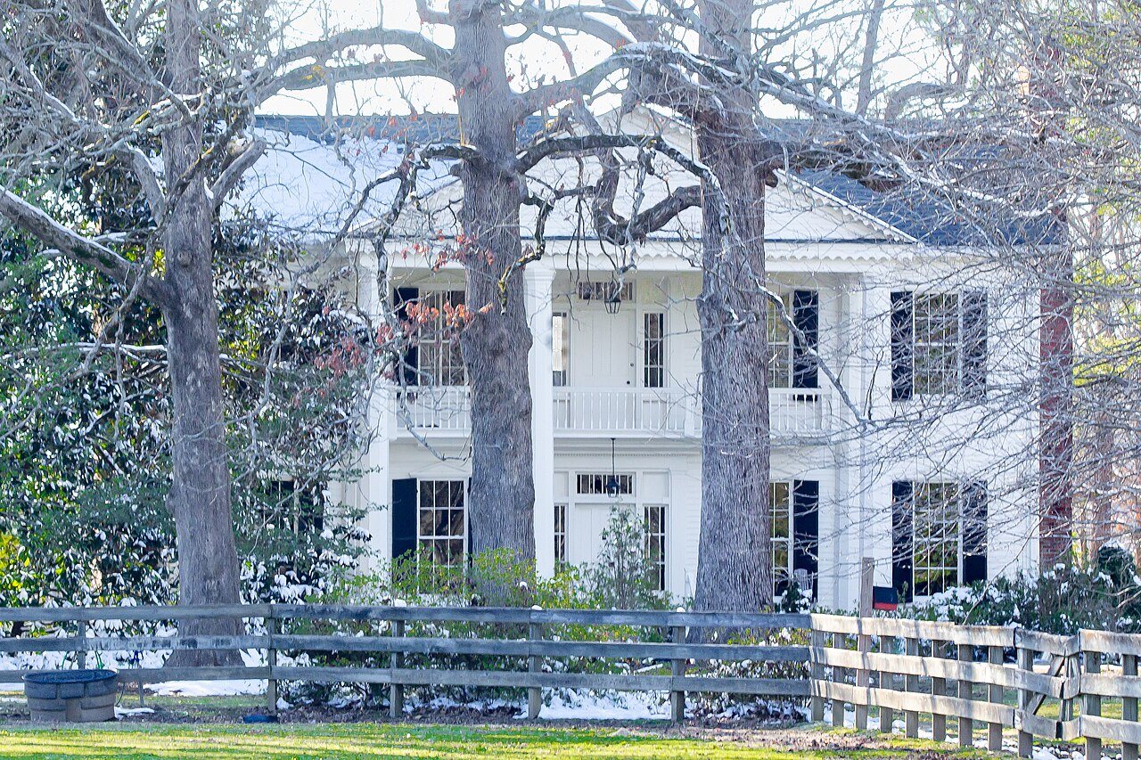
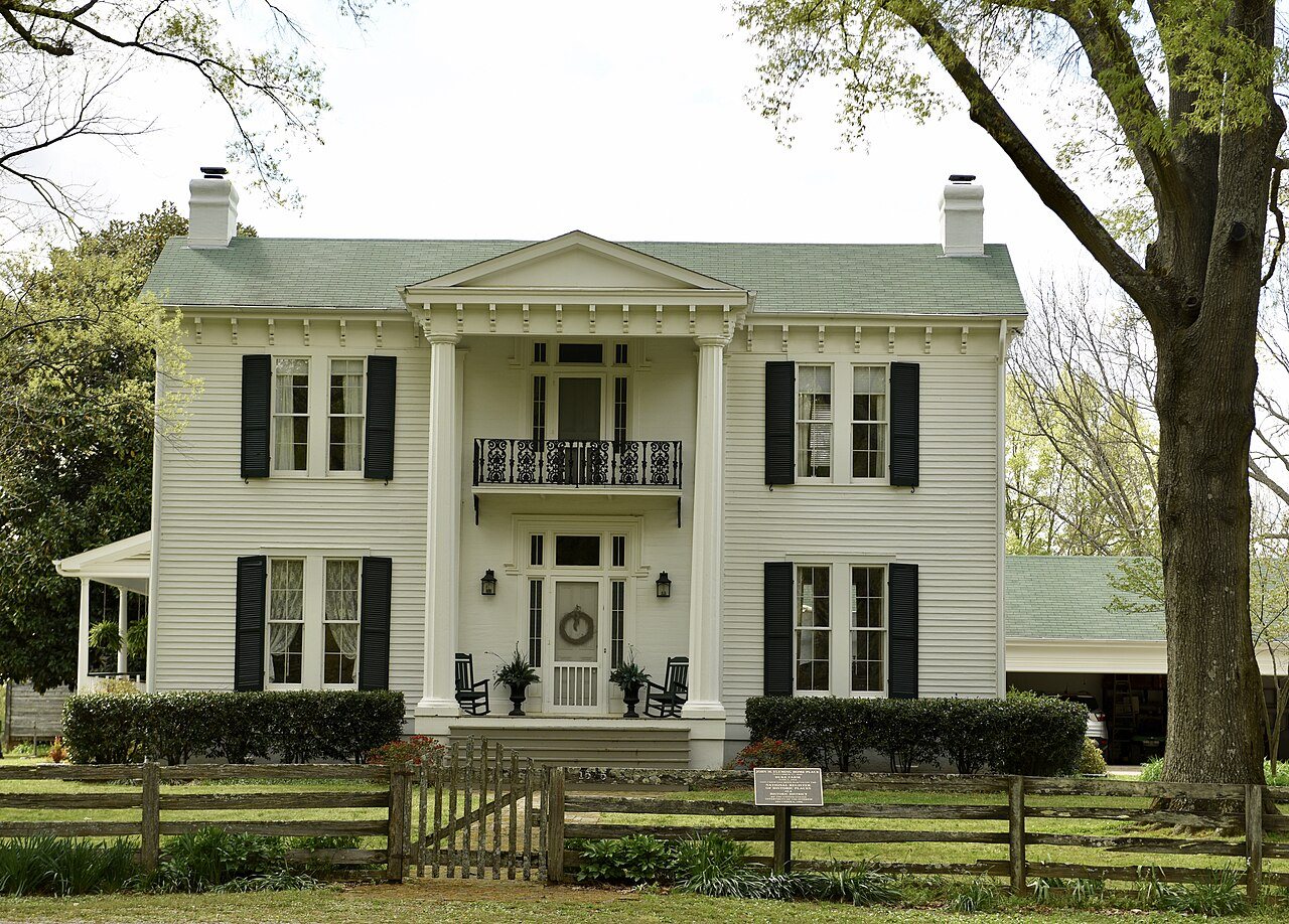
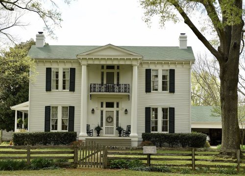
10 listings: 8 buildings, among them the Greenlevel (listed 1987, the first), and 2 historic districts, the John M. Fleming Home Place and the Collierville Historic District, with 90 contributing buildings. 102 historic buildings in all.
How old are the homes in Collierville?
0.8% of Collierville’s homes were built before 1940 (Census estimate), against a typical 4.9% for a Tennessee town; the median home was built in 1998.
Founding dates: Wikidata, Wikipedia, the U.S. post office records of Blevins & Helbock (CC0) and the Census. Homes by year built: Census ACS 2020–24. National Register of Historic Places: National Park Service (list of May 22, 2026). Old photos, postcards and papers: Wikimedia Commons, the Library of Congress and other public archives, credited on each item’s page. Maps: U.S. Geological Survey historical topographic maps (via Esri) and Sanborn fire-insurance maps (Library of Congress). History text and census tables: Wikipedia (CC BY-SA 4.0). Places that used to be: USGS Geographic Names Information System (2021).
From Wikimedia Commons (17), Wikidata (3), the National Register of Historic Places (10), Wikipedia, Wikidata and Wikipedia for famous people, U.S. Geological Survey historical maps, U.S. Census counts (via Wikipedia), the US Post Offices dataset (Blevins & Helbock), the USGS Geographic Names Information System, Sanborn fire insurance maps (Library of Congress) and old county and town histories (Internet Archive). Archive images are copied here with their credits and licenses, shown on each photo’s page. Refreshed monthly.




 2010
 2010
 2010
 2010
 2010
 2010
 2010
 2010
 2010
 2010
 2010
 2010
 2009
 2009
 2009
 2008
 2004