Alexandria dates to 1820, and 19% of its homes were built before 1940
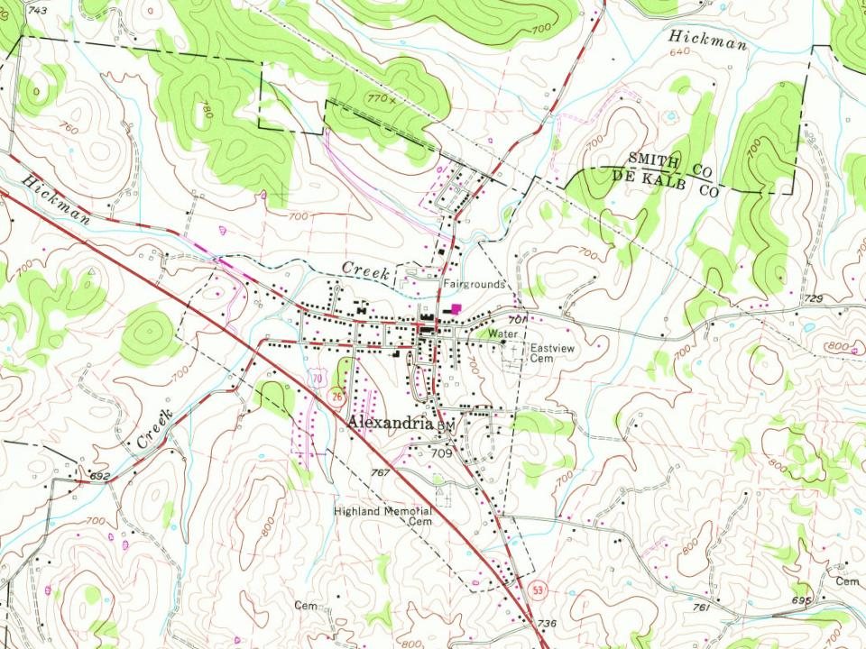
2 places in town are on the National Register, among them a historic district with 1 buildings. Below: 1 old photo or paper, maps from 1958 on, and the census since 1850.
Passages that mention Alexandria, cut from the printed page as they were published.
History of DeKalb county, Tennessee1915 · page 94Read the page →
Read the text
This tradition is told by the older people of Alexandria: Dr. Miers (or Mize) was of French extraction, locating in Alexandria long before the War between the States (about 1848 or 1849), and wooed and won a Miss Paty. He was impatient to build up a practice, and it was charged that, going to Woodbury one day and procuring smallpox virus, or "scabs," ho returned to his home with a sinister scheme. Inviting
Text read by machine from the scan; it may contain errors.
History of DeKalb county, Tennessee1915 · page 95Read the page →
Read the text
The writer has had access to an old ledger which belonged to Dr. John W. Overall, who resided in Alexandria. It covers a period from 1830 to October, 1834, and no doubt the names listed therein include a number of the pioneers of Alexandria as well as a 95
Text read by machine from the scan; it may contain errors.
Scans and text from the Internet Archive. Books published in 1930 or earlier, which are in the public domain.
By decade
Alexandria, decade by decade
One decade in the archive so far: the 1940s. Scroll each row; tap a photo for its story.
Nothing in the archives for these yearsWeddings on Main Street, storms, parades, school pictures, the old store. If it’s in your family album, it belongs here.
Founding dates: Wikidata, Wikipedia, the U.S. post office records of Blevins & Helbock (CC0) and the Census. Homes by year built: Census ACS 2020–24. National Register of Historic Places: National Park Service (list of May 22, 2026). Old photos, postcards and papers: Wikimedia Commons, the Library of Congress and other public archives, credited on each item’s page. Maps: U.S. Geological Survey historical topographic maps (via Esri) and Sanborn fire-insurance maps (Library of Congress). History text and census tables: Wikipedia (CC BY-SA 4.0). Places that used to be: USGS Geographic Names Information System (2021). How TownRatings grades history →
From Wikimedia Commons (7), the National Register of Historic Places (2), Wikipedia, U.S. Geological Survey historical maps, U.S. Census counts (via Wikipedia), the US Post Offices dataset (Blevins & Helbock), the USGS Geographic Names Information System and old county and town histories (Internet Archive). Archive images are copied here with their credits and licenses, shown on each photo’s page. Refreshed monthly.


 2013
 2011
 2010
 2009
 2009
 2009