21% of Canton Township’s homes were built before 1940
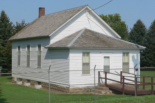
Its Register listings are the Grand Valley Schoolhouse, District No. 12, the Canton Asylum for American Indians Cemetery and the South Dakota Dept of Trans. Bridge No. 42-200-125. Its Register listings are the Grand Valley Schoolhouse, District No. 12, the Canton Asylum for American Indians Cemetery and the South Dakota Dept of Trans. Bridge No. 42-200-125. Below: 2 old photos and papers, maps from 1897 on, and the census since 1880.
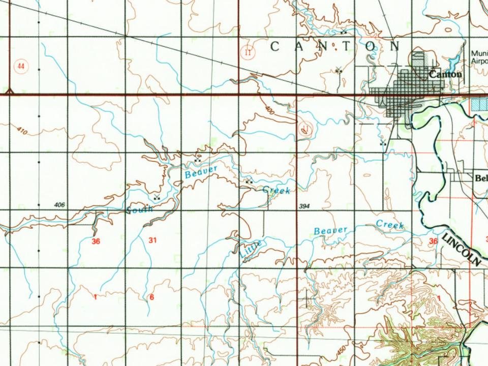
Every edition of the U.S. Geological Survey’s map of Canton Township. Tap a year, or press play to watch the town change.
1897Canton sheet · 1:125,000
U.S. Geological Survey historical topographic maps (public domain), via Esri’s collection of the scans. The red ring marks the center of Canton Township.
The earliest known visitor to the area was Lewis P. Hyde, who first came to the area in 1866. The first actual settler was August Linderman. By 1868, there were 35 people living in Lincoln County. The residents named the community Canton, believing the location to be the exact opposite of Canton, China. By the summer of that year, a caravan of 180 Norwegian settlers crossed the Big Sioux River to make their home in Canton. In 1880, the Chicago, Milwaukee, St. Paul and Pacific Railroad crossed the Big Sioux River to reach Canton. The city still has an active rail freight service. The city has many historical homes and buildings dating back to the late 1800s. Some notable sites include The Kennedy Mansion on Dakota Street, as well as the Historical Society House built in 1886. Lincoln County Courthouse was built in 1889, and Canton Lutheran Church was built in 1908.
Nothing in the archives for these yearsWeddings on Main Street, storms, parades, school pictures, the old store. If it’s in your family album, it belongs here.
What is on the National Register in Canton Township?
Three places: the Grand Valley Schoolhouse, District No. 12 (listed 1997), the Canton Asylum for American Indians Cemetery (1998) and the South Dakota Dept of Trans. Bridge No. 42-200-125 (2002).
Founding dates: Wikidata, Wikipedia, the U.S. post office records of Blevins & Helbock (CC0) and the Census. Homes by year built: Census ACS 2020–24. National Register of Historic Places: National Park Service (list of May 22, 2026). Old photos, postcards and papers: Wikimedia Commons, the Library of Congress and other public archives, credited on each item’s page. Maps: U.S. Geological Survey historical topographic maps (via Esri) and Sanborn fire-insurance maps (Library of Congress). History text and census tables: Wikipedia (CC BY-SA 4.0). Places that used to be: USGS Geographic Names Information System (2021). How TownRatings grades history →
From Wikimedia Commons (11), the Library of Congress (1), the National Register of Historic Places (3), Wikipedia, U.S. Geological Survey historical maps, U.S. Census counts (via Wikipedia) and the USGS Geographic Names Information System. Archive images are copied here with their credits and licenses, shown on each photo’s page. Refreshed monthly.




 1907
 2025
 2025
 2014
 2013
 2010
 2010
 2010
 2010
 2010
 2004