Peaked at 690 in 1930; 147 people lived here in 2020.
12 censuses, 1910–2020.
U.S. Census Bureau decennial counts, from the census table on Sellers’ Wikipedia page.
The story so far
Sellers, in brief
Wikipedia doesn’t have a history of Sellers yet. The photos, dates and memories neighbors add here are how it gets written.
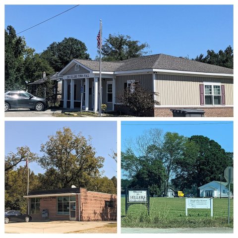
Sellers is a small town in Marion County, South Carolina, United States. As of the 2020 census, Sellers had a population of 147.
Its first post office opened in 1888. Between the 2010 and 2020 censuses its population fell from 219 to 147 (-33%).
Intro from Wikipedia. Population: U.S. Census Bureau.
From the old history books
What they wrote about Sellers in 1902
Passages that mention Sellers, cut from the printed page as they were published.
A history of Marion county, South Carolina, from its earliest times to the present, 19011902 · page 560Read the page →
Read the text
Sellers was named for John C. Sellers, who lives there, and operates the adjoining lands as a farm. It also is in the midst of a prosperous and progressive section of the county. There are three stores, operated by J. K. Page, J. D. Haselden and E.
Text read by machine from the scan; it may contain errors.
A history of Marion county, South Carolina, from its earliest times to the present, 19011902 · page 559Read the page →
Read the text
Hamer and Sellers. — Hamer and Sellers are stations on the Florence Railroad. The first was named for R. P. Hamer, Jr., who resides there and owns the adjacent lands. It is on the east side of Little Pee Dee, in.Carmichael Township, in the midst of a thriving section of the county, and large shipments of cotton and other farm products are sent from that point, and much guano is shipped to the station for the surrounding farm-
Text read by machine from the scan; it may contain errors.
Scans and text from the Internet Archive. Books published in 1930 or earlier, which are in the public domain.
Timeline
Sellers, 1867 to 1960
Woven from the archive, old maps, post office records, the National Register and the people born here.
Founding dates: Wikidata, Wikipedia, the U.S. post office records of Blevins & Helbock (CC0) and the Census. Homes by year built: Census ACS 2020–24. National Register of Historic Places: National Park Service (list of May 22, 2026). Old photos, postcards and papers: Wikimedia Commons, the Library of Congress and other public archives, credited on each item’s page. Maps: U.S. Geological Survey historical topographic maps (via Esri) and Sanborn fire-insurance maps (Library of Congress). History text and census tables: Wikipedia (CC BY-SA 4.0). Places that used to be: USGS Geographic Names Information System (2021). How TownRatings grades history →
From Wikimedia Commons (2), Wikidata and Wikipedia for famous people, U.S. Geological Survey historical maps, U.S. Census counts (via Wikipedia), the US Post Offices dataset (Blevins & Helbock), the USGS Geographic Names Information System and old county and town histories (Internet Archive). Archive images are copied here with their credits and licenses, shown on each photo’s page. Refreshed monthly.


 2022
 2004

