52 of Greenville’s places are on the National Register
More historic than 71% of U.S. towns · #39 of 169 in South Carolina. What drives it
Most of Greenville was built recently: 7% of its homes predate 1940 and the median home dates from 1987. Below: maps from 1884 on and the census since 1850.
On its age, its old homes and the National Register, Greenville is more historic than 71% of U.S. towns, #39 of 169 in South Carolina. Its National Register listings hold the grade up; its share of homes from before 1940 pulls it down.
B+
HistoryA character grade: shown, never part of Greenville’s overall grade.
South Carolina towns list more on the Register than most of the country (a typical South Carolina town has 3.2 per 10,000 residents, the U.S. 2.4), so Greenville’s 55.7 sits above most of its state (81% of South Carolina towns have fewer) while its 406 historic buildings outnumber those of 96% of U.S. towns.
How sure. Graded on two of the three inputs, so a change in either one moves the letter more than it would with three. The pre-1940 share (±0.7 points) is firm at this size.
Founding year: our sources. Homes: Census ACS 2020–24. National Register: National Park Service, May 2026 list; each listing counted once (boundary changes and added documentation belong to their listing), and a historic district counts its contributing buildings. How TownRatings grades history →
What stands out about Greenville’s past
Read from the archive, the National Register and the record. The page puts what stands out first.
The country’s official list of buildings and places worth saving. One is a National Historic Landmark, the highest tier. Boundary changes and added documentation are counted with their listing.
Chicora CollegeschoolDavid Street Baptist ChurchchurchDonaldson SchoolschoolFair Forest SchoolschoolFlat Rock ChurchchurchGreenville Female CollegeschoolHayne SchoolschoolJohn Street Primary School Number 1schoolJones StorelocaleMcBee MilllocaleOscar Street SchoolschoolSullivan Street Elementary Schoolschool
5cemeteries and burying grounds inside Greenville
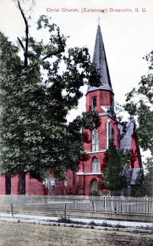
Christ ChurchRichlandSpringwoodWhite Oak Baptist ChurchWoodlawn Memorial Park
US Post Offices dataset (Blevins & Helbock, CC0). Places and cemeteries from the USGS Geographic Names Information System (2021).
The land of present-day Greenville was once the hunting ground of the Cherokee, which was forbidden to colonists. A wealthy settler from Virginia named Richard Pearis arrived in South Carolina around 1754 and established relations with the Cherokee. Pearis had a child with a Cherokee woman and received about 100,000 acres (40,000 ha) from the Cherokee around 1770. Pearis established a plantation on the Reedy River called the Great Plains in present-day Downtown Greenville. The American Revolution divided the South Carolina country between the Loyalists and Patriots. Pearis supported the Loyalists and together with their allies, the Cherokee, attacked the Patriots. The Patriots retaliated by burning down Pearis' plantation and jailing him in Charleston. Pearis never returned to his plantation but Paris Mountain is named after him. The Treaty of Dewitt's Corner in 1777 ceded almost all Ch…
Every edition of the U.S. Geological Survey’s map of Greenville. Tap a year, or press play to watch the town change.
1938Greenville sheet · 1:62,500
U.S. Geological Survey historical topographic maps (public domain), via Esri’s collection of the scans. The red ring marks the center of Greenville.
Every building
Greenville, building by building, 1884–1913
Fire insurance maps drew every building, what it was made of and what it was used for, so insurers could price the risk of fire. Pick a year, then a sheet.
Greenville is more historic than 71% of U.S. towns, #39 of 169 in South Carolina. The History grade combines the town’s founding era, the share of homes built before 1940 and its National Register listings. It’s a character grade, so it isn’t part of the overall grade. How it works.
What is on the National Register in Greenville?
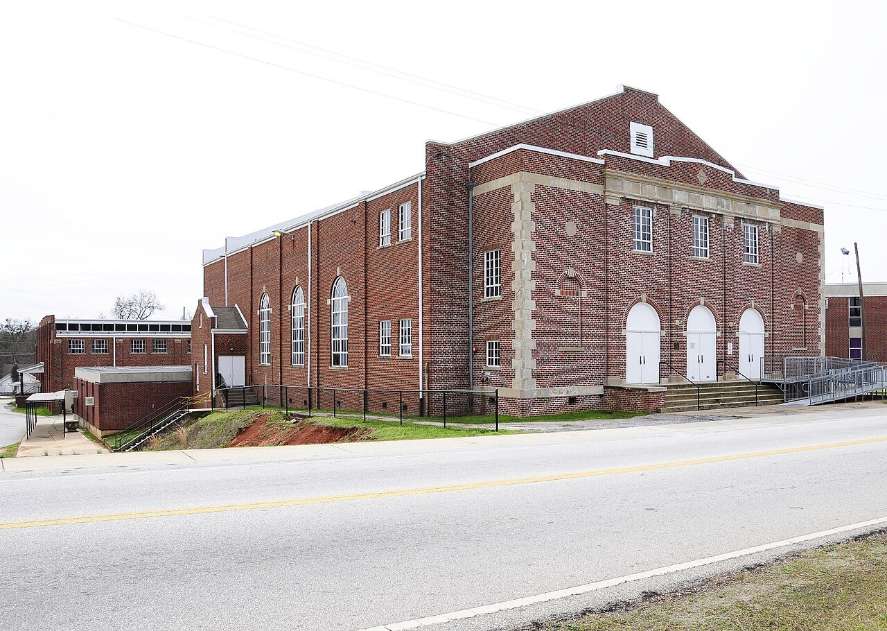
52 listings: 42 buildings, among them the Parker High School Auditorium (a National Historic Landmark since 1990) and the Earle Town House (listed 1969, the first), 7 historic districts with 351 contributing buildings, and 3 sites. 406 historic buildings in all.
How old are the homes in Greenville?
7% of Greenville’s homes were built before 1940 (Census estimate), against a typical 3.5% for a South Carolina town; the median home was built in 1987.
Founding dates: Wikidata, Wikipedia, the U.S. post office records of Blevins & Helbock (CC0) and the Census. Homes by year built: Census ACS 2020–24. National Register of Historic Places: National Park Service (list of May 22, 2026). Old photos, postcards and papers: Wikimedia Commons, the Library of Congress and other public archives, credited on each item’s page. Maps: U.S. Geological Survey historical topographic maps (via Esri) and Sanborn fire-insurance maps (Library of Congress). History text and census tables: Wikipedia (CC BY-SA 4.0). Places that used to be: USGS Geographic Names Information System (2021).
From Wikidata (24), the National Register of Historic Places (52), Wikipedia, Wikidata and Wikipedia for famous people, U.S. Geological Survey historical maps, U.S. Census counts (via Wikipedia), the US Post Offices dataset (Blevins & Helbock), the USGS Geographic Names Information System and Sanborn fire insurance maps (Library of Congress). Archive images are copied here with their credits and licenses, shown on each photo’s page. Refreshed monthly.


 ★ Landmark