159 years in pictures
The archive holds 12 old photos and papers going back to 1871 and 8 maps from 1889 on.
- 1867Narragansett Pier is settled
Each edition grades its towns against each other only.

8.2% of residents are under 18 in Narragansett Pier, against 18% in Rhode Island’s towns and 22% across U.S. towns. Among 39 Rhode Island towns, just 2 have a higher share of residents 65 or older than Narragansett Pier. We don’t grade Narragansett Pier yet; the figures below are still real.
Where Narragansett Pier beats most towns.
The archive holds 12 old photos and papers going back to 1871 and 8 maps from 1889 on.
Where Narragansett Pier’s working residents go each day. Line width shows the share.
Census LEHD 2023
Ordered by what stands out in Narragansett Pier.
14% of Narragansett Pier residents live below the poverty line. For most workers, Narragansett Pier is a place to come home to: only 10% work in town. The top destinations are South Kingstown (16%), Narragansett (14%) and Providence (12%). Since 2013, Narragansett Pier has lost 113 jobs, to 2,126 in 2023.
| Narragansett Pier | Rhode Island towns | U.S. towns | |
|---|---|---|---|
| Below the poverty line | 14% | 6.8% | 9.6% |
| Median household income | $82,000 | $104,000 | $80,000 |
| Average trip to work | 27 minutes | 26 minutes | 25 minutes |
| Working residents who work in town | 9.6% | 12% | 8% |
Census LEHD 2023 · ACS
FEMA puts 66% of Narragansett Pier’s expected hazard losses down to inland flooding, and 15% to hurricanes. Compared with 90% of U.S. communities, expected storm and flood damage in the town is lower. Paid flood insurance claims in the town since 1980: 58.
FEMA flood insurance claims · FEMA National Risk Index · OpenFEMA
Only 3 of the 39 Rhode Island towns we compare have a lower midsummer high than Narragansett Pier. July afternoons reach 81°, January nights drop to 24° and about 35 inches of snow falls in a winter.
NOAA U.S. Climate Normals, 1991–2020
3.4 miles of trail in 3 parks and preserves. Narragansett Pier’s concentration of trails comes in at 0.8 miles per square mile.
| Narragansett Pier | Rhode Island towns | U.S. towns | |
|---|---|---|---|
| Conserved land | 14% | 12% | 4.3% |
| Miles of trail per square mile | 0.8 miles per square mile | 0.8 | 0.4 |
| Biggest places to walk | Trails | Acres |
|---|---|---|
| 1. Sprague Park | — | 4 |
| 2. Veteran's Memorial Park | — | 2 |
| 3. Casino Park | — | 1 |
Trails & parks © OpenStreetMap contributors · Conserved land: USGS PAD-US
On the CDC’s 32 measures, Narragansett Pier is ahead of Rhode Island on 16 and behind on 7. 14% of adults report frequent mental distress in the town. Of the 39 Rhode Island towns we compare, none has a higher share of adults who have high blood pressure than Narragansett Pier.
| Narragansett Pier | Rhode Island towns | U.S. towns | |
|---|---|---|---|
| Feel lonely (CDC PLACES) | 27% | 34% | 33% |
| Yearly checkup (CDC PLACES) | 88% | 85% | 79% |
| Frequent mental distress (CDC PLACES) | 14% | 16% | 17% |
| Sleep under 7 hours (CDC PLACES) | 31% | 34% | 36% |
| What stands out | Narragansett Pier | RI |
|---|---|---|
| Fewer adults facing housing insecurity | 7.2% | 13.1% |
| Fewer uninsured adults | 4.8% | 8.2% |
| More adults who have had cancer | 12.3% | 8.4% |
CDC PLACES 2025 · modeled estimates for adults · CMS · HRSA
Narragansett Pier’s median rent is $1,649 a month. The share of households in Narragansett Pier who live in a home they own: 63%. Homes sold in Narragansett Pier spent a median 38 days on the market.
| Narragansett Pier | Rhode Island towns | U.S. towns | |
|---|---|---|---|
| Households that own their home | 63% | 76% | 73% |
| Median rent | $1,649 a month | $1,368 a month | $1,185 a month |
Census ACS, 2020–24 · Zillow Home Value Index · Redfin Data Center
Museums, parks, gardens and other places to visit around Narragansett Pier. Close and well known come first.
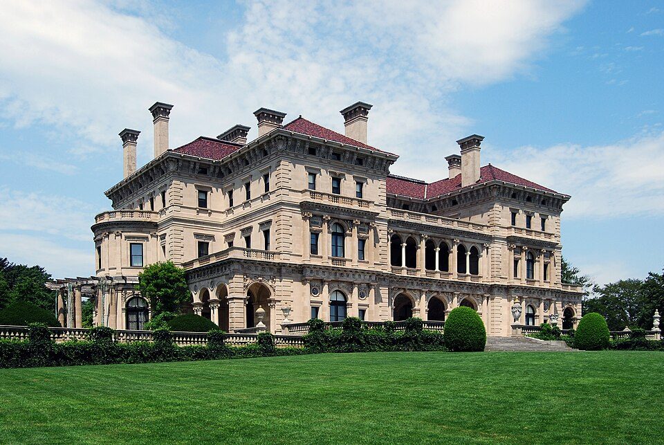
Big draw9 mi MuseumThe Breakers
13 mi Ancient siteHMS Endeavour
9 mi MuseumMarble House
9 mi MuseumThe Elms
25 mi MuseumUSS Massachusetts
9 mi MuseumRosecliffThe Breakers: UpstateNYer, CC BY-SA 3.0 · HMS Endeavour: Samuel Atkins (c.1760-1810), Public domain · Marble House: [email protected], Public domain · The Elms: The original uploader was Daderot at English Wikipedia., CC BY-SA 3.0 · USS Massachusetts: USN, Public domain · Rosecliff: n ole, CC BY 2.0
Narragansett Pier is unincorporated, so Washington County and regional agencies provide most services.
EPA SDWIS (Oct 9, 2026) · HIFLD + EIA-861 2025 · Census 2020 ZCTAs · NCES 2024–25 · registration: vote.gov, updated Sep 30, 2026.
2 within 15 miles of the center of Narragansett Pier
About 11 of every 100 Narragansett Pier residents are enrolled in college, against 8 across Rhode Island.
Census-designated place in Rhode Island, United States
Narragansett Pier is an unincorporated village and a census-designated place (CDP) in the town of Narragansett, Rhode Island, United States. As of the 2020 census, Narragansett Pier had a population of 3,308. It is named after the Narrangansett nation.
From Wikipedia, licensed CC BY-SA 4.0 · facts via Wikidata (CC0)
3 towns share a border with Narragansett Pier.
| Town | RI rank | Overall | Cost | Safety | Schools | Health |
|---|---|---|---|---|---|---|
| Narragansett Pier | — | — | — | — | — | — |
| Narragansett | #8 | A | D− | A | A | A |
| South Kingstown | #13 | A | D | A | B+ | A |
| Wakefield-Peace Dale | — | — | — | — | — | — |
Narragansett Pier and Wakefield-Peace Dale aren’t graded (fewer than 1,000 residents, or not enough data). Compare Narragansett Pier with a neighbor →
Short answers, built from the data on this page.
We don’t grade Narragansett Pier yet; the figures below are still real.
Ask a question, answer one, post a photo or an event. Free, and the parts only a neighbor would know are the parts worth reading.