Waynesboro dates to 1749, and 36% of its homes were built before 1940
Among the most historic 1% of U.S. towns · #27 of 1,035 in Pennsylvania. What drives it
5 places in town are on the National Register, among them a historic district with 504 buildings. Below: 11 old photos and papers, maps from 1886 on, and the census since 1840.
Founding year: Wikidata. First post office: 1807.The full story ↓
History grade
What drives Waynesboro’s History grade
On its age, its old homes and the National Register, Waynesboro is among the most historic 1% of U.S. towns, #27 of 1,035 in Pennsylvania. All 3 inputs put Waynesboro near the top nationally; its age ranks highest.
A+
HistoryA character grade: shown, never part of Waynesboro’s overall grade.
Pennsylvania towns list about as much on the Register as the country (a typical Pennsylvania town has 2.1 per 10,000 residents, the U.S. 2.4), so Waynesboro’s 463 sits above most of its state (94% of Pennsylvania towns have fewer) while its 511 historic buildings outnumber those of 97% of U.S. towns.
NoteThe founding year comes from Wikidata alone; no second source gives 1749.
How sure. Graded on any two of the three inputs instead, the letter would still be A+. The pre-1940 share is a Census survey estimate (±4.6 points).
Founding year: Wikidata (other dates in Quick answers). Homes: Census ACS 2020–24. National Register: National Park Service, May 2026 list; each listing counted once (boundary changes and added documentation belong to their listing), and a historic district counts its contributing buildings. How TownRatings grades history →
What stands out about Waynesboro’s past
Read from the archive, the National Register and the record. The page puts what stands out first.
National Park Service, National Register of Historic Places. Photos from Wikimedia Commons, credited on each place’s page.
Every building
Waynesboro, building by building, 1886–1916
Fire insurance maps drew every building, what it was made of and what it was used for, so insurers could price the risk of fire. Pick a year, then a sheet.
The region around Antietam Creek had been home to Native Americans, primarily Susquehannock and Lenape, for thousands of years prior to settlement by Anglo-Europeans in the mid-18th century. Beginning in 1749 and again in 1751, a certain John Wallace obtained several warrants for the land on which the center of the town now stands. In 1797, John Wallace, a son of the original Scottish settler, laid out the town of Waynesburg in Franklin County, Pennsylvania. The place originally incorporated as Waynesburg borough on December 21, 1818, however that charter was repealed March 30, 1825. When reincorporated on January 30, 1831, the borough was given the name "Waynesboro". It is one of several dozen towns, cities, and counties named after General Anthony Wayne, a hero of the American Revolution.
mi- A new era now dawned upon the Lutheran Church of Waynesboro. The Waynesboro church was detached from the Smithsburg charge; Jacobs Lutheran church was detached from the Greencastle charge, and a new charge formed, known as the Waynesboro charge, consisting of the Waynesboro, Jacobs and Quincy, and for a short time Funkstown churches.
Text read by machine from the scan; it may contain errors.
tion of State funds and its many curvings through mountain and glade to reach its destination, it became popularly known as the Thaddeus Stevens "Tape Worm Railroad. " By special act of Legislature, Waynesboro was made a *<* of As8embly' point on this railroad, the "Gettysburg Railroad," as its p h" p' 85°* incorporated name was. The Legislature of Pennsylvania, however, preferring the more feasible route and plan of the Cumberland Valley railroad, gave the finishing stroke
Text read by machine from the scan; it may contain errors.
Scans and text from the Internet Archive. Books published in 1930 or earlier, which are in the public domain.
By decade
Waynesboro, decade by decade
3 decades in the archive, from the 1930s to the 1980s. Scroll each row; tap a photo for its story.
Nothing in the archives for these yearsWeddings on Main Street, storms, parades, school pictures, the old store. If it’s in your family album, it belongs here.
Nothing in the archives for these yearsWeddings on Main Street, storms, parades, school pictures, the old store. If it’s in your family album, it belongs here.
In 1749, according to Wikidata. Waynesboro’s post office opened in 1807, and the census of 1840 counted 799 people here.
How does Waynesboro rank for history?
Waynesboro is among the most historic 1% of U.S. towns, #27 of 1,035 in Pennsylvania. The History grade combines the town’s founding era, the share of homes built before 1940 and its National Register listings. It’s a character grade, so it isn’t part of the overall grade. How it works.
What is on the National Register in Waynesboro?
5 listings: 4 buildings, among them the Alexander Hamilton House (listed 1980, the first), and 1 historic district, the Waynesboro Historic District, with 504 contributing buildings. 511 historic buildings in all.
How old are the homes in Waynesboro?
36% of Waynesboro’s homes were built before 1940 (Census estimate, ±4.6 points), against a typical 18% for a Pennsylvania town; the median home was built in 1956.
Founding dates: Wikidata, Wikipedia, the U.S. post office records of Blevins & Helbock (CC0) and the Census. Homes by year built: Census ACS 2020–24. National Register of Historic Places: National Park Service (list of May 22, 2026). Old photos, postcards and papers: Wikimedia Commons, the Library of Congress and other public archives, credited on each item’s page. Maps: U.S. Geological Survey historical topographic maps (via Esri) and Sanborn fire-insurance maps (Library of Congress). History text and census tables: Wikipedia (CC BY-SA 4.0). Places that used to be: USGS Geographic Names Information System (2021).
From Wikimedia Commons (26), the Library of Congress (3), Wikidata (1), the National Register of Historic Places (5), Wikipedia, Wikidata and Wikipedia for famous people, U.S. Geological Survey historical maps, U.S. Census counts (via Wikipedia), the US Post Offices dataset (Blevins & Helbock), the USGS Geographic Names Information System, Sanborn fire insurance maps (Library of Congress) and old county and town histories (Internet Archive). Archive images are copied here with their credits and licenses, shown on each photo’s page. Refreshed monthly.


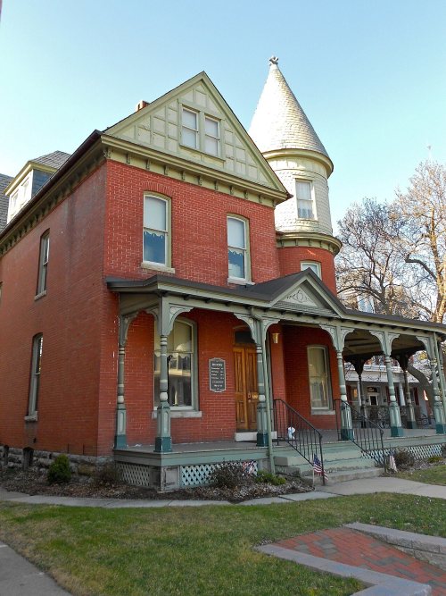


 c. 1930
 c. 1930
 c. 1930
 c. 1930
 c. 1930
 1940
 1980
 Date?
 2015
 2015
 2012
 2012
 2012
 2012
 2012
 2012
 2012
 2011
 2010
 2009
 2008
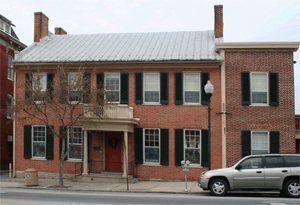 2006
 2004
 2004
 2004
 2004


