
Diamond Fire Co, Walnutport PA 01, 2015
Walnutport’s story
144 years in pictures
The archive holds 6 old photos and papers going back to 2015.
- 1882Walnutport is settled
Each edition grades its towns against each other only.

A town of 2,097, settled in 1882.
Walnutport’s best subject grades are an A− for the outdoors and a B+ for walkability. 16% of residents live below the poverty line in Walnutport, against 7.6% in Pennsylvania’s towns and 9.6% across U.S. towns. Walnutport has fewer than 2,500 residents, so it gets subject grades but no overall grade.
Where Walnutport beats most towns.
Where Walnutport’s working residents go each day. Line width shows the share.
Census LEHD 2023
Each subject compared with towns across the country (schools within Pennsylvania), ordered by how far Walnutport is from typical.
How TownRatings grades towns →
The archive holds 6 old photos and papers going back to 2015.
Museums, parks, gardens and other places to visit around Walnutport. Close and well known come first.
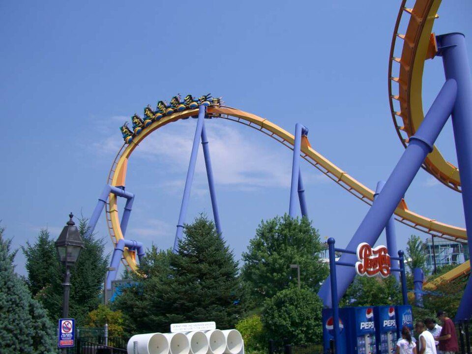 12 mi Theme parkDorney Park & Wildwater Kingdom
 12 mi Stadium & arenaPPL Center6 mi Ski areaBlue Mountain Resort44 runs · 1,077 ft vertical
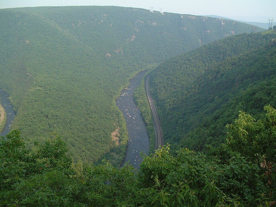 21 mi Park & preserveLehigh River
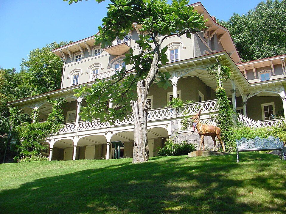 11 mi MuseumAsa Packer Mansion
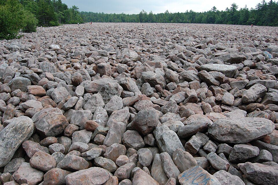 20 mi State parkHickory Run State Park
Dorney Park & Wildwater Kingdom: Coasterman1234 at en.wikipedia, CC BY-SA 3.0 · PPL Center: Hunter Kahn, CC BY-SA 3.0 · Lehigh River: The original uploader was Malepheasant at English Wikipedia., CC BY-SA 2.0 · Asa Packer Mansion: Chris18240 (talk), Public domain · Hickory Run State Park: Mtruch, CC BY-SA 3.0
Who provides power, water and the rest in Walnutport, and how to reach them.
EPA SDWIS (Oct 9, 2026) · HIFLD + EIA-861 2025 · Census 2020 ZCTAs · NCES 2024–25 · registration: vote.gov, updated Nov 18, 2024.
Ordered by what stands out in Walnutport.
Most working residents leave Walnutport for work: only 3% work in town. Jobs based in Walnutport grew to 604 in 2023, 84 more than in 2013. Walnutport’s average trip to work is 28 minutes, above both the Pennsylvania town median (26 minutes) and the median of U.S. towns (25 minutes).
| Walnutport | Pennsylvania towns | U.S. towns | |
|---|---|---|---|
| Average trip to work | 28 minutes | 26 minutes | 25 minutes |
| Working residents who work in town | 2.7% | 6.3% | 8% |
| Median household income | $76,000 | $81,000 | $80,000 |
Census LEHD 2023 · ACS
The typical Walnutport home is worth about $351,000, up 2.2% in a year, 22% above the Pennsylvania typical home. The median rent in Walnutport is $1,539 a month.
| Walnutport | Pennsylvania towns | U.S. towns | |
|---|---|---|---|
| Median rent | $1,539 a month | $1,115 a month | $1,185 a month |
| Households that own their home | 74% | 78% | 73% |
Census ACS, 2020–24 · Zillow Home Value Index · Redfin Data Center
Walnutport has chilly, snowy winters and warm summers, with plenty of rain. July afternoons reach 86°, January nights drop to 19° and about 33 inches of snow falls in a winter.
NOAA U.S. Climate Normals, 1991–2020
Walnutport beats the Pennsylvania average on 0 of 26 CDC measures and trails it on 5. 20% of adults binge drink in Walnutport.
| Walnutport | Pennsylvania towns | U.S. towns | |
|---|---|---|---|
| Binge drink (CDC PLACES) | 20% | 18% | 16% |
| Smoke cigarettes (CDC PLACES) | 19% | 17% | 14% |
| Frequent mental distress (CDC PLACES) | 18% | 16% | 17% |
| Frequent physical distress (CDC PLACES) | 15% | 14% | 14% |
| What stands out | Walnutport | PA |
|---|---|---|
| More uninsured adults | 7.8% | 5.8% |
| More adults with COPD | 9.2% | 7.7% |
| More smokers | 18.8% | 15.8% |
CDC PLACES 2025 · modeled estimates for adults · CMS · HRSA
Walnutport's reported crime rate is well below Pennsylvania's. Walnutport’s violent crime rate is 0 per 1,000 residents. Most reported incidents are property crimes, mainly thefts.
| Walnutport | Pennsylvania towns | U.S. towns | |
|---|---|---|---|
| Violent crimes per 1,000 (2025) | 0 per 1,000 residents | 0.7 | 1.6 |
| Property crimes per 1,000 (2025) | 4.7 per 1,000 residents | 5.7 | 9.9 |
FBI crime data, 2025 · crimes reported to police
Expected storm and flood damage is higher than in 57% of U.S. communities. One flood insurance claim has been paid in Walnutport since 1987.
FEMA flood insurance claims · FEMA National Risk Index · OpenFEMA
| Walnutport | Pennsylvania towns | U.S. towns | |
|---|---|---|---|
| Conserved land | 3.6% | 8.2% | 4.3% |
| Miles of trail per square mile | 0.5 miles per square mile | 0.4 | 0.4 |
| Biggest places to walk | Trails | Acres |
|---|---|---|
| 1. Walnutport Playground | 0.3 mi | 8 |
| 2. Earl F. Snyder Park | — | 7 |
| 3. Walnutport Canal Park | — | 6 |
Trails & parks © OpenStreetMap contributors · Conserved land: USGS PAD-US
4 within 15 miles of the center of Walnutport
About 3 of every 100 Walnutport residents are enrolled in college, against 6 across Pennsylvania.
Borough in Pennsylvania, US
Walnutport is a borough in Northampton County, Pennsylvania. It was first incorporated in 1909. The population of Walnutport was 1,918 at the 2022 census. Walnutport is located along the Lehigh River and is part of the Lehigh Valley metropolitan area, which had a population of 861,899 and was the 68th-most populous metropolitan area in the U.S. as of the 2020 census. The ZIP Code is 18088.
From Wikipedia, licensed CC BY-SA 4.0 · facts via Wikidata (CC0)
3 towns share a border with Walnutport.
| Town | PA rank | Overall | Cost | Safety | Schools | Health |
|---|---|---|---|---|---|---|
| Walnutport | — | — | C+ | — | C+ | C+ |
| Lehigh Township | #419 | B+ | C | A+ | B+ | B |
| Slatington | #752 | C+ | B− | A− | C+ | C− |
| Washington Township | #742 | B− | B− | — | C+ | B− |
Walnutport has fewer than 2,500 residents, so it gets subject grades but no overall grade. Walnutport and Washington Township report no FBI crime data of their own. Compare Walnutport with a neighbor →
Short answers, built from the data on this page.
That is 4.1 years of the area's median household income ($84,587 across the Allentown-Bethlehem-Easton, PA-NJ metro area). Cost of living, which also weighs rents, property taxes and how many households pay 30% or more of their income for housing, grades C+.
2 notable people were born here, including Meredith Marakovits and Ted Wieand.


