Tunkhannock Township’s strongest is safety: it reports less crime per resident than 89% of U.S. towns. Taken together, its subjects give Tunkhannock Township a B+ overall, better than nearly two thirds of U.S. towns. That places it 510th of 1032 in Pennsylvania. What counts against it is walkability. Most errands need a car: it is less walkable than 60% of U.S. towns. Homes run about $236K for a typical one, 3.6 times the Scranton metro’s $65K median household income. Hazard risk is weaker too: FEMA rates its natural-hazard risk higher than three fifths of U.S. communities, with inland flooding at the top. On civic life, just 74 of Pennsylvania’s 1,717 towns do better.
Figures: FBI crime data, 2025 · FEMA National Risk Index · home values, Zillow · incomes, Census ACS, 2020–24.
Ordered by what stands out in Tunkhannock Township.
Tunkhannock Township is safe by national standards but not by Pennsylvania’s; it also carries more natural-hazard risk than most of Pennsylvania (mostly inland flooding).
At 6 crimes per 1,000 residents a year, it reports less crime than 76% of Pennsylvania’s graded towns. Violent crime is rare: 1 reported in 2025, 0.1 per 1,000 residents.
In Tunkhannock Township, the violent offense rate is 0.1 per 1,000 residents, below both the Pennsylvania town median (0.7) and the median of U.S. towns (1.6). The town’s property crime rate is 5.6 per 1,000 residents.
The median commute is under 16 miles. Employers in Tunkhannock Township added 175 jobs between 2013 and 2023, to 2,118. Most working residents leave Tunkhannock Township for work: only 13% work in town. In Tunkhannock Township, the average trip to work is 27 minutes.
13%work in town
Tunkhannock Township
Pennsylvania towns
U.S. towns
Working residents who work in town
13%
6.3%
8%
Average trip to work
27 minutes
26 minutes
25 minutes
Below the poverty line
7.4%
7.6%
9.6%
Where working residents work
In Tunkhannock Township13%
Mehoopany Township7%
Tunkhannock7%
Scranton6%
Eaton Township4%
16 mi
median commute distance
2,118
jobs based in Tunkhannock Township
Balanced
jobs vs. working residents
C+
Walkability grade: more walkable than 40% of U.S. towns
FEMA rates its natural-hazard risk higher than 85% of Pennsylvania towns, with expected losses of about $437 per resident a year; that rating is what its C for hazard risk is built on.
Flood insurance has paid out on 87 claims in Tunkhannock Township since 1979.
The biggest park or preserve is Lazy Brook Park, at 38 acres. Tunkhannock Township’s trail network density comes in at 0.1 miles per square mile. 4.2 miles of trail in 3 parks and preserves.
17% of adults smoke cigarettes in Tunkhannock Township. In Tunkhannock Township, 18% of adults binge drink, and 24% have been diagnosed with depression.
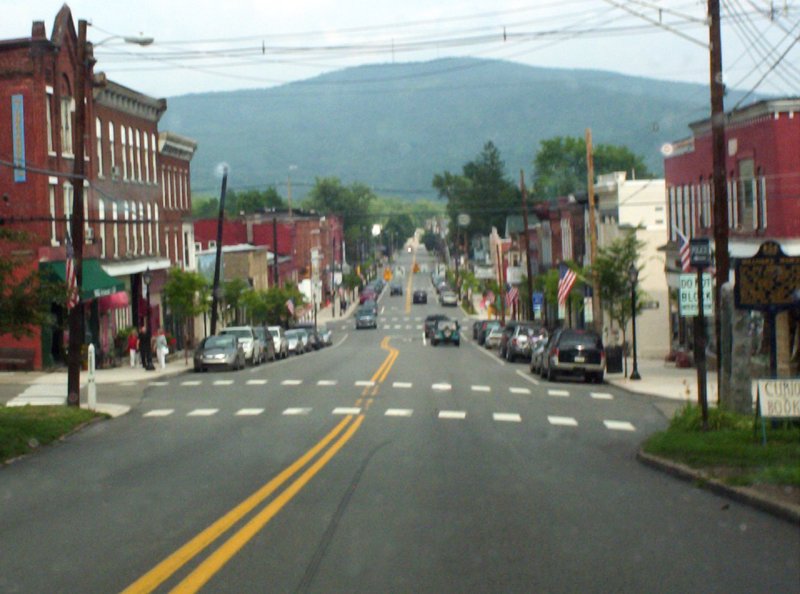
Tunkhannock ( tuhng-KA-nuhk) is a borough and county seat of Wyoming County, Pennsylvania, United States. Located 31 miles (50 km) northwest of Wilkes-Barre, Tunkhannock is in the Scranton–Wilkes-Barre–Hazleton, PA Metropolitan Statistical Area. In the past, lumbering was carried on extensively. Today, many residents are employed by the Procter & Gamble plant in nearby Washington Township. As of the 2020 census, the borough population was 1,766. The name Tunkhannock is derived from the Minsi-Len'api term Ptuk'hanna'unk, which means "Bend-in-river-place", especially to the town's west, upstream at the radical bend called "The Neck". Modern Tunkhannock, Wyoming County, The Tunkhannock Histori…
Eaton Township, Washington Township, Overfield Township, Tunkhannock, Lemon Township, Clinton Township and Falls Township have fewer than 2,500 residents, so they get subject grades but no overall grade. Eaton Township, Washington Township, Overfield Township, Lemon Township, Clinton Township and Falls Township report no FBI crime data of their own. Compare Tunkhannock Township with a neighbor →
Questions about Tunkhannock Township
Short answers, built from the data on this page.
Is Tunkhannock Township, PA a good place to live?
By most measures, yes. Tunkhannock Township grades B+ overall, better than 66% of U.S. towns and #510 of 1032 in Pennsylvania. It grades B for health, A for safety and B− for schools.
Is Tunkhannock Township, PA expensive?
Cost of living, which also weighs rents, property taxes and how many households pay 30% or more of their income for housing, grades B.

 15 mi
 36 mi
 24 mi
 38 mi
 19 mi


