
Lehigh Canal, Lock 20, 800 feet south of Aquashicola Creek
Towamensing Trails’s story
Towamensing Trails in pictures
The archive holds 2 old photos and papers.
Explore the history →Each edition grades its towns against each other only.
A town of 1,716.
Towamensing Trails’ average trip to work is 42 minutes, where Pennsylvania’s towns sit at 26 minutes and U.S. towns at 25 minutes. Of the 1,036 Pennsylvania towns we compare, none has a higher median age than Towamensing Trails. We don’t grade Towamensing Trails yet; the figures below are still real.
Where Towamensing Trails’s working residents go each day. Line width shows the share.
Census LEHD 2023
The archive holds 2 old photos and papers.
Explore the history →Towamensing Trails is unincorporated, so Carbon County and regional agencies provide most services.
EPA SDWIS (Oct 9, 2026) · HIFLD + EIA-861 2025 · Census 2020 ZCTAs · NCES 2024–25 · registration: vote.gov, updated Nov 18, 2024.
Ordered by what stands out in Towamensing Trails.
Expected storm and flood damage is lower than in 91% of U.S. communities.
FEMA National Risk Index · OpenFEMA
Most working residents leave Towamensing Trails for work: only 3% work in town. Since 2013, Towamensing Trails has lost 56 jobs, to 89 in 2023. The top destinations are Penn Forest Township (6%), Kidder Township (5%) and Allentown (4%).
| Towamensing Trails | Pennsylvania towns | U.S. towns | |
|---|---|---|---|
| Working residents who work in town | 2.7% | 6.3% | 8% |
| Below the poverty line | 6.8% | 7.6% | 9.6% |
Census LEHD 2023 · ACS
At 79°F, Towamensing Trails’ July high is below both the Pennsylvania town median (85°F) and the median of U.S. towns (85°F). Towamensing Trails has chilly winters and pleasant summers, with plenty of rain.
NOAA U.S. Climate Normals, 1991–2020
Towamensing Trails beats the Pennsylvania average on 3 of 26 CDC measures and trails it on 7. 14% of Towamensing Trails adults have diabetes.
| Towamensing Trails | Pennsylvania towns | U.S. towns | |
|---|---|---|---|
| Diabetes (CDC PLACES) | 14% | 11% | 12% |
| High blood pressure (CDC PLACES) | 39% | 34% | 35% |
| Smoke cigarettes (CDC PLACES) | 18% | 17% | 14% |
| Frequent physical distress (CDC PLACES) | 15% | 14% | 14% |
| What stands out | Towamensing Trails | PA |
|---|---|---|
| Fewer older adults who have lost all their teeth | 9.9% | 14.5% |
| More adults treating high blood pressure | 83.2% | 79.2% |
| More adults with COPD | 9.8% | 7.7% |
CDC PLACES 2025 · modeled estimates for adults · CMS · HRSA
0.5 miles of trail in 3 parks and preserves.
| Towamensing Trails | Pennsylvania towns | U.S. towns | |
|---|---|---|---|
| Miles of trail per square mile | 0.1 miles per square mile | 0.4 | 0.4 |
| Conserved land | 5.7% | 8.2% | 4.3% |
| Biggest places to walk | Trails | Acres |
|---|---|---|
| 1. Bethlehem Authority Wild Creek | — | 9 |
| 2. Horseshoes and Baseball fields | — | 9 |
| 3. Hickory Run State Park | — | 1 |
Trails & parks © OpenStreetMap contributors · Conserved land: USGS PAD-US
100% of households own their home in Towamensing Trails. The median sale price was $436,000 in May 2026.
Census ACS, 2020–24 · Zillow Home Value Index · Redfin Data Center
Museums, parks, gardens and other places to visit around Towamensing Trails. Close and well known come first.
 29 mi Theme parkDorney Park & Wildwater Kingdom
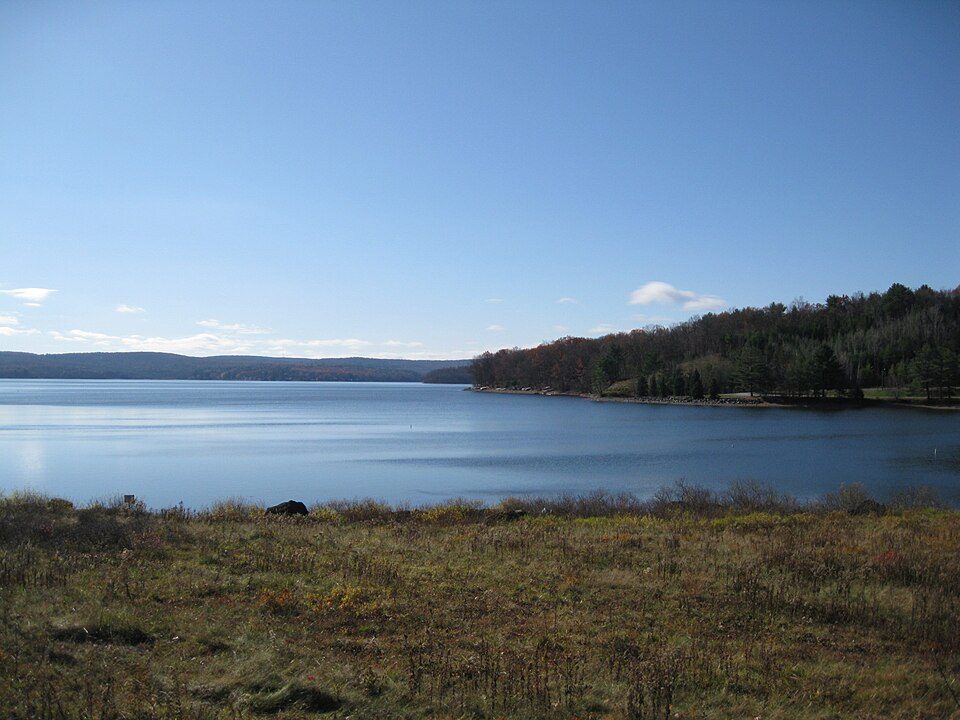 34 mi LakeLake Wallenpaupack
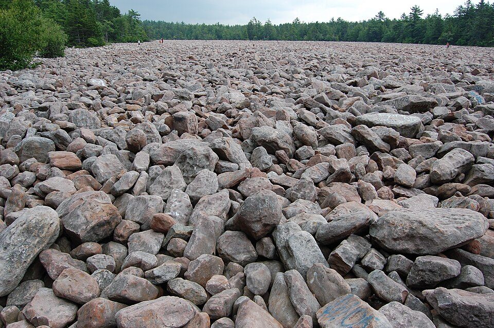 6 mi State parkHickory Run State Park
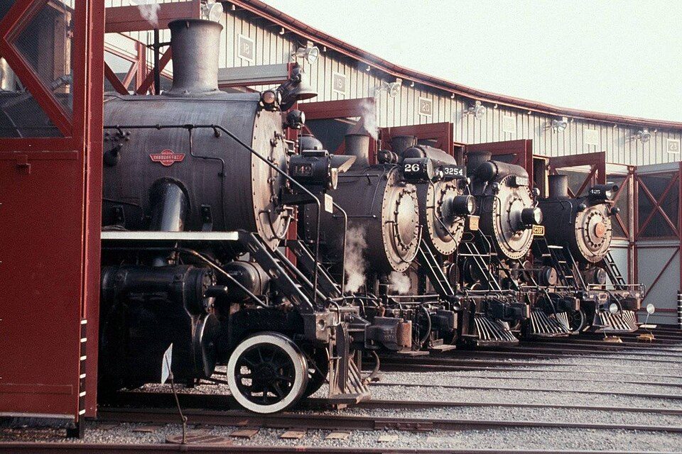 29 mi National Historic SiteSteamtown National Historic Site61K visitors a year
 12 mi Ski areaCamelback Mountain Resort37 runs · 804 ft vertical
 28 mi Stadium & arenaPPL Center
Dorney Park & Wildwater Kingdom: Coasterman1234 at en.wikipedia, CC BY-SA 3.0 · Lake Wallenpaupack: Doug Kerr from Albany, NY, United States, CC BY-SA 2.0 · Hickory Run State Park: Mtruch, CC BY-SA 3.0 · Steamtown National Historic Site: National Park Service, Public domain · Camelback Mountain Resort: Calzarette at en.wikipedia, Public domain · PPL Center: Hunter Kahn, CC BY-SA 3.0
None within 15 miles of Towamensing Trails; the nearest are
About 7 of every 100 Towamensing Trails residents are enrolled in college, about the same as Pennsylvania.
Unincorporated community in Pennsylvania, US
Towamensing Trails is a census-designated place (CDP) in Penn Forest Township, Pennsylvania, United States. It is part of Northeastern Pennsylvania. Towamensing was once home to the Lenni Lenapes (Delaware) Indians. The land became part of Pennsylvania as a result of the infamous "Walking Purchase". The community is located directly south of Albrightsville in the southern part of the Poconos, bordered by Pennsylvania Route 903 on the northwest, separating it from Albrightsville, and by Pennsylvania Route 534 on the northeast. PA 903 leads southwest 12 miles (19 km) to Jim Thorpe, the Carbon County seat, and north 7 miles (11 km) to Interstate 80 near Blakeslee, while PA 534 leads south 9 mi…
From Wikipedia, licensed CC BY-SA 4.0 · facts via Wikidata (CC0)
3 towns share a border with Towamensing Trails.
| Town | PA rank | Overall | Cost | Safety | Schools | Health |
|---|---|---|---|---|---|---|
| Towamensing Trails | — | — | — | — | — | — |
| Penn Forest Township | #969 | C− | C | — | C+ | B− |
| Kidder Township | — | — | B+ | — | C+ | B− |
| Albrightsville | — | — | — | — | — | — |
Kidder Township has fewer than 2,500 residents, so it gets subject grades but no overall grade. Penn Forest Township and Kidder Township report no FBI crime data of their own. Towamensing Trails and Albrightsville aren’t graded (fewer than 1,000 residents, or not enough data). Compare Towamensing Trails with a neighbor →
Short answers, built from the data on this page.
We don’t grade Towamensing Trails yet; the figures below are still real.


