Founding year: Wikidata. First post office: 1850.The full story ↓
History grade
What drives Susquehanna Depot’s History grade
On its age, its old homes and the National Register, Susquehanna Depot is more historic than 92% of U.S. towns. All 3 inputs are above most U.S. towns; its share of homes from before 1940 ranks highest and its National Register listings lowest.
A
HistoryA character grade: shown, never part of Susquehanna Depot’s overall grade.
Pennsylvania towns list about as much on the Register as the country (a typical Pennsylvania town has 2.1 per 10,000 residents, the U.S. 2.4), so Susquehanna Depot’s 7.7 sits above most of its state (73% of Pennsylvania towns have fewer) while its 1 listings outnumber those of 51% of U.S. towns.
NoteThe founding year comes from Wikidata alone; no second source gives 1794.
How sure. Graded on any two of the three inputs instead, the letter would range from A− to A+. The pre-1940 share is a Census survey estimate (±7.0 points).
Founding year: Wikidata (other dates in Quick answers). Homes: Census ACS 2020–24. National Register: National Park Service, May 2026 list; each listing counted once (boundary changes and added documentation belong to their listing), and a historic district counts its contributing buildings. How TownRatings grades history →
What stands out about Susquehanna Depot’s past
Read from the archive, the National Register and the record. The page puts what stands out first.
The New York and Erie Railroad (later reorganized as the Erie Railroad) built a rail line through the county in 1848, including the Starrucca Viaduct: a monumental stone structure spanning Starrucca Creek. Concurrently, the railroad established workshops in what would eventually be known as Susquehanna Depot. Initially, 350 workers were employed. The line opened for traffic in 1851.
Passages that mention Susquehanna Depot, cut from the printed page as they were published.
History of Susquehanna County, Pennsylvania. from a period preceding its settlement to recent times, including the annals and geography of each township... Also a sketch of woman's work in the county for the United States sanitary commission, and a list o1873 · page 101Read the page →
Read the text
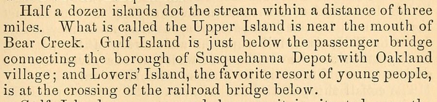
Half a dozen islands dot the stream within a distance of three miles. What is called the Upper Island is near the mouth of Bear Creek. Gulf Island is just below the passenger bridge connecting the borough of Susquehanna Depot with Oakland village; and Lovers’ Island, the favorite resort of young people, is at the crossing of the railroad bridge below.
Text read by machine from the scan; it may contain errors.
History of Susquehanna County, Pennsylvania1873 · page 101Read the page →
Read the text
Half a dozen islands clot the stream within a distance of three miles. What is called the Upper Island is near the mouth of Bear Creek. Gulf Island is just below the passenger bridge connecting the borough of Susquehanna Depot with Oakland village ; and Lovers' Island, the favorite resort of young people, is at the crossing of the railroad bridge below.
Text read by machine from the scan; it may contain errors.
History of Susquehanna County, Pennsylvania1873 · page 160Read the page →
Read the text
1870, our lumbermen shipped at this depot, 3,720,000 feet of lumber. 1 think that every foot of this lumber was taken from the forests of this township, and it is believed that more lumber has been shipped at Somersville and Susquehanna Depot than at New Milford. Our dairymen have also shipped at this depot, through our village merchants, 240,169 pounds of butter, from the 1st of June to the 1st of January."
Text read by machine from the scan; it may contain errors.
History of Susquehanna County, Pennsylvania. from a period preceding its settlement to recent times, including the annals and geography of each township... Also a sketch of woman's work in the county for the United States sanitary commission, and a list o1873 · page 581Read the page →
Read the text
Starting from Susquehanna Depot to reach this place, one crosses the bridge and turns to the left following the road nearest the river, which strikes the old river road atShutt’s house; then continuing on down until he crosses a creek and comes in sight of a school-house, with a grove beyond it, in front of which, on the opposite side of the road, is a graveyard. Just above the school-house he turns into a road on the right, and follows up “Flat Brook” to the farm now owned by J. I. Skinner. From his house a path leads about 120 yards southeast to the largest excavation, which was also the last one,
Text read by machine from the scan; it may contain errors.
Scans and text from the Internet Archive. Books published in 1930 or earlier, which are in the public domain.
By decade
Susquehanna Depot, decade by decade
4 decades in the archive, from the 1860s to the 1970s. Scroll each row; tap a photo for its story.
Nothing in the archives for these yearsWeddings on Main Street, storms, parades, school pictures, the old store. If it’s in your family album, it belongs here.
Nothing in the archives for these yearsWeddings on Main Street, storms, parades, school pictures, the old store. If it’s in your family album, it belongs here.
Nothing in the archives for these yearsWeddings on Main Street, storms, parades, school pictures, the old store. If it’s in your family album, it belongs here.
Every edition of the U.S. Geological Survey’s map of Susquehanna Depot. Tap a year, or press play to watch the town change.
1932Susquehanna sheet · 1:62,500
U.S. Geological Survey historical topographic maps (public domain), via Esri’s collection of the scans. The red ring marks the center of Susquehanna Depot.
Then & now
Stand where they stood
No then-and-now pairs yet. Take a photo from the same spot as an old one and they appear here side by side.
Retake this viewDining Hall, Starrucca House. Susquehanna Depot, Pa. On the line of the Erie Railway.Alternate Title: 2, c. 1860
Find the spot, match the angle, and add your photo. It becomes the first then-and-now pair on Susquehanna Depot’s page.
In 1794, according to Wikidata. Susquehanna Depot’s post office opened in 1850, and the census of 1860 counted 2,080 people here.
How does Susquehanna Depot rank for history?
Susquehanna Depot is more historic than 92% of U.S. towns. The History grade combines the town’s founding era, the share of homes built before 1940 and its National Register listings. It’s a character grade, so it isn’t part of the overall grade. How it works.
What is on the National Register in Susquehanna Depot?
One place: the Erie Railroad Station (listed 1972).
How old are the homes in Susquehanna Depot?
68% of Susquehanna Depot’s homes were built before 1940 (Census estimate, ±7.0 points), against a typical 18% for a Pennsylvania town; the median home was built in 1938.
Founding dates: Wikidata, Wikipedia, the U.S. post office records of Blevins & Helbock (CC0) and the Census. Homes by year built: Census ACS 2020–24. National Register of Historic Places: National Park Service (list of May 22, 2026). Old photos, postcards and papers: Wikimedia Commons, the Library of Congress and other public archives, credited on each item’s page. Maps: U.S. Geological Survey historical topographic maps (via Esri) and Sanborn fire-insurance maps (Library of Congress). History text and census tables: Wikipedia (CC BY-SA 4.0). Places that used to be: USGS Geographic Names Information System (2021).
From Wikimedia Commons (6), the National Register of Historic Places (1), Wikipedia, Wikidata and Wikipedia for famous people, U.S. Geological Survey historical maps, U.S. Census counts (via Wikipedia), the US Post Offices dataset (Blevins & Helbock), the USGS Geographic Names Information System and old county and town histories (Internet Archive). Archive images are copied here with their credits and licenses, shown on each photo’s page. Refreshed monthly.








 1923
 2008


