Sunbury dates to 1772, and 51% of its homes were built before 1940
Among the most historic 1% of U.S. towns · #17 of 1,035 in Pennsylvania. What drives it
4 places in town are on the National Register, among them a historic district with 238 buildings. Below: 18 old photos and papers, maps from 1887 on, and the census since 1800.
Founding year: Wikidata; Wikipedia’s history section gives the same year. First post office: 1795.The full story ↓
History grade
What drives Sunbury’s History grade
On its age, its old homes and the National Register, Sunbury is among the most historic 1% of U.S. towns, #17 of 1,035 in Pennsylvania. All 3 inputs put Sunbury near the top nationally; its share of homes from before 1940 ranks highest.
A+
HistoryA character grade: shown, never part of Sunbury’s overall grade.
Pennsylvania towns list about as much on the Register as the country (a typical Pennsylvania town has 2.1 per 10,000 residents, the U.S. 2.4), so Sunbury’s 251 sits above most of its state (92% of Pennsylvania towns have fewer) while its 241 historic buildings outnumber those of 94% of U.S. towns.
How sure. Graded on any two of the three inputs instead, the letter would still be A+. The pre-1940 share is a Census survey estimate (±4.8 points). Two sources give 1772.
Founding year: Wikidata (other dates in Quick answers). Homes: Census ACS 2020–24. National Register: National Park Service, May 2026 list; each listing counted once (boundary changes and added documentation belong to their listing), and a historic district counts its contributing buildings. How TownRatings grades history →
What stands out about Sunbury’s past
Read from the archive, the National Register and the record. The page puts what stands out first.
National Park Service, National Register of Historic Places. Photos from Wikimedia Commons, credited on each place’s page.
On the map
Sunbury on the map, 1893 to 1999
Every edition of the U.S. Geological Survey’s map of Sunbury. Tap a year, or press play to watch the town change.
1893Sunbury sheet · 1:62,500
U.S. Geological Survey historical topographic maps (public domain), via Esri’s collection of the scans. The red ring marks the center of Sunbury.
Every building
Sunbury, building by building, 1887–1918
Fire insurance maps drew every building, what it was made of and what it was used for, so insurers could price the risk of fire. Pick a year, then a sheet.
The first known settlers at the site of Sunbury were likely Shawnee migrants. A large population of Delaware Indians was also forcibly resettled there in the early 18th century after they lost rights to their land in the Walking Purchase. Canassatego of the Six Nations, enforcing the Walking Purchase on behalf of George Thomas, Deputy Governor of Pennsylvania, ordered the Delaware Indians to relocate to two places on the Susquehanna River, one of which was present-day Sunbury.
Passages that mention Sunbury, cut from the printed page as they were published.
History of Northumberland County, Pennsylvania1891 · page 301Read the page →
Read the text
"a number of people" were "daily making improvements and fencing in the level lands." They therefore prayed the court to have a road laid out "from William Winter's land the most convenient way to Geiger's mill and from thence to the town of Sunbury." Aaron Wilkerson, Eobert Fitzrandolph, William Baker, Thomas Eunyon, Valentine Geiger, and Anthony Hinkle were appointed as viewers; at May sessions they reported having laid out a road "beginning at a white-oak marked N. B. on William Winter's land," thence by Geiger's mill to Simbim-. which was ordered to be opened the
Text read by machine from the scan; it may contain errors.
History of Northumberland County, Pennsylvania1891 · page 320Read the page →
Read the text
The Sunbury, Hazelton and Wilkesbarre Railroad extends from Sunbury to Tomhicken, Pennsylvania, a distance of forty-three and forty-four hiuidredths miles. The company was originally chartered as the Wilkesbarre and Pittston, April 15, 1859, for the construction of a railroad along the Susquehanna river from Pittston to Danville or Sunbury. April 10, 1867, the name was changed to the Danville, Hazelton and Wilkesbarre Kailroad Company. The survey of the route was begun by F. C. Arms on the 22d of April, 1867. On the 10th of October following the contract for its construc-
Text read by machine from the scan; it may contain errors.
Locust Gap, Northumberland County, Pennsylvania1929Read the page →
Read the text
1832—The first industry in the town, a saw-mill, was erected by Samuel, William and Joseph Casper, of Sunbury, on Big Shamokin Creek, about three hundred yards north of the present ‘Locust Gap Junction station on the Pennsylvania Railroad.
Text read by machine from the scan; it may contain errors.
Scans and text from the Internet Archive. Books published in 1930 or earlier, which are in the public domain.
Timeline
Sunbury, 1772 to 1920
Woven from the archive, old maps, post office records, the National Register and the people born here.
Nothing in the archives for these yearsWeddings on Main Street, storms, parades, school pictures, the old store. If it’s in your family album, it belongs here.
In 1772, according to Wikidata and Wikipedia’s history of the town. Sunbury’s post office opened in 1795, and the census of 1800 counted 613 people here.
How does Sunbury rank for history?
Sunbury is among the most historic 1% of U.S. towns, #17 of 1,035 in Pennsylvania. The History grade combines the town’s founding era, the share of homes built before 1940 and its National Register listings. It’s a character grade, so it isn’t part of the overall grade. How it works.
What is on the National Register in Sunbury?
4 listings: 3 buildings, among them the Northumberland County Courthouse (listed 1974, the first), and 1 historic district, the Sunbury Historic District, with 238 contributing buildings. 241 historic buildings in all.
How old are the homes in Sunbury?
51% of Sunbury’s homes were built before 1940 (Census estimate, ±4.8 points), against a typical 18% for a Pennsylvania town; the median home was built in 1938.
Founding dates: Wikidata, Wikipedia, the U.S. post office records of Blevins & Helbock (CC0) and the Census. Homes by year built: Census ACS 2020–24. National Register of Historic Places: National Park Service (list of May 22, 2026). Old photos, postcards and papers: Wikimedia Commons, the Library of Congress and other public archives, credited on each item’s page. Maps: U.S. Geological Survey historical topographic maps (via Esri) and Sanborn fire-insurance maps (Library of Congress). History text and census tables: Wikipedia (CC BY-SA 4.0). Places that used to be: USGS Geographic Names Information System (2021).
From Wikimedia Commons (7), the Library of Congress (11), the National Register of Historic Places (4), Wikipedia, Wikidata and Wikipedia for famous people, U.S. Geological Survey historical maps, U.S. Census counts (via Wikipedia), the US Post Offices dataset (Blevins & Helbock), the USGS Geographic Names Information System, Sanborn fire insurance maps (Library of Congress) and old county and town histories (Internet Archive). Archive images are copied here with their credits and licenses, shown on each photo’s page. Refreshed monthly.
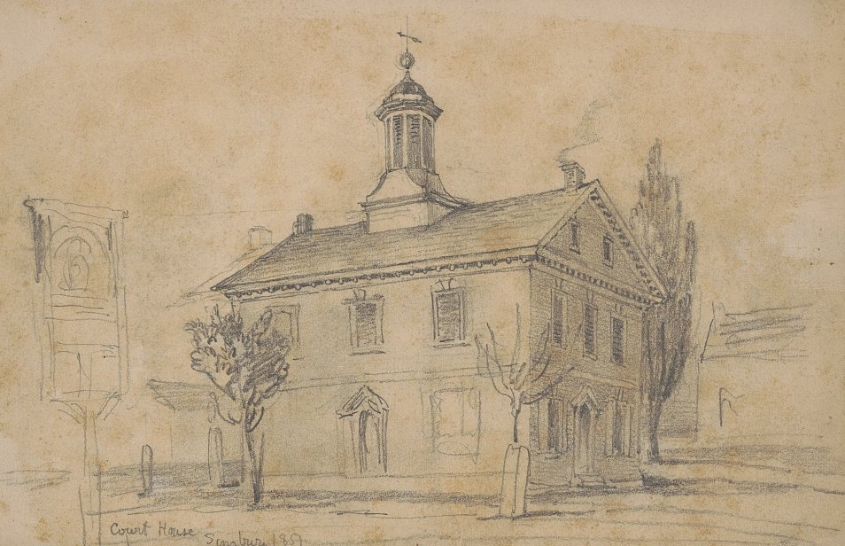


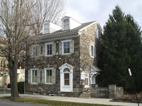




 1851
 1851
 1851
 1904
 1905
 1905
 1905
 1905
 1905
 1905
 1909
 1917
 1917

