Saltsburg’s post office opened in 1828, and 43% of its homes were built before 1940
1 place in town is on the National Register, among them a historic district with 118 buildings. Below: 6 old photos and papers, maps from 1886 on, and the census since 1840.
On June 20, 1769, William Gray conducted the first survey in the Saltsburg area. Early settlers of the wooded region were mainly Scots-Irish immigrants who migrated west between 1768 and 1795. The settlers did not settle the area near the Kiskiminetas River until 1795 because of "the frequent attacks of the savages".
The name 'Saltsburg' was adopted because of the salt grain that flourished in the area. Around the years 1795–1798, a Mrs. Deemer was the first settler to prove salt was present in the Conemaugh River, about one mile above Saltsburg's present site, in the town now known as Moween. Deemer produced a sample of salt by evaporating the water from the river.
into building lots and sold, this being what is now Perrysville. In 1846 he became interested in salt works on the Kiskiminetas river, near Saltsburg, and for a time was engaged in making salt, and at the same time conducted a steam gristmill located on the Kiskiminetas.
Text read by machine from the scan; it may contain errors.
He began his education in the neighborhood, at common school, later attending the academies at Eldersridge and Saltsburg, and the State normal school at Indiana. For two years he taught school in Conemaugh township, and then for a year was engaged in carrying the mail over the rural free delivery route No. 2, out of Saltsburg. He has since
Text read by machine from the scan; it may contain errors.
Scans and text from the Internet Archive. Books published in 1930 or earlier, which are in the public domain.
Timeline
Saltsburg, 1828 to 1950
Woven from the archive, old maps, post office records, the National Register and the people born here.
Nothing in the archives for these yearsWeddings on Main Street, storms, parades, school pictures, the old store. If it’s in your family album, it belongs here.
Fire insurance maps drew every building, what it was made of and what it was used for, so insurers could price the risk of fire. Pick a year, then a sheet.
1886Sheet 1 of 1
Edition
Sheets
BrickWoodStone
Sanborn Map Company, via the Library of Congress. Editions published in 1930 or earlier, which are in the public domain.
Then & now
Stand where they stood
No then-and-now pairs yet. Take a photo from the same spot as an old one and they appear here side by side.
Retake this viewSaltsburg, 1875
Find the spot, match the angle, and add your photo. It becomes the first then-and-now pair on Saltsburg’s page.
Founding dates: Wikidata, Wikipedia, the U.S. post office records of Blevins & Helbock (CC0) and the Census. Homes by year built: Census ACS 2020–24. National Register of Historic Places: National Park Service (list of May 22, 2026). Old photos, postcards and papers: Wikimedia Commons, the Library of Congress and other public archives, credited on each item’s page. Maps: U.S. Geological Survey historical topographic maps (via Esri) and Sanborn fire-insurance maps (Library of Congress). History text and census tables: Wikipedia (CC BY-SA 4.0). Places that used to be: USGS Geographic Names Information System (2021). How TownRatings grades history →
From Wikimedia Commons (5), the Library of Congress (1), the National Register of Historic Places (1), Wikipedia, Wikidata and Wikipedia for famous people, U.S. Geological Survey historical maps, U.S. Census counts (via Wikipedia), the US Post Offices dataset (Blevins & Helbock), the USGS Geographic Names Information System, Sanborn fire insurance maps (Library of Congress) and old county and town histories (Internet Archive). Archive images are copied here with their credits and licenses, shown on each photo’s page. Refreshed monthly.


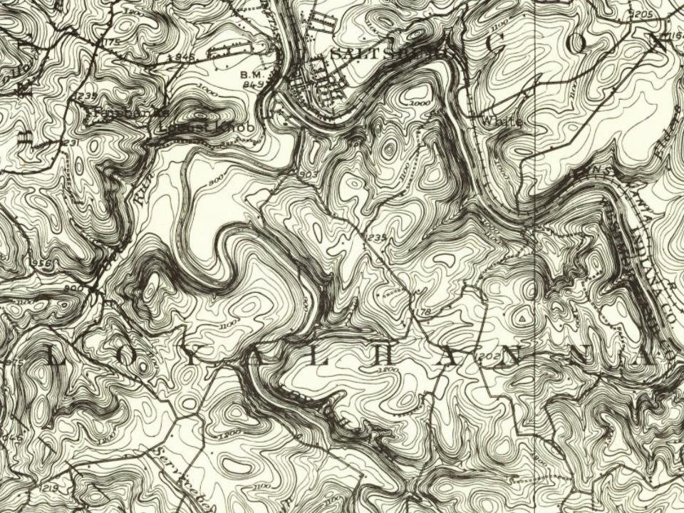




 1908
 1933
 1933
