Guest, Sign inJoin

Post to Portland

We’ll email a one-tap link to publish your post. No password, and nothing is public until you click it.
Already a member? Sign in
–Not graded
History · Portland

Portland dates to 1845, and 55% of its homes were built before 1940

Its Register listing is the County Bridge No. 36. Below: 2 old photos and papers, maps from 1891 on, and the census since 1880.

1845founded
1on the National Register
55%homes built before 1940
2old photos & papers
From Portland’s archive · credits on each photo
Quick answers

How Portland began

When was Portland founded?

1845

Portland dates its founding to 1845 (Wikidata). The census first counted it in 1880.

First census: 608 in 18802020 census: 494181 years
Founding year: Wikidata. First post office: 1813.The full story ↓

What stands out about Portland’s past

Read from the archive, the National Register and the record. The page puts what stands out first.

★ What stands out · Help out

Start Portland’s collection

The first neighbors to add old photos shape how Portland’s history is told.

Decades since 1900 with photos
00s10s20s30s40s50s60s70s80s90s
2 of 10 decades. The empty ones are waiting for someone’s album.
On the map

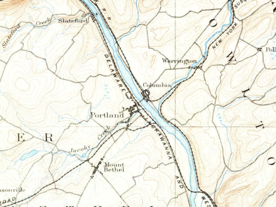
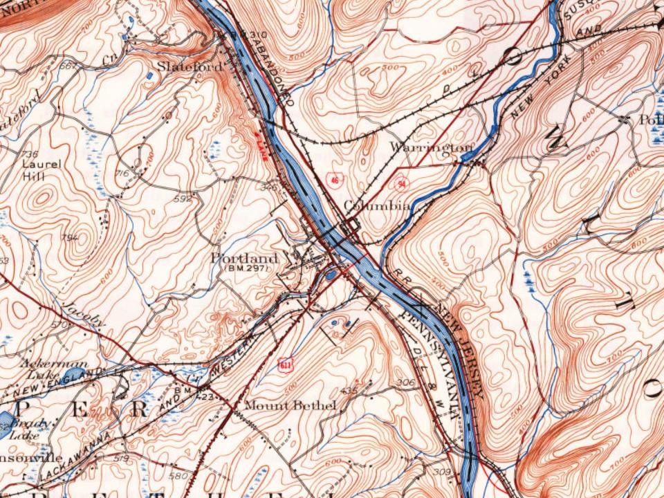
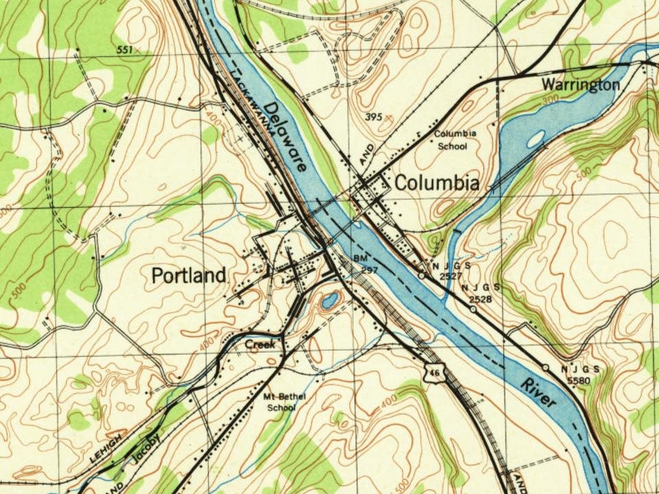
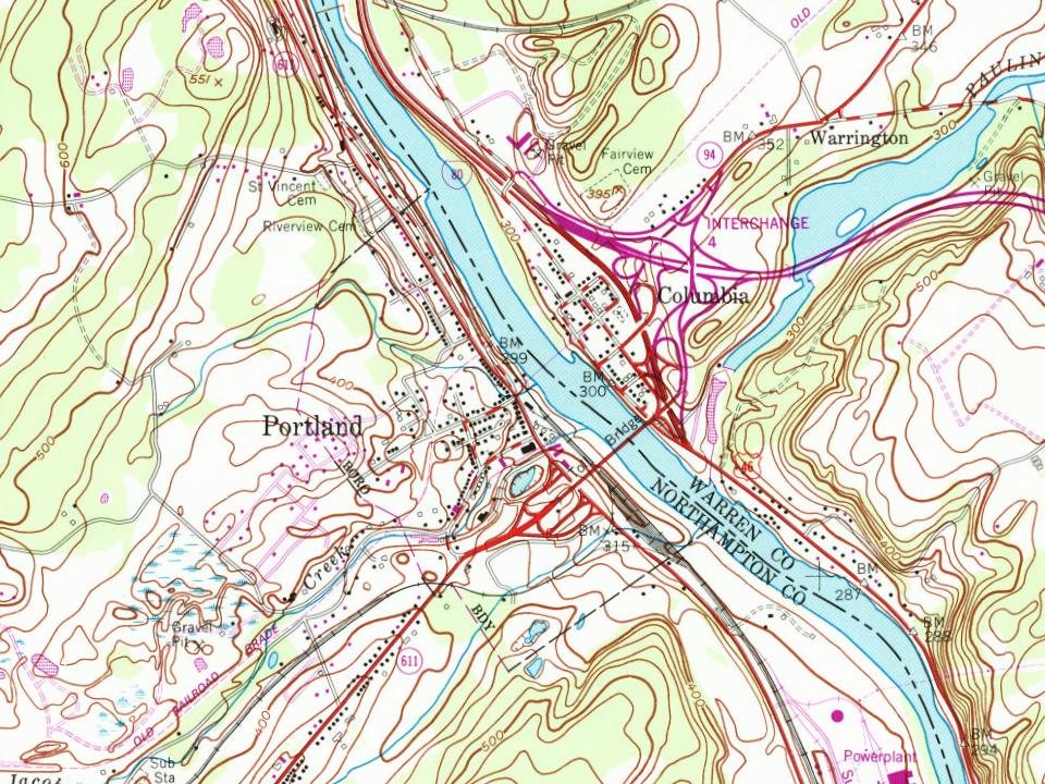
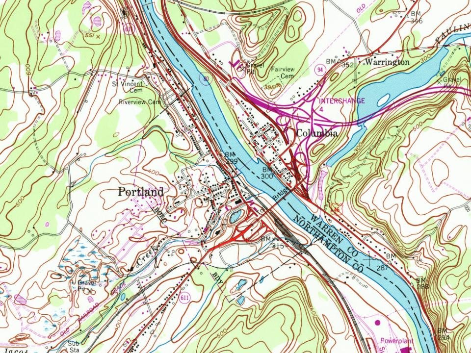
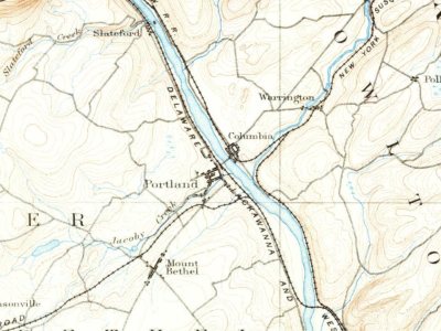
Portland on the map, 1891 to 1992

Every edition of the U.S. Geological Survey’s map of Portland. Tap a year, or press play to watch the town change.

Portland on the 1891 USGS mapPortland on the 1936 USGS mapPortland on the 1943 USGS mapPortland on the 1984 USGS mapPortland on the 1992 USGS map1891Delaware Water Gap sheet · 1:62,500

U.S. Geological Survey historical topographic maps (public domain), via Esri’s collection of the scans. The red ring marks the center of Portland.

The story

How Portland came to be

From Wikipedia’s history of Portland.

Read it all →

Portland's first major business was logging. It also had several taverns and hotels. Records show that the Hibblertown Hotel, which is the present-day Ackerson house on State Street, the Dill's Tavern, which was later torn down, and the What Cheer Inn, which is present-day Duckloe Showroom at the corner of Delaware Avenue and Main Street, all prospered because of loggers.

Text from Wikipedia, licensed CC BY-SA 4.0.

From the old history books

What they wrote about Portland in 1920

Passages that mention Portland, cut from the printed page as they were published.

The boroughs of Portland and East Bangor have been established within the boundaries of the township. Slateford. in the northeastern part of the township at the mouth of Slateford creek, which falls into the Delaware just south of the village, is a small collection of houses, and has been a post-of…
History of Northampton County [Pennsylvania] and the grand valley of the Lehigh under supervision and revision of William J. Heller, assisted by an advisory board of editors..1920 · page 468Read the page →
Read the text

The boroughs of Portland and East Bangor have been established within the boundaries of the township. Slateford. in the northeastern part of the township at the mouth of Slateford creek, which falls into the Delaware just south of the village, is a small collection of houses, and has been a post-office since 1856. The houses were built by James M. Porter about 1805, who owned and operated slate quarries at that place, and to the slate industry the village owes all its energy and importance.

Text read by machine from the scan; it may contain errors.
Portland Methodist Episcopal Church was built in 1872, and dedicated July 12, 1874. The Rev. H. T. Zeider was pastor in 191 5. The church in 1919 is in charge of the Rev. David W. Siegrist. Mount Bethel Baptist Church of Portland was formally organized June 10, 1875. On the organization of this chu…
History of Northampton County [Pennsylvania] and the grand valley of the Lehigh under supervision and revision of William J. Heller, assisted by an advisory board of editors..1920 · page 522Read the page →
Read the text

Portland Methodist Episcopal Church was built in 1872, and dedicated July 12, 1874. The Rev. H. T. Zeider was pastor in 191 5. The church in 1919 is in charge of the Rev. David W. Siegrist. Mount Bethel Baptist Church of Portland was formally organized June 10, 1875. On the organization of this church the congregation then worshipping at Johnsonville was dissolved. A church edifice was built in 1878 at the cost of $2,250, the pastor at that time being Rev. A. E. Spring. The Rev. J. Albert Crawn, the present pastor, has had charge of the congregation for a number of years. The First

Text read by machine from the scan; it may contain errors.

Scans and text from the Internet Archive. Books published in 1930 or earlier, which are in the public domain.

Timeline

Portland, 1813 to 1923

Woven from the archive, old maps, post office records, the National Register and the people born here.

  1. 19th century
  2. 1813Post officeThe Dills Ferry post office opens
  3. 1845
    FoundingPortland is established
  4. 1858Post officeThe Marshfield post office opens
  5. 1858Post officeThe Marshfield post office closes
  6. 1867Post officeThe Dills Ferry post office closes
  7. 1867Post officeThe Portland post office opens
  8. 1891On the mapFirst mapped by the U.S. Geological Survey
  9. 20th century
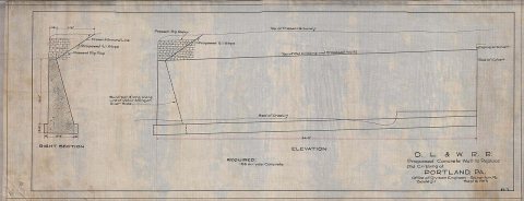
  10. 1913In the archive082-12.LF--Proposed concrete wall--Portland, PA
  11. 1923In the archivePortland PA Presby PHS507
By decade

Portland, decade by decade

2 decades in the archive, from the 1910s to the 1920s. Scroll each row; tap a photo for its story.

1930s–1990snothing yet
Nothing in the archives for these yearsWeddings on Main Street, storms, parades, school pictures, the old store. If it’s in your family album, it belongs here.
Add from your album
Every building

Portland, building by building, 1904–1912

Fire insurance maps drew every building, what it was made of and what it was used for, so insurers could price the risk of fire. Pick a year, then a sheet.

Portland fire insurance map, 1904, sheet 11904Sheet 1 of 2
Edition
BrickWoodStone

Sanborn Map Company, via the Library of Congress. Editions published in 1930 or earlier, which are in the public domain.

Then & now

Stand where they stood

No then-and-now pairs yet. Take a photo from the same spot as an old one and they appear here side by side.

082-12.LF--Proposed concrete wall--Portland, PA
Retake this view082-12.LF--Proposed concrete wall--Portland, PA, 1913

Find the spot, match the angle, and add your photo. It becomes the first then-and-now pair on Portland’s page.

Retake this view · +15
On the National Register

1 historic place in Portland

The country’s official list of buildings and places worth saving.

place listed
1
National Historic Landmarks
0
none yet
historic buildings protected
1
each building in a district counts
first listed
1988
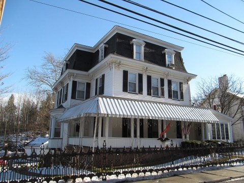
County Bridge No. 36

National Park Service, National Register of Historic Places. Photos from Wikimedia Commons, credited on each place’s page.

People over time

Portland, census by census

010020030040050060070018801900192019401960198020002020Peak: 676

Between 427 and 676 people in every census since 1880.

15 censuses, 1880–2020.

U.S. Census Bureau decennial counts, from the census table on Portland’s Wikipedia page.

Famous people

Famous people close to Portland

Nobody well known was born in Portland itself, so here are the best known from just nearby.

See all →
Places that used to be

Lost post offices and places now gone

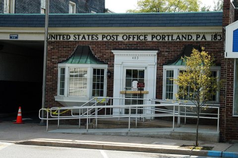
Portland’s post office has been open since 1867. Two other post offices opened and closed inside today’s town.

Dills Ferry
1813–1867
Marshfield
1858–1858
Portland
1867–today
18101920today
Gone or out of use
Dills Ferrylocale

US Post Offices dataset (Blevins & Helbock, CC0). Places and cemeteries from the USGS Geographic Names Information System (2021).

Stories next door

History across the town line

Each neighbor’s History grade, on the same three inputs.

Questions about Portland’s history

What year was Portland founded?

In 1845, according to Wikidata. Portland’s post office opened in 1813, and the census of 1880 counted 608 people here.

What is on the National Register in Portland?

One place: the County Bridge No. 36 (listed 1988).

Memory lane

What the archives can’t tell you, neighbors can.

Town Square →
Start a conversation
Sources

Where this page comes from

Founding dates: Wikidata, Wikipedia, the U.S. post office records of Blevins & Helbock (CC0) and the Census. Homes by year built: Census ACS 2020–24. National Register of Historic Places: National Park Service (list of May 22, 2026). Old photos, postcards and papers: Wikimedia Commons, the Library of Congress and other public archives, credited on each item’s page. Maps: U.S. Geological Survey historical topographic maps (via Esri) and Sanborn fire-insurance maps (Library of Congress). History text and census tables: Wikipedia (CC BY-SA 4.0). Places that used to be: USGS Geographic Names Information System (2021). How TownRatings grades history →

From Wikimedia Commons (6), the National Register of Historic Places (1), Wikipedia, U.S. Geological Survey historical maps, U.S. Census counts (via Wikipedia), the US Post Offices dataset (Blevins & Helbock), the USGS Geographic Names Information System, Sanborn fire insurance maps (Library of Congress) and old county and town histories (Internet Archive). Archive images are copied here with their credits and licenses, shown on each photo’s page. Refreshed monthly.